Throggs Neck
| Throggs Neck | |
|---|---|
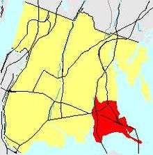
| Neighborhood of The Bronx | |
|
Throgs Neck Bridge | |
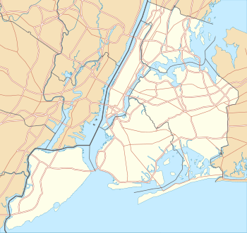 Throggs Neck  Throggs Neck  Throggs Neck Location in New York City | |
| Coordinates: 40°49′21″N 73°49′10″W / 40.8226008°N 73.8195784°WCoordinates: 40°49′21″N 73°49′10″W / 40.8226008°N 73.8195784°W | |
| Country |
|
| State |
|
| City |
|
| Borough |
|
| Area[1] | |
| • Total | 4.93 km2 (1.903 sq mi) |
| Population (2011)[1] | |
| • Total | 21,009 |
| • Density | 4,300/km2 (11,000/sq mi) |
| Economics | |
| • Median income | $65,856 |
| ZIP codes | 10465 |
| Area code | 718, 347, 646 |
.jpg)

Throggs Neck (also known as Throgs Neck) is a narrow spit of land in the southeastern portion of the borough of the Bronx in New York City. It demarcates the passage between the East River (an estuary), and Long Island Sound. "Throggs Neck" is also the name of the neighborhood of the peninsula, bounded on the north by East Tremont Avenue and Baisley Avenue, on the west by Westchester Creek, and on the other sides by the River and the Sound. The neighborhood is part of Bronx Community Board 10.[2] Throggs Neck was largely exempt from the severe urban decay that affected much of the Bronx in the 1970s.[3]
Throggs Neck is at the northern approach to the Throgs Neck Bridge, which connects the Bronx with the neighborhood of Bay Terrace in the borough of Queens on Long Island. The Throgs Neck Lighthouse formerly stood at its southern tip. Historically, the correct spelling is with two Gs,[4] and while NYC Parks Commissioner and Triborough Bridge and Tunnel Authority Chairman Robert Moses officially shortened it to one G after deciding that two would not fit on many of the street signs, long-time residents continue to recognize the traditional spelling.[5][6] On September 17, 2012, News12 (Bronx) reported a story about the differences in spelling.[7]
The landscape is a long breezy bluff about 50 to 60 ft above the water. There are two beaches below and along Indian Trail, the latter, a popular place to live that is right on the river. From the southern end of Indian trail, Ft Schuyler is visible at the tip of Throggs Neck (this area is referred to as "strawberry fields"). At the northern end the trail opens up into a common area that the locals call the "green grass". From there, there are nice views of the Throggs Neck Bridge to the left and the Whitestone Bridge to the right. Beneath the Whitestone Bridge the Manhattan skyline straddles the western horizon. Both strawberry fields and the green grass were popular drinking spots for teenagers in the area.
History

The peninsula was called Vriedelandt, "Land of Peace", by the New Netherlanders. The current name comes from John Throckmorton, English immigrant and associate of Roger Williams in Massachusetts and Rhode Island. The Dutch allowed Throckmorton to settle in this peripheral area of New Amsterdam in 1642, with thirty-five others.[8][9] At this time, the peninsula was also known as Maxson's point as the Maxson family (Richard, Rebecca, John, etc.) lived there. Many of the settlers, including Anne Hutchinson and her family, were murdered in a 1643 uprising of Native Americans. Throckmorton returned to Rhode Island.[8] In 1668, the peninsula appeared on maps as "Frockes Neck". The peninsula was virtually an island at high tide.
In 1776, George Washington's headquarters wrote of a potential British landing at "Frogs Neck".[10] At the bridge over Westchester Creek, now represented by an unobtrusive steel and concrete span at East Tremont Avenue near Westchester Avenue, General Howe did make an unsuccessful effort to cut off Washington's troops in October 1776; when the British approached, the Americans ripped up the plank bridge and opened a heavy fire that forced Howe to withdraw and change his plans; six days later he landed troops at Rodman's Neck to the north, on the far side of Eastchester Bay.[11] A farm in the area owned by the Stephenson family was sold in 1795 to Abijah Hammond, who built a large mansion (later the offices of the Silver Beach Garden Corporation).
In the 19th century, the area remained the site of large farms, converted into estates. About 1848 members of the Morris family purchased a large parcel of land and built two mansions and many cottages and service buildings, reached by a private dock in Morris Cove at the end of what is now Emerson Avenue, where they had nearly a mile of shoreline.[12] After the Civil War, Collis P. Huntington, the railroad builder, owned an extensive parcel,[13] which his heirs held until they were almost the last estate on Throggs Neck. Huntington's property was previously owned by Frederick C. Havemeyer Jr., the sugar magnate,[14] and the Havemeyer-Huntington mansion is now home to Preston High School, New York.
Throgs Neck Park, a 0.44 acres (0.18 ha) public park[15] that faces Throggs Neck from the opposite shore at the end of Myers Street, was acquired as a public place in 1836.[16] From 1833 to 1856, the construction of Fort Schuyler brought in laborers and craftsmen, many of whom were immigrants from Ireland, to settle in the area with their families. By the late 19th century, the area had developed into a fashionable but more public summer resort, which also contained large German beer gardens,[17] to which the residents of Yorkville arrived by steamboat service up the East River. The 19th-century steamboat landing at Ferris Dock on Westchester Creek stood at present-day Brush Avenue north of Wenner Place; the road to it bore the name of the steamboat Osseo.[18] The Ferris family were 18th-century residents, whose Ferris Point at the southeast corner of the Throggs Neck neighborhood now supports the Hutchinson River Parkway (formerly Ferris Lane)[19] overhead ramp to the Bronx-Whitestone Bridge and Ferry Point Park.
In the decades after the incorporation of the Bronx into the City of Greater New York in 1898, transit lines were extended to the neighborhood, bringing in many Italian farmers and tradesmen. In the 1920s the large estates largely became converted into smaller row homes and densely built bungalow lots.[12] The Peters and Sorgenfrel families formed Silver Beach Garden (named for the color of the beach at low tide), a summer colony of bungalows that were later adapted for year-round use; most of the streets were named for flowers and trees found on the Hammond estate. Residents owned their houses but rented the land when they joined together to buy it. Nearby to the north, a campsite for church youth transformed into a bungalow colony later named Edgewater Park.
In 1932, Fort Schuyler closed as an active military installation and became the campus for cadets of the State University of New York Maritime College. A 1929–39 pair of plans to expand the subway system with a Second Avenue Subway branch to Throggs Neck did not come to pass. By 1961, with the construction of the Throggs Neck Bridge, as well as the adjacent parkways, the neighborhood lost its comparative isolation.
The last two of several large and handsome 18th-century Ferris houses in the neighborhood lasted until the 1960s, when the James Ferris house overlooking Eastchester Bay was hastily demolished in 1962 and the Watson Ferris house was demolished in 1964 by its occupants, the Tremont Terrace Moravian Church. The James Ferris house had been commandeered by Admiral Richard Howe as his headquarters in October 1776, when James Ferris was sent to the prison hulks in New York harbor, where he died in 1780.[20]
Demographics

The neighborhood has several beach clubs and a diverse housing stock, including middle-class homes, up-market waterfront condominiums, as well as the Throggs Neck Houses, built in 1953 as one of the first low-income public housing projects in New York City and later expanded twice. In 1984, the New York Times described Throggs Neck as one of the last middle- and upper-middle-class areas in the Bronx, noting the area "seems like a well-kept suburb."[3] Even in the mid-1980s, after the city failed to pave neighborhood streets properly, waterfront condominiums were selling for as much as $416,468 in 2005 dollars.[3]
As of the 2000 Census, the median household income for census tracts within the neighborhood ranged from $18,000 to $85,000 in the less affluent tracts and well over $100,000 for the waterfront tracts near the Throgs Neck Bridge.[21]
Transportation
Bus transportation includes:
- Bx5: to Pelham Bay Park or Bay Plaza (Weekend only) or Southern Blvd. - West Farms Road (via Story Ave.)
- Bx8: to 225th St station or Locust Point (via Williamsbridge Rd.)
- Bx40/Bx42: to Throggs Neck or Morris Heights (via Tremont and Burnside Aves.)
- Q44 SBS: to Jamaica, Queens or West Farms (via Cross Bronx Expressway Service Road.)
- Q50: to Flushing, Queens or Co-op City (via Brunkner Blvd.)
- BxM9: express to Throggs Neck or Midtown
The Throgs Neck Bridge and the Whitestone Bridge provide access to Queens and Long Island.
Due to the proximity of the Bruckner Interchange, the crossroads of the Hutchinson River Parkway, the Bruckner Expressway, the Hutchinson River Expressway, the Cross-Bronx Expressway, and also the Throgs Neck Expressway and the New England Thruway, there is convenient highway access to Throggs Neck from many parts of the New York area.
Numerous roadways near the Southern end of Throggs Neck are named in honor of Union generals from the American Civil War, including Philip Kearny, John Reynolds, Carl Schurz, Thomas Meagher, and Benjamin Prentiss. Another roadway is named for James Longstreet, a Confederate general who, once the war had ended, embraced Reconstruction and consequently became the object of intense Southern opprobrium.
In popular culture
Several television shows and movies have been filmed in Throggs Neck, including these films:
- Awakenings (1990)
- Summer of Sam (1999)
Television shows include:
- Episodes of Law & Order: Special Victims Unit
- Storage Wars: New York
- Scenes in The Leftovers
Notable people
- Frank Bello (born 1965), bass player for the heavy metal band Anthrax[22]
- Charlie Benante (born 1962), drummer for the heavy metal band Anthrax[22]
- Collis Potter Huntington (1821–1900), railroad magnate[23]
- Christine Jorgensen (1926-1989), first transsexual celebrity, 1950s-60s, following surgical transformation in Denmark, 1952; born and raised on Dudley Avenue[24]
- Michael Kay (born 1961), sports broadcaster[25]
- Doug Marrone (born 1964), assistant head coach of the Jacksonville Jaguars[26]
- Bill Polian (born 1942), Hall of Fame NFL executive
References
- 1 2 "Throgs Neck neighborhood in New York". Retrieved 27 October 2015.
- ↑ "Bronx Community District 10" (PDF). Retrieved 27 October 2015.
- 1 2 3 Dolan, Dolores (June 3, 1984). "If You're Thinking of Living in Throgs Neck". The New York Times. Retrieved 2006-11-02.
- ↑ "Spell It Throg(g)s Neck And Give or Take One G". The New York Times. January 17, 1955. p. 18. Retrieved 2010-08-27.
- ↑ Bill Twomey, John McNamara. Throggs Neck & Pelham Bay.
- ↑ John McNamara. Throggs Neck Memories.
- ↑ Video: Throgs Neck or Throggs Neck?
- 1 2 Sitherwood, Frances Grimes (1929). Throckmorton family history : being the record of the Throckmortons in the United States of America with cognate branches, emigrant ancestors located at Salem, Massachusetts, 1630, and in Gloucester County, Virginia, 1660. Bloomington, Ill.: Pantagraph Printing & Stationary Co.
- ↑ Edwin G. Burrows and Mike Wallace, Gotham, a History of New York City to 1898 (1999, p. 37, giving "Throgmorton").
- ↑ "In Revolutionary Days; Third Installment of the Interesting Tilghman-Duer Letters". The New York Times. April 21, 1895. p. 25. Retrieved 2008-08-25.
Frogs Neck and Point is a kind of Island, there are two passages at the Main which are fordable at low Water at both of which we have thrown up Works, which will give some Annoyance should they attempt to come off by either of these Ways... The grounds leading from Frogs Point towards our Post at Kingsbridge are as defensible as they can be wished...
- ↑ WPA Guide p.547
- 1 2 ["Auction Throg's Neck lots: Morris estates will sell 1,600 waterfront bungalow properties, The New York Times, 6 August 1922] accessed 23 November 2010.
- ↑ The WPA Guide to New York, (1939, repr. 1982), p.546.
- ↑ "Land Records". Office of the Westchester County Clerk. Retrieved 1 April 2016.
- ↑ NYC Parks: Throgs Neck Park
- ↑ McNamara, s.v. "Throgs Neck Park".
- ↑ WPA Guide p. 546.
- ↑ McNamara, s.v. "Ferris Dock".
- ↑ McNamara, s.v. "Ferris Lane".
- ↑ McNamara, s.v. "Ferris House (1-7)"; WPA Guide, East Bronx map p. 545.
- 1 2 "US Census Bureau, Income Map". Retrieved 2006-11-02.
- 1 2 Freedlander, David. "Break Out The Cipro: It’s Anthrax Day in the Bronx", New York Observer, September 14, 2011. Accessed September 23, 2016. "Both Benante and Bello grew up in Throggs Neck, while Caggiano is a native of Pelham Parkway."
- ↑ About the Library, East Bronx History Forum. Accessed September 23, 2016. "The library was officially founded in 1892 by Collis P. Huntington, a Southern Pacific Railroad magnate whose summer home was in nearby Throgs Neck."
- ↑ Docter, Richard. Becoming a Woman: A Biography of Christine Jorgensen, p. 13. Routledge, 2013. ISBN 9781136576287. Accessed September 23, 2016. "George William Jorgensen Jr. was born May 30, 1926, at the Community Hospital in Manhattan and raised in the Throggs Neck district of the Bronx, a few miles north of his birthplace."
- ↑ Raissman, Bob. "For Kay, Return is Fall Circle", New York Daily News, October 3, 1995. Accessed September 23, 2016. "Especially a guy like Kay, a homeboy out of Throgs Neck."
- ↑ Logan, Greg. "Stadium bowl makes Bronx's Marrone nostalgic", Newsday, December 27, 2010. Accessed September 23, 2016. "Marrone lived nine miles from old Yankee Stadium in Throgs Neck. To get to his house, you took the last exit before the western entrance to the bridge, Harding Avenue."
- McNamara, John. History in Asphalt: The Origin of Bronx Street and Place Names, (New York: Bronx County Historical Society, 1984)
- Hermalyn, Gary; and Kornfe, Robert. Landmarks of the Bronx, (New York: Bronx County Historical Society, 1990)
- Hermalyn, Gary D. The Encyclopedia of New York City, Edited by Kenneth T. Jackson. New Haven, Yale University Press. 1995.
External links
| Wikimedia Commons has media related to Throggs Neck, Bronx. |
- Throggs Neck Merchant Association
- Forgotten NY: Throgs Neck, NY
- Lighthouse Museum: Throgs Neck Lighthouse
- "The Winner by a Neck" (Throcke's, Frog's, Throggs, or Throgs?), The New York Times, 4 January 1998
- Throgs Neck or Throggs Neck: The Debate Lives On