Thonburi
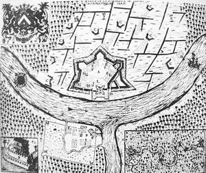
Thonburi (Thai: ธนบุรี) is an area of modern Bangkok. During the era of the kingdom of Ayutthaya, its location on the right (west) bank at the mouth of the Chao Phraya River had made it an important garrison town, which is reflected in its name: thon (ธน) a loanword from Pali dhána wealth and buri (บุรี), from púra fortress.[2] The full formal name was City of Treasures Gracing the Ocean (กรุงธนบุรีศรีมหาสมุทร Krung Thonburi Sri Maha Samut.)[3][4] For the informal name, see the history of Bangkok under Ayutthaya.
In 1768, a year after the sack of Ayutthaya by the Burmese, General Taksin took back Thonburi and, by right of conquest, made it the capital of the Thonburi Kingdom with himself king until 6 April 1782. Rama I, as newly enthroned king, decided to move the capital to across the river, where stakes driven into the soil of Bangkok for the City Pillar at 06:45 on 21 April 1782, marked the official founding of the new capital.[4]:p.14 Thonburi remained an independent town and province, until it was merged into Bangkok in 1971.[5] Thonburi stayed less developed than the other side of the river. Many of the traditional small waterways, Khlongs, still exist there, while they are nearly gone from the other side of the river.
In 1950, Bangkok had around 1.3m people, and the municipality of Thonburi around 400,000. In 1970 Thonburi was Thailand's second largest city proper with around 600,000 residents.
Wong Wein Yai is a landmark of Thonburi District.
Administration
At the time of the merger, Thonburi province consisted of nine districts (Amphoe).
- Thonburi District (Thai: อำเภอธนบุรี)
- Bangkok Yai District (Thai: อำเภอบางกอกใหญ่)
- Khlong San District (Thai: อำเภอคลองสาน)
- Taling Chan District (Thai: อำเภอตลิ่งชัน)
- Bangkok Noi District (Thai: อำเภอบางกอกน้อย)
- Bang Khun Thian District (Thai: อำเภอบางขุนเทียน)
- Phasi Charoen District (Thai: อำเภอภาษีเจริญ)
- Nong Khaem District (Thai: อำเภอหนองแขม)
- Rat Burana District (Thai: อำเภอราษฎร์บูรณะ)
As of 2012, these have been reorganized into 15 districts.
References
- ↑ Jean Vollant des Verquains History of the revolution in Siam in the year 1688, in Smithies 2002, p.95-96
- ↑ Turner, Sir Ralph Lilley (1985) [London: Oxford University Press, 1962-1966.]. "A Comparative Dictionary of the Indo-Aryan Languages". Includes three supplements, published 1969-1985. Digital South Asia Library, a project of the Center for Research Libraries and the University of Chicago. pp. 384 and 469. Retrieved 5 August 2013.
dhána 6717 ; púra 8278
- ↑ Glenn Slayden, ed. (July 27, 2014). "results for: Thai กรุง-ธนบุรี-ศรี-มหาสมุทร" (Dictionary). Bulk Lookup. Thai-language.com. Retrieved 2014-07-27.
- 1 2 Barrett, Kenneth (2013). "Introduction". 22 Walks in Bangkok (PDF 2.5MB 36 pp. ebook sample). Singapore: Tuttle. p. 12. ISBN 9781462913800. Retrieved 2014-07-27.
....'Thonburi' ... translated loosely as "Money Town" ....in 1557 ... became Thonburi Sri Maha Samut, "City of Treasures Gracing the Ocean".
- ↑ ประกาศของคณะปฏิวัติ ฉบับที่ ๒๔ (PDF). Royal Gazette (in Thai). 88 (144 ก): 816–819. 1971-12-21.
Further reading
- Smithies, Michael (2002), "Three military accounts of the 1688 'Revolution' in Siam", Itineria Asiatica, Orchid Press, Bangkok, ISBN 974-524-005-2.
- Syamananda, Rong (1990). A History of Thailand. Chulalongkorn University.
- Wyatt, David K. (2003). Thailand: A Short History. Yale University Press.
- Knoles, Gordon D. Bangkok Page 56-57, Temples to visit in Thonburi. Retrieved, September 20, 2011 from http://www.thailand-delights.com/page1106.html - http://www.thailand-delights.com/page1107.html
- Thonburi Area | Bangkok Travel Guide & Info, Travel Information and Tourist Guide for Bangkok City. Retrieved, September 20, 2011 from http://www.bangkok-bangkok.org/sights-attractions-in-bangkok-thailand/thonburi-aera/4/
- Bangkok Palace - ComeThailand.com. Retrieved, September 20, 2011 from http://www.comethailand.com/bangkok-palace/blog
- The King Taksin Monument - a Monument to a Great Warrior. Retrieved, September 20, 2011 from http://www.tour-bangkok-legacies.com/king-taksin-monument.html
- Wat Arun - Temple of the Dawn. Retrieved, September 21, 2011 from http://www.bangkoksite.com/WatArun/WatArunPage.html
External links
 Thonburi travel guide from Wikivoyage
Coordinates: 13°43′30″N 100°29′09″E / 13.725°N 100.485833333°E