Thompson Lake (Manitoba)
| Thompson Lake | |
|---|---|
 Thompson Lake | |
| Location | Manitoba |
| Coordinates | 54°45′58″N 101°34′32″W / 54.76611°N 101.57556°WCoordinates: 54°45′58″N 101°34′32″W / 54.76611°N 101.57556°W |
| Lake type | Glacial Lake |
| Primary inflows | Alberts Lake, Bryan Lake |
| Primary outflows | Murray Lake |
| Basin countries | Canada |
| Max. length | 3 km (1.9 mi) |
| Max. width | 1.6 km (0.99 mi) |
| Shore length1 | 13 km (8.1 mi) |
| Surface elevation | 299 m (981 ft) |
| Islands | 13 |
| 1 Shore length is not a well-defined measure. | |
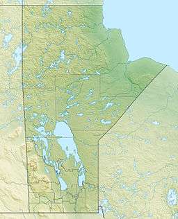
Location of Thompson Lake in Manitoba
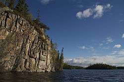
Thompson Lake is a glacial lake approximately 12 kilometres (7.5 mi) northeast of Bakers Narrows which drains into Murray Lake. It is part of the Nelson River watershed, in the Hudson Bay drainage basin in the Northern Region of Manitoba, Canada. The lakes sits in Churchill River Upland portion of the Midwestern Canadian Shield forests and is surrounded by mixed forest with stands of black spruce, white spruce, jack pine, and trembling aspen. The shoreline is characterized by steeply sloping irregular rock ridges and poorly drained areas of muskeg.[1] The lake contains northern pike, walleye, and yellow perch.[2]
The name was officially adopted in 1940.[3]
See also
References
- ↑ Smith, R.E. (1998). Terrestrial Ecozones, Ecoregions, and Ecodistricts of Manitoba (PDF). Winnipeg, Manitoba: Agriculture and Agri-Food Canada. p. 88. ISBN 0-662-27446-6.
- ↑ "Master Angler Awards". Travel Manitoba. Retrieved 19 May 2014.
- ↑ "Geographic Names Board of Canada". Natural Resources Canada. Retrieved 19 May 2014.
This article is issued from Wikipedia - version of the 7/10/2014. The text is available under the Creative Commons Attribution/Share Alike but additional terms may apply for the media files.