Thompson's Station, Tennessee
| Thompson's Station, Tennessee | |
|---|---|
| Town | |
|
Thompson's Station Town Hall | |
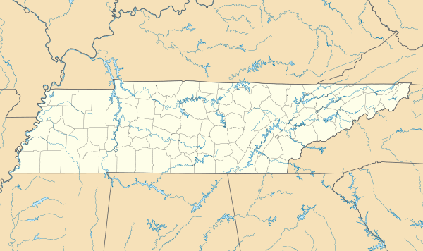 Thompson's Station, Tennessee Location within the state of Tennessee | |
| Coordinates: 35°47′55″N 86°54′26″W / 35.79861°N 86.90722°WCoordinates: 35°47′55″N 86°54′26″W / 35.79861°N 86.90722°W | |
| Country | United States |
| State | Tennessee |
| County | Williamson |
| Settled | 1780[1] |
| Incorporated | 1990[2] |
| Named for | Elijah Thompson, early settler[1] |
| Area | |
| • Total | 14.7 sq mi (38.1 km2) |
| • Land | 14.7 sq mi (38.1 km2) |
| • Water | 0.0 sq mi (0.0 km2) |
| Elevation | 801 ft (244 m) |
| Population (2010) | |
| • Total | 2,194 |
| • Density | 87.2/sq mi (33.7/km2) |
| Time zone | Central (CST) (UTC-6) |
| • Summer (DST) | CDT (UTC-5) |
| ZIP code | 37179 |
| Area code(s) | 615 |
| FIPS code | 47-73900[3] |
| GNIS feature ID | 1652469[4] |
| Website | thompsons-station.com |

Thompson's Station is a town in Williamson County, Tennessee. The population was 2,194 at the 2010 census, up significantly from 1,283 in 2000. It is the location of two places listed on the U.S. National Register of Historic Places: the Jacob Critz House and the Thomas L. Critz House.
History
The first settlers arrived in what is now Thompson's Station in the late 18th century. The community was originally known as "White House," but changed its name to "Littlebury" in 1836.[1] After the arrival of the railroad in 1855, Dr. Elijah Thompson donated land for a town and train station, and the community was thus renamed for him.[1]
On March 5, 1863, during the Civil War, the Battle of Thompson's Station was fought, with Confederate forces led by General Earl Van Dorn defeating Union forces under Colonel John Coburn.[1]
The community voted to incorporate in August 1990. David Lee Coleman was chosen as the first mayor.[1]
In 2015, Tiger Woods stated that he plans to open a golf course and luxury home development in Thompson's Station. [5]
Geography
Thompson's Station is located at 35°47′55″N 86°54′26″W / 35.79861°N 86.90722°W (35.798670, -86.907341).[6] It is approximately 25 miles south of Nashville, just south of Franklin, and just north of Spring Hill.
According to the United States Census Bureau, the town has a total area of 14.7 square miles (38 km2), all land.
Demographics
| Historical population | |||
|---|---|---|---|
| Census | Pop. | %± | |
| 1880 | 135 | — | |
| 2000 | 1,283 | — | |
| 2010 | 2,194 | 71.0% | |
| Est. 2015 | 3,801 | [7] | 73.2% |
| Sources:[8][9] | |||
As of the census[3] of 2000, there were 1,283 people, 447 households, and 375 families residing in the town. The population density was 87.2 people per square mile (33.7/km²). There were 473 housing units at an average density of 32.2 per square mile (12.4/km²). The racial makeup of the town was 91.19% White, 7.01% African American, 0.16% Native American, 0.55% Asian, 0.62% from other races, and 0.47% from two or more races. Hispanic or Latino of any race were 2.57% of the population.

There were 447 households out of which 40.0% had children under the age of 18 living with them, 75.2% were married couples living together, 6.9% had a female householder with no husband present, and 15.9% were non-families. 14.1% of all households were made up of individuals and 4.7% had someone living alone who was 65 years of age or older. The average household size was 2.87 and the average family size was 3.17.
In the town the population was spread out with 26.8% under the age of 18, 6.3% from 18 to 24, 31.0% from 25 to 44, 26.8% from 45 to 64, and 9.0% who were 65 years of age or older. The median age was 38 years. For every 100 females there were 102.4 males. For every 100 females age 18 and over, there were 96.4 males.
The median income for a household in the town was $66,875, and the median income for a family was $70,568. Males had a median income of $50,337 versus $31,528 for females. The per capita income for the town was $24,143. About 4.1% of families and 4.4% of the population were below the poverty line, including 5.3% of those under age 18 and 12.6% of those age 65 or over.
A special census was taken by the Town in June, 2008 and the new census of 1,723 residents was certified by the State of Tennessee on June 30, 2008. No demographic data was obtained in this census. Another special census was launched in November 2013.
Education
Thompson's Station Public Schools are part of Williamson County Schools. The Williamson County School District has twenty-four elementary schools, nine middle schools, and nine high schools.
Schools located in Thompson's Station include:
- Independence High School and Summit High School for grades nine to twelve.
- Heritage Elementary and Middle School for grades Kindergarten to eighth grade
Dr. Mike Looney is the Superintendent of Schools.[10]
References
- 1 2 3 4 5 6 Timeline of Thompson's Station, Official town website. Retrieved: 26 February 2013.
- ↑ Tennessee Blue Book, 2005-2006, pp. 618-625.
- 1 2 "American FactFinder". United States Census Bureau. Retrieved 2008-01-31.
- ↑ "US Board on Geographic Names". United States Geological Survey. 2007-10-25. Retrieved 2008-01-31.
- ↑ http://www.golfchannel.com/news/golf-central-blog/report-woods-design-course-outside-nashville/
- ↑ "US Gazetteer files: 2010, 2000, and 1990". United States Census Bureau. 2011-02-12. Retrieved 2011-04-23.
- ↑ "Annual Estimates of the Resident Population for Incorporated Places: April 1, 2010 to July 1, 2015". Retrieved July 2, 2016.
- ↑ "Census of Population and Housing: Decennial Censuses". United States Census Bureau. Retrieved 2012-03-04.
- ↑ "Incorporated Places and Minor Civil Divisions Datasets: Subcounty Resident Population Estimates: April 1, 2010 to July 1, 2012". Population Estimates. U.S. Census Bureau. Retrieved 11 December 2013.
- ↑ "Williamson County Schools". Williamson County School. Retrieved 2012-06-22.
Municipalities and communities of Williamson County, Tennessee, United States | ||
|---|---|---|
| Cities | ||
| Towns | ||
| Unincorporated Communities | ||
| Footnotes | ‡This populated place also has portions in an adjacent county or counties | |