Thomas County, Nebraska
| Thomas County, Nebraska | |
|---|---|
 Thomas County courthouse in Thedford | |
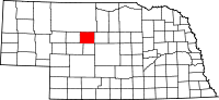 Location in the U.S. state of Nebraska | |
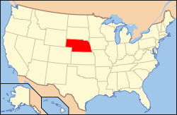 Nebraska's location in the U.S. | |
| Founded | 1887 |
| Named for | George Henry Thomas |
| Seat | Thedford |
| Largest village | Thedford |
| Area | |
| • Total | 714 sq mi (1,849 km2) |
| • Land | 713 sq mi (1,847 km2) |
| • Water | 0.8 sq mi (2 km2), 0.1% |
| Population | |
| • (2010) | 647 |
| • Density | 0.9/sq mi (0/km²) |
| Congressional district | 3rd |
| Time zone | Central: UTC-6/-5 |
Thomas County is a county in the U.S. state of Nebraska. As of the 2010 census, the population was 647.[1] Its county seat is Thedford.[2] The county was formed in 1887 and named after General George H. Thomas.[3]
In the Nebraska license plate system, Thomas County is represented by the prefix 89 (it had the eighty-ninth-largest number of vehicles registered in the county when the license plate system was established in 1922).
Geography

According to the U.S. Census Bureau, the county has an area of 714 square miles (1,850 km2), of which 713 square miles (1,850 km2) is land and 0.8 square miles (2.1 km2) (0.1%) is water.[4]
Major highways
Adjacent counties
- Cherry County - north
- Blaine County - east
- Logan County - south
- McPherson County - southwest
- Hooker County - west
National protected area
- Nebraska National Forest (part)
Demographics
| Historical population | |||
|---|---|---|---|
| Census | Pop. | %± | |
| 1890 | 517 | — | |
| 1900 | 628 | 21.5% | |
| 1910 | 1,191 | 89.6% | |
| 1920 | 1,773 | 48.9% | |
| 1930 | 1,510 | −14.8% | |
| 1940 | 1,553 | 2.8% | |
| 1950 | 1,206 | −22.3% | |
| 1960 | 1,078 | −10.6% | |
| 1970 | 954 | −11.5% | |
| 1980 | 973 | 2.0% | |
| 1990 | 851 | −12.5% | |
| 2000 | 729 | −14.3% | |
| 2010 | 647 | −11.2% | |
| Est. 2015 | 684 | [5] | 5.7% |
| U.S. Decennial Census[6] 1790-1960[7] 1900-1990[8] 1990-2000[9] 2010-2013[1] | |||
As of the census[10] of 2000, there were 729 people, 325 households, and 216 families residing in the county. The population density was 1 person per square mile (0/km²). There were 446 housing units at an average density of 1 per square mile (0/km²). The racial makeup of the county was 99.45% White, 0.27% Native American, and 0.27% from two or more races. 0.82% of the population were Hispanic or Latino of any race.
There were 325 households out of which 26.80% had children under the age of 18 living with them, 60.60% were married couples living together, 4.30% had a female householder with no husband present, and 33.50% were non-families. 31.40% of all households were made up of individuals and 16.60% had someone living alone who was 65 years of age or older. The average household size was 2.24 and the average family size was 2.84.
In the county the population was spread out with 23.60% under the age of 18, 4.40% from 18 to 24, 23.90% from 25 to 44, 27.80% from 45 to 64, and 20.30% who were 65 years of age or older. The median age was 44 years. For every 100 females there were 99.70 males. For every 100 females age 18 and over, there were 90.80 males.
The median income for a household in the county was $27,292, and the median income for a family was $36,618. Males had a median income of $25,662 versus $20,577 for females. The per capita income for the county was $15,335. About 13.60% of families and 14.30% of the population were below the poverty line, including 21.30% of those under age 18 and 17.30% of those age 65 or over.
Communities
See also
References
- 1 2 "State & County QuickFacts". United States Census Bureau. Retrieved September 22, 2013.
- ↑ "Find a County". National Association of Counties. Retrieved 2011-06-07.
- ↑ Retrieved on March 15, 2008.
- ↑ "2010 Census Gazetteer Files". United States Census Bureau. August 22, 2012. Retrieved December 12, 2014.
- ↑ "County Totals Dataset: Population, Population Change and Estimated Components of Population Change: April 1, 2010 to July 1, 2015". Retrieved July 2, 2016.
- ↑ "U.S. Decennial Census". United States Census Bureau. Retrieved December 12, 2014.
- ↑ "Historical Census Browser". University of Virginia Library. Retrieved December 12, 2014.
- ↑ "Population of Counties by Decennial Census: 1900 to 1990". United States Census Bureau. Retrieved December 12, 2014.
- ↑ "Census 2000 PHC-T-4. Ranking Tables for Counties: 1990 and 2000" (PDF). United States Census Bureau. Retrieved December 12, 2014.
- ↑ "American FactFinder". United States Census Bureau. Retrieved 2008-01-31.
 |
Cherry County | | ||
| Hooker County | |
Blaine County | ||
| ||||
| | ||||
| McPherson County | Logan County |
Municipalities and communities of Thomas County, Nebraska, United States | ||
|---|---|---|
| Villages | ||
| Unincorporated communities | ||
| Footnotes | ‡This populated place also has portions in an adjacent county or counties | |
Coordinates: 41°55′N 100°35′W / 41.92°N 100.58°W