Theni district
| Theni district தேனி மாவட்டம் | |
|---|---|
| District | |
|
Bullock Cart Race | |
| Nickname(s): GATEWAY TO TOURISM , THE HIDDEN PARADISE IN EARTH | |
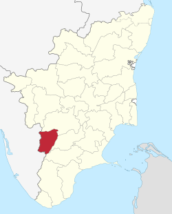 Location in Tamil Nadu, India | |
| Coordinates: 10°00′32″N 77°28′12″E / 10.009°N 77.47°ECoordinates: 10°00′32″N 77°28′12″E / 10.009°N 77.47°E | |
| Country |
|
| State | Tamil Nadu |
| District | Theni |
| Established | July 07, 1996 |
| Headquarters | Theni |
| Talukas | Periyakulam, Theni, Andipatti, Uthamapalayam, Bodinayakanur |
| Government | |
| • Collector & District Magistrate | N.Venkatachalam IAS[1] |
| Area | |
| • District | 2,889 km2 (1,115 sq mi) |
| Population (2011)[2] | |
| • District | 1,245,899 |
| • Density | 430/km2 (1,100/sq mi) |
| • Metro | 591,841 |
| Languages | |
| • Official | Tamil |
| Time zone | IST (UTC+5:30) |
| PIN | 625531 |
| Telephone code | 04546 |
| ISO 3166 code | [[ISO 3166-2:IN|]] |
| Vehicle registration | TN-60 |
| Coastline | 0 kilometres (0 mi) |
| Largest city | Theni |
| Sex ratio | M-50.5%/F-49.5% ♂/♀ |
| Literacy | 71.58%% |
| Legislature type | elected |
| Legislature Strength | 5 |
| Precipitation | 833.5 millimetres (32.81 in) |
| Avg. summer temperature | 40.5 °C (104.9 °F) |
| Avg. winter temperature | 15 °C (59 °F) |
| Website |
www |
Theni District is a district of Tamil Nadu state in South India. The city of Theni is the district headquarters. The district is divided into two natural divisions: The hilly areas are constituted by parts of the three taluks Periyakulam, Uthamapalayam and Andipatti with thick vegetation and perennial streams from the hills on the western side and Cumbum valley which lies in Uthamapalayam taluk.[3] As of 2011, Theni district had a population of 1,245,899 with a sex-ratio of 991 females for every 1,000 males.
History
Theni District was formed by the bifurcation from erstwhile Madurai District as per G.O. Ms. No. 679 Revenue Department Dated July 7, 1996. Consequent to the bifurcation, one new Revenue Division with headquarters at Uthamapalayam and two new Taluks at Theni and Bodinayakanur were also created with effect from January 1, 1997. Theni Municipal town was only a firka headquarters until December 31, 1996. Consequent to the formation of the new District, Theni Municipal Town was upgraded as the Taluk and District headquarters on January 1, 1997.[4]
The region covered by present-day Theni District was sparsely populated before the 1900s. In 1886 Mullaperiyar dam project bought some part of the water from Periyar River downhill to the Cumbum Valley and merged it into the Mullayar River. This project helped more people to settle down in Cumbum Valley. Also to be noted that Theni was itself was a small though lesser-known town by the 1900s. After the Mullay-Periyaar merger project lots of people from nearby dry arid regions (Sivakasi, Kovilpatti, Virudhunagar, Sattur and several nearby towns) settled in Cumbum-Valley (present day Theni District). So there was influx of people by the 1890s to 1920s. Bodi and Periyakulam were famous places at that time. Later Theni developed rapidly due to lots of business activities.
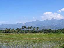
Geography


The 2,889 km2 (1,115 sq mi) district lies at the foot of the Western Ghats between 9' 39' and 10' 30' North latitude and between 77' 00' and 78' 30' of East Longitude. Central location: 10°04′N 77°45′E / 10.067°N 77.750°E. The district is bounded by Dindigul District to the north, Madurai District to the east, Virudhunagar District to the southwest, and Idukki district of the Kerala State to the west. The district is home to Theni, Periyakulam, Bodinayakanur, Cumbum, Uthamapalayam, Kombai, Gudalur, Chinnamanur, Andipatti, Thevaram,Pottipuram,Ramakrishnapuram, Telugu dominant Lakshmipuram Ambasamudram,Govindanagaram,Srirengapuram,Venkadachalapuram and several other small villages likePathirakalipuram, SukkangalPatti, sadaiyalpatti, Meenatchipuram, Melasindalaichery, Pallavarayan Patti a popular village in Tamil Nadu Jallikattu. Kamatchipuram It is diversified by several ranges and hills. A range of hills which runs parallel to Western Ghats from north to south separate it from the neighboring state of Kerala.[5]
Climate- In the plains, the temperatures range from a minimum of 13 °C to a maximum of 39.5 °C. In the hills the temperatures can range from as low as 4-5 °C to 25 °C. The district is known for its salubrious climate, hills and lakes.
Rivers and dams- The Vaigai River, Kottagudi River, Suruliyar River, Varaganathi River, Manjalar River and Varattaru River flow through the district. The important reservoirs in the district are Vaigai Dam, Manjalaru Dam, Sothuparai Dam, Sanmughanathi Dam, Manalaru Dam and Melmanalaru Dam.
Economy
Its economy is mostly agricultural. Utilisation of land area for cultivation in Theni district is 40.33%.[3][6] The principal crop production (in tonnes) in 2005-2006 was: sugarcane 1,201,221, cotton 95,360 (561 bales of 170. kg lint each), rice (paddy) 66,093, millets and other cereals 57,081, pulses 6,677, groundnut 4,021 and gingelly 325.[7] Silk, Banana, Coconut, Tea, Coffee, Cardamom, Grapes and Mangoes are other main produce of the district.[8] even though this place is economically good. Cumbum Valley is a major centre for grape production with 4,000 small farmers producing over 90,000 tonnes of Muscat grapes, locally known as panneer dhrakshai, and about 10,000 tonnes of Thomson seedless grapes. The unique feature here is that the grapes are harvested throughout the year, while in most grape growing centres elsewhere the season ends with summer.

Cotton Spinning Mills and Sugar Mills are the major industries in this district. In Andipatti Taluk Handloom weaving and power looms are flourishing. In Uthamapalayam Taluk, the Highwavis Estate produces an important amount of Tea. Bodinayakanur is a major market place for cardamom, coffee, tea and black pepper. This city is also called "Cardamom City" because of the large quantity of cardamom trade in this area. It has an auction centre for cardamom.[5]
The Periyar and Surliar Hydro Power Stations and the Vaigai Micro Hydro Power Station have 181 MW installed capacity and actual power generation of 494 MW in 1996 in this district.[3][9] Theni is one of the active business hubs in the western side of Tamil Nadu, inviting more industries to its locality. The district currently has 41.09 km of Metre gauge track serving 3 Railway Stations which connect to Madurai.[3][6]
Forest resources

The forest area in Theni district is about 33.70%. There are 27 forest areas in Theni district constituting a total area of 795.81 km2 (307.26 sq mi). 19 areas fall under the Reserve Forest category with 255.44 km2 (98.63 sq mi), 8 areas under Reserve Land category with 540.37 km2 (208.64 sq mi). Total area of forest under green cover classification was 806.86 km2 (311.53 sq mi). Dense forest and Sparse forest are 292.81 km2 (113.05 sq mi) and 22.43 km2 (8.66 sq mi) respectively. There is no Unclassed Forest type in the district. About 44.65 km2 (17.24 sq mi) of Man Made Forest Area are cultivated in the district. Wattle, Softwood, Fuel wood, Cashew, Neem, Tamarind are the main forest plantation species in Theni district.[3]
There has been no conservation of biological resources in the district. The information of wild life census in Theni district is yet to be made available.[3]
Demographics
According to 2011 census, Theni district had a population of 1,245,899 with a sex-ratio of 991 females for every 1,000 males, much above the national average of 929.The district has diverse ethnic group majority being Tamils[10] A total of 119,661 were under the age of six, constituting 61,873 males and 57,788 females. Scheduled Castes and Scheduled Tribes accounted for 20.72% and .15% of the population respectively. The average literacy of the district was 69.84%, compared to the national average of 72.99%.[10] The district had a total of 338,112 households. There were a total of 591,642 workers, comprising 36,371 cultivators, 275,585 main agricultural labourers, 12,714 in house hold industries, 205,921 other workers, 61,051 marginal workers, 1,996 marginal cultivators, 39,576 marginal agricultural labourers, 2,225 marginal workers in household industries and 17,254 other marginal workers.[11]
Tourism
Bodinayakanur, Periyakulam, Cumbum, Uthamapalayam and Theni are charming towns in the district. Resounding cascades, silver-lined clouds resting a top billiard green hill tops, sheer rock faces and temples of antiquity distinguish these places.
Places of interest-

- Vaigai Dam (~10 km from Theni)
- Suruli falls (~50 km from Theni)
- Manjalar Dam(~35 km from Theni)
- Meghamalai Hill (~57 km from Theni)
- Peyathevar Canal,Gudalur Hill (~50 km from Theni)
- Bodi Mettu Hill (~40 km from Theni)
- Kumbakarai Falls (~15 km from Theni)
- Sothuparai Dam (~20 km from Theni)
- Shanmuganathi Dam (~50 km from Theni)
- Chinna Suruli falls (~15 km from Theni)
- Ramakkal Mettu(~30 km from Theni)
- Kurankani (~20 km from Theni)
- HighWeaves (~70 km from Theni)

Nearest Places in Kerala

Festivals

- St. Antony's festivel celebration at T.Sindalaicherry the month of january
- Famous KARUPPASWAMY festival celebration at ANAIPATTY is celebrated grandly in district.
- The Ramzan Peru naal Thozhuhai at Uthamapalayam, Cumbum, Devadhanapatti, Gudalur, Kottur, Bodinayakanur, Cinnamanur,Priyakulam, Batalagundu in Theni.
- The celebration of Gowmariyamman temple festival at Veerapandi and cumbum during the month of May.
- Shri Pathirakaliyamman Chiththirai Thiruvizha Festival at Pathirakalipuram
- Shri Veerappa Ayyanar festival during Chiththirai Thiruvizha at Theni-Allinagaram is the most aspicious festival.
- Kamatchi Amman festival at Devadhanapatti and Saneeswaran Temple festival at Kuchanoor are the most important festivals of the district.
- Apart from Pongal celebrations in other areas, the birthday of JOHN PENNYCUICK who gave birth to Mullai Periyar Dam is celebrated grandly in surulipatty and other places.
- Theni district is known for its brilliant celebration of Pongal, which is considered to be one of the most important festivals of Tamil Nadu. Pallavarayanpatti, Ayyampatti and pudupatti is very famous for its Jallikattu during the Pongal festival.And very Fomous games its kabati & cricket. "Volcano sport club - Bootdipuram" is one of the very big team in theni district.
- Another important festival is Chitra Pournima festival, which is celebrated at Sri Mangala Devi Kannagi temple, on the Western Ghats near Gudalur during the month of May.
- Other important festivals of the region are festivals of Masi Maham and Shivarathri which are celebrated in the Kamatchi Amman Temple during the months of February–March and kottur Ekadasi.
- Christmas and New Year are very majestically celebrated in Anaimalayanpatty.
- Chithirai Thiruvizha in which Lord Aalagar enters in the Vaigai river at Ambasamudram & Govinda Nagaram.
- Another important festival is Pankuni Thiruveza in Gandamanur
- Arulmigu Pattalamman,Kaliyamman,Karuppasamy temple festivel in Kattunaickenpatty
- India-based Neutrino Observatory (INO) is proposed in the District. Once completed, it shall be used for the study of different parameters of atmospheric neutrinos.
References
- ↑ "Theni District". Theni District. 2014-12-28. Retrieved 5 January 2015.
- ↑ "2011 Census of India" (Excel). Indian government. 16 April 2011.
- 1 2 3 4 5 6 National Environmental Information System (India). "Environment Profile for Theni district" (PDF). ENVIS. pp. 1–29. Retrieved 2008-09-14.
- ↑ M.Subramani M.A., M.Phil., P.G.D.J & M.C., D.L.L & A.L.,. "History of Theni District.". thenitimes.sitesled.com. pp. history p1/2. Retrieved 2008-09-14.
- 1 2 M.Subramani M.A., M.Phil., P.G.D.J & M.C., D.L.L & A.L.,. "History of Theni District.". thenitimes.sitesled.com. pp. history p2/2. Retrieved 2008-09-14.
- 1 2 p.29
- ↑ Collectorate staff (2006–2007). "District Profile Theni District" (PDF). District Collectorate, Theni. pp. 1–15. Retrieved 2008-09-15.
- ↑ Collectorate staff (2006–2007). "District Statistical Handbook 2006-2007 Theni District" (PDF). District Collectorate, Theni. pp. 1–47. Retrieved 2008-09-15.
- ↑ p.15
- 1 2 "Census Info 2011 Final population totals". Office of The Registrar General and Census Commissioner, Ministry of Home Affairs, Government of India. 2013. Retrieved 26 January 2014.
- ↑ "Census Info 2011 Final population totals - Theni district". Office of The Registrar General and Census Commissioner, Ministry of Home Affairs, Government of India. 2013. Retrieved 26 January 2014.
External links
| Wikimedia Commons has media related to Theni district. |
| State symbols |
|
|---|---|
| Governance |
|
| Topics | |
| Districts |
|
| Major cities | |