The Valley, Anguilla
| The Valley | |
|---|---|
| Town and District | |
|
| |
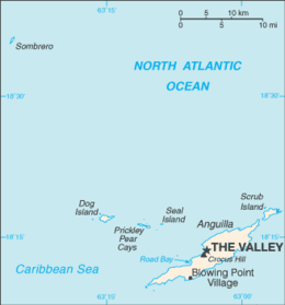 The Valley's location on Anguilla | |
 Location of Anguilla in the Caribbean Sea | |
| Coordinates: 18°13′15″N 63°03′06″W / 18.22083°N 63.05167°W | |
| Country |
|
| Overseas Territory | Anguilla |
| Elevation | 9 m (30 ft) |
| Population (2011) | |
| • Total | 1,067 |

The Valley is the capital of Anguilla, one of its fourteen districts, and the main "town" on the island. As of 2011, it had a population of 1,067.[1]
History
Historical landmarks
The Valley has few examples of colonial architecture due to the relocation of Anguilla's administration to St. Kitts in 1825, though Wallblake House, built in 1787, still stands and is used as a rectory by the adjacent church. New shops have opened in new buildings and renovated West Indian-style cottages. Old shops have been modernized and have enlarged their stocks as well as their space.
The ruins of the Old Court House are located on Crocus Hill, the island's highest point. All that remains are the broken walls of a few basement jail cells. At Cross Roads at the western edge of The Valley is Wallblake House, a plantation home built around 1787 that is now owned by the Catholic Church (the parish priest lives there) and St. Gerard's Catholic Church, with its highly original façade of pebbles, stones, cement, wood and tile.
Geography
Location
The town is located in the middle of the island, in front of Crocus Bay and nearby Crocus Hill, the island's highest point. Nearest villages are North Side, The Quarter, North Hill and George Hill.
Climate
The Valley has a tropical wet and dry climate (Aw) under the Köppen climate classification.[2] The area has a short dry season that covers the months of February and April, and a wet season that covers the remainder of the year. However the wet season, though lengthy, does not quite see the heavy precipitation that is commonplace in other Caribbean cities such as Santo Domingo and San Juan. Average temperatures in The Valley are relatively constant throughout the year, ranging from 26–29 degrees Celsius.
| Climate data for The Valley | |||||||||||||
|---|---|---|---|---|---|---|---|---|---|---|---|---|---|
| Month | Jan | Feb | Mar | Apr | May | Jun | Jul | Aug | Sep | Oct | Nov | Dec | Year |
| Record high °C (°F) | 32 (90) |
32 (90) |
32 (90) |
32 (90) |
34 (93) |
32 (90) |
35 (95) |
37 (99) |
36 (97) |
33 (91) |
32 (90) |
32 (90) |
37 (99) |
| Average high °C (°F) | 28 (82) |
28 (82) |
28 (82) |
28 (82) |
30 (86) |
31 (88) |
31 (88) |
31 (88) |
31 (88) |
30 (86) |
29 (84) |
28 (82) |
30 (86) |
| Daily mean °C (°F) | 26 (79) |
26 (79) |
26 (79) |
27 (81) |
27 (81) |
28 (82) |
29 (84) |
29 (84) |
29 (84) |
28 (82) |
27 (81) |
26 (79) |
27 (81) |
| Average low °C (°F) | 23 (73) |
23 (73) |
23 (73) |
25 (77) |
25 (77) |
26 (79) |
26 (79) |
26 (79) |
26 (79) |
26 (79) |
25 (77) |
24 (75) |
23 (73) |
| Record low °C (°F) | 18 (64) |
20 (68) |
21 (70) |
20 (68) |
18 (64) |
20 (68) |
22 (72) |
22 (72) |
22 (72) |
22 (72) |
21 (70) |
20 (68) |
18 (64) |
| Average precipitation cm (inches) | 7 (2.8) |
4 (1.6) |
4 (1.6) |
7 (2.8) |
9 (3.5) |
7 (2.8) |
8 (3.1) |
11 (4.3) |
11 (4.3) |
9 (3.5) |
11 (4.3) |
9 (3.5) |
102 (40.2) |
| Average relative humidity (%) | 77 | 76 | 76 | 76 | 77 | 76 | 76 | 76 | 76 | 77 | 78 | 77 | 76 |
| Source: Weatherbase[3] | |||||||||||||
Demography
| Year | 1974 | 1984 | 1994 | 2001 | 2011 |
|---|---|---|---|---|---|
| Population | 1,048 | 1,709 | 795 | 1,169 | 1,067 [4] |
Transport
The Valley is served by Clayton J. Lloyd International Airport (IATA: AXA, ICAO: TQPF) with some international flights.
Notable residents
- Cardigan Connor – Former Hampshire County Cricket Club fast bowler.
See also
References
- ↑ "Number of Dwellings and Persons for Censuses 1974 – 2001 (Table 2)". Statistics Department of Anguilla. Retrieved 2008-04-16.
- ↑ Climate Summary for The Valley, Anguilla
- ↑ "Weatherbase: Historical Weather for The Valley".
- ↑ Anguilla census data at Statoids.com
External links
| Wikimedia Commons has media related to The Valley. |
Populated places (districts) in Anguilla | ||
|---|---|---|
Coordinates: 18°13′15″N 63°03′06″W / 18.22083°N 63.05167°W