The Rocks, Sydney
| The Rocks Sydney, New South Wales | |||||||||||||
|---|---|---|---|---|---|---|---|---|---|---|---|---|---|
 The Rocks, Sydney | |||||||||||||
| Population | 614 (2006 census)[1] | ||||||||||||
| • Density | 3,100/km2 (8,000/sq mi) | ||||||||||||
| Postcode(s) | 2000 | ||||||||||||
| Area | 0.2 km2 (0.1 sq mi) | ||||||||||||
| Location | 1 km (1 mi) from Sydney CBD | ||||||||||||
| LGA(s) | City of Sydney | ||||||||||||
| Parish | St. Philip | ||||||||||||
| State electorate(s) | Sydney[2] | ||||||||||||
| Federal Division(s) | Sydney[3] | ||||||||||||
| |||||||||||||
The Rocks is an urban locality, tourist precinct and historic area of Sydney's city centre, in the state of New South Wales, Australia. It is located on the southern shore of Sydney Harbour, immediately north-west of the Sydney central business district. The precinct and its immediate surroundings are administered independently of the local government area of the City of Sydney, by a New South Wales state government statutory authority, the Sydney Harbour Foreshore Authority.
The Rocks area borders on the Bradfield Highway, leading to the Sydney Harbour Bridge, with the localities of Dawes Point and Millers Point, to the west. It is immediately adjacent to Circular Quay on Sydney Cove, the site of Australia's first European settlement in 1788.
History
The Rocks became established shortly after the colony's formation in 1788. It was known as Tallawoladah by the Cadigal people. The original buildings were first traditional vernacular houses, of wattle and daub, with thatched roofs, and later of local sandstone, from which the area derives its name. From the earliest history of the settlement, the area had a reputation as a slum and the arriving convicts' side of town, often frequented by visiting sailors and prostitutes. After November 1790, many of the inhabitants were also aboriginals. In 1823, the district had a population of about 1,200. During the late nineteenth century, the area was dominated by a gang known as the Rocks Push. It maintained this rough reputation until approximately the 1870s.[4][5]
By the early 20th century, many of the area's historic buildings were in serious decay. In 1900, bubonic plague broke out, and the state government resumed areas around The Rocks and Darling Harbour, with the intention of demolishing them and rebuilding them. More than 3800 houses, buildings and wharves were inspected and hundreds demolished, but the continuation of these plans were brought to a halt due to the outbreak of World War I.[6] During the 1920s, several hundred buildings were demolished during the construction of the Sydney Harbour Bridge.
In 1968, the state government gave control of The Rocks to the Sydney Cove Redevelopment Authority, with the intention of demolishing all the original buildings, re-developing them as high-density residential dwellings. In February 1971, a group of local residents formed the Rocks Residents Group to oppose the plans. They felt that the new dwellings would result in increased rents, which would force out the traditional residents of the area. The residents' group requested a green ban from the Builder's Labourers Federation, who had become increasingly active in preventing controversial developments over the previous four years.
By 1973, the union had imposed the ban, and after discussions with the Sydney Cove Redevelopment Authority, a 'People's Plan' was developed. By October 1973, it appeared that the redevelopment would proceed as originally planned, using non-union labour. For two weeks, demonstrations by local residents and unionists followed, with numerous arrests being made. Liberal Premier Robert Askin was in the midst of an election campaign, and used the protests as a means of conveying his law and order message to voters. However, the green ban stayed in place until 1975, when the state union leadership was overthrown, and was ultimately successful, as can be seen in the buildings that survive today. Instead of demolishing The Rocks, renovations transformed the area into a commercial and tourist precinct.
Today the Rocks is a partly gentrified area, but still contains a significant proportion of Housing Commission properties, and there is still a significant problem of urban poverty and street crime in this district. As housing stock becomes dilapidated, government policy is to sell the now extremely valuable public housing units to private owners, in the expectation that they will restore the properties. The Sirius building and the associated "Save Our Sirius" protest group was formed to protest relocation of its residents.[7]
Culture
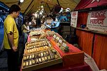
The close proximity to Circular Quay and the views of the iconic Harbour Bridge, as well as the historic nature of many of the buildings, makes the Rocks very popular with tourists. It features a variety of souvenir and craft shops, as well as many themed and historic pubs. The Rocks Market operates each weekend, with around 100 stalls. During the week, shopping options include galleries exhibiting Australian artists, such as Ken Done and Ken Duncan, as well as Australian clothing and Australian opal shops. There are numerous historic walks through the area, visiting historical buildings such as Cadmans Cottage and Sydney Observatory, and the Dawes Point Battery, which was the first fortified position in New South Wales.[8]
Two separate pubs in The Rocks claim to be Sydney's oldest surviving pubs: the Fortune of War and the Lord Nelson. Others in the area include the Observer, the Orient, the Mercantile, the Palisade and the Hero of Waterloo.
A passenger boat terminal and the Museum of Contemporary Art, Sydney is also situated beside the Rocks area. The precinct can also be accessed by rail, as it is within walking distance of Circular Quay station.
Water Polo by the Sea is held there every year by Australian Water Polo with the Australia men's national water polo team take on the International All Stars.[9]
Gallery
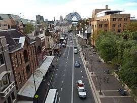
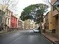 Harrington Street in The Rocks
 Arts Exchange Building from Hickson Street
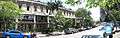 Terrace Houses, Lower Fort Street
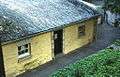 The rear of Cadmans Cottage
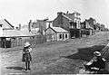 Historical image
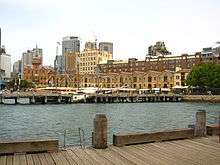
 Campbell's Cove
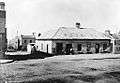 Princes St – the first hotel on The Rocks from The Powerhouse Museum Collection
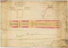 A Transverse section showing the bridges over the Argyle Cut. Dated: 22 March 1832.
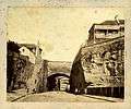 Argyle Cutting (photograph from the 1870s).
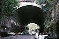 The Argyle Cut, constructed with convict labour.
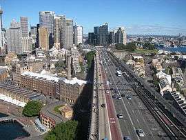 Southern approach of the Sydney Harbour Bridge with The Rocks to the left.
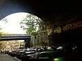 Inside the tunnel
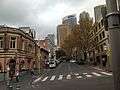 Argyle Street
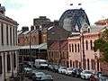 Terrace houses in The Rocks
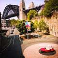 Sydney Harbour Bridge from The Rocks. The bridge is visible from most areas of the district.
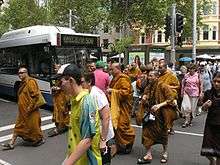 Monks crossing a street in The Rocks
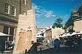 First Impression sculpture
Literature
- Ambrose Pratt: King of the Rocks, novel. Hutchinson, London 1900
- D. Manning Richards. Destiny in Sydney: An epic novel of convicts, Aborigines, and Chinese embroiled in the birth of Sydney, Australia. First book in Sydney series. Washington DC: Aries Books, 2012. ISBN 978-0-9845410-0-3
- Grace Karskens, The Rocks: Life in Early Sydney, Melbourne University Press, 1997.
References
- ↑ "2006 Census Community Profile Series : The Rocks (Sydney) (State Suburb)". Australian Bureau of Statistics. Retrieved 31 October 2009.
- ↑ "Sydney". Electoral Commission of NSW.
- ↑ "Sydney". Australian Electoral Commission.
- ↑ "Heritage & History". The Rocks. Retrieved 22 December 2012.
- ↑ Grace, Karskens (2008). "The Rocks". Dictionary of Sydney. Dictionary of Sydney Trust. Retrieved 11 July 2013.
- ↑ How plague almost demolished historic Sydney, Australian Geographic, 16 August 2010.
- ↑ "save our community". save-our-community. Retrieved 6 November 2014.
- ↑ "The Rocks". NSW Government. Retrieved 22 December 2012.
- ↑ http://www.waterpolobythesea.com/
External links
Dictionary of Sydney entries
- Grace Karskens - UNSW (2008). "The Rocks". Dictionary of Sydney. Retrieved 29 September 2015. [CC-By-SA]
- Caroline Butler-Bowden - Sydney Living Museums and Grace Karskens - UNSW (2014). "Painting Old Sydney". Dictionary of Sydney. Dictionary of Sydney Trust. Retrieved 5 October 2015. [CC-By-SA]
- Melissa Holmes (2012). "Reynolds' cottages". Dictionary of Sydney. Dictionary of Sydney Trust. Retrieved 16 October 2015. [CC-By-SA]
- Mark Dunn (2008). "St Patrick's Catholic church Church Hill". Dictionary of Sydney. Dictionary of Sydney Trust. Retrieved 16 October 2015. [CC-By-SA]
Coordinates: 33°51′35″S 151°12′32″E / 33.85985°S 151.20901°E