The Meadows, Florida
- This article describes the place in Sarasota County, Florida. For other uses, see The Meadows (disambiguation).
| The Meadows, Florida | |
|---|---|
| Census-designated place | |
 Location in Sarasota County and the state of Florida | |
| Coordinates: 27°21′53″N 82°28′23″W / 27.36472°N 82.47306°WCoordinates: 27°21′53″N 82°28′23″W / 27.36472°N 82.47306°W | |
| Country |
|
| State |
|
| County | Sarasota |
| Area | |
| • Total | 2.3 sq mi (6.0 km2) |
| • Land | 2.2 sq mi (5.6 km2) |
| • Water | 0.2 sq mi (0.4 km2) |
| Elevation | 26 ft (8 m) |
| Population (2010) | |
| • Total | 3,994 |
| • Density | 1,848/sq mi (713.7/km2) |
| Time zone | Eastern (EST) (UTC-5) |
| • Summer (DST) | EDT (UTC-4) |
| FIPS code | 12-71580[1] |
| GNIS feature ID | 1867218[2] |
The Meadows is a census-designated place (CDP) in Sarasota County, Florida, United States. The population was 3,994 at the 2010 census.[3] The Meadows Community Association is an active, deed-restricted community consisting of 3500 households, including single-family homes, villas, condominiums, a skilled care and rehabilitation center, and a rental retirement community with all levels of living from independent and assisted living to memory care, skilled nursing, and rehabilitation. The Meadows is also home to a shopping village and The Meadows Country Club, a private facility that offers golf, tennis, dining, and social memberships as well as two courses open for public golf.
Situated in a 1650-acre, natural setting, The Meadows offers more than 80 pristine lakes and waterways and preserve areas. There are approximately 17 miles of roads, 14 miles of sidewalks and bike trails, and a 1.7-mile fitness trail that wind throughout the community.
The development was originally built by the British construction company Taylor Woodrow in the early 1980s. The CDP is part of the Bradenton–Sarasota–Venice Metropolitan Statistical Area.
Geography
The Meadows is located at 27°21′53″N 82°28′23″W / 27.36472°N 82.47306°W (27.364719, -82.473011).[4]
According to the United States Census Bureau, the CDP has a total area of 2.3 square miles (6.0 km2), of which 2.2 square miles (5.6 km2) is land and 0.15 square miles (0.4 km2), or 6.18%, is water.[3]
Demographics
As of the census[1] of 2000, there were 4,423 people, 2,395 households, and 1,456 families residing in the CDP. The population density was 1,909.7 people per square mile (736.1/km²). There were 3,163 housing units at an average density of 1,365.7/sq mi (526.4/km²). The racial makeup of the CDP was 96.47% White, 1.72% African American, 0.07% Native American, 0.63% Asian, 0.05% Pacific Islander, 0.41% from other races, and 0.66% from two or more races. Hispanic or Latino of any race were 1.45% of the population.
There were 2,395 households out of which 5.1% had children under the age of 18 living with them, 56.2% were married couples living together, 3.5% had a female householder with no husband present, and 39.2% were non-families. 35.4% of all households were made up of individuals and 23.3% had someone living alone who was 65 years of age or older. The average household size was 1.77 and the average family size was 2.19.
In the CDP the population was spread out with 4.7% under the age of 18, 1.4% from 18 to 24, 9.8% from 25 to 44, 24.3% from 45 to 64, and 59.9% who were 65 years of age or older. The median age was 69 years. For every 100 females there were 79.9 males. For every 100 females age 18 and over, there were 78.7 males.
The median income for a household in the CDP was $54,942, and the median income for a family was $67,917. Males had a median income of $40,966 versus $34,184 for females. The per capita income for the CDP was $38,826. About 1.8% of families and 3.4% of the population were below the poverty line, including 9.0% of those under age 18 and 1.4% of those age 65 or over.
References
- 1 2 "American FactFinder". United States Census Bureau. Retrieved 2008-01-31.
- ↑ "US Board on Geographic Names". United States Geological Survey. 2007-10-25. Retrieved 2008-01-31.
- 1 2 "Geographic Identifiers: 2010 Demographic Profile Data (G001): The Meadows CDP, Florida". U.S. Census Bureau, American Factfinder. Retrieved April 12, 2013.
- ↑ "US Gazetteer files: 2010, 2000, and 1990". United States Census Bureau. 2011-02-12. Retrieved 2011-04-23.
External links
Municipalities and communities of Sarasota County, Florida, United States | ||
|---|---|---|
| Cities | 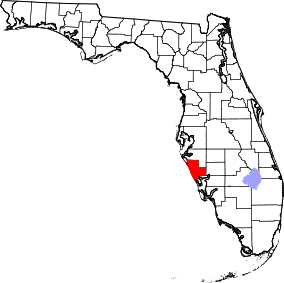 | |
| Town | ||
| CDPs | ||
| Unincorporated community | ||
| Footnotes | ‡This populated place also has portions in an adjacent county or counties | |