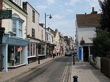
Great Fire of Whitstable, 1869
The Great Fire of Whitstable in 1869 devastated the coastal town of Whitstable in Kent, England.
On the evening of Wednesday, 16 November 1869, the fire swept through the closely built area along The Wall, west of the town's harbour. Given that the population of the town was a little under 2,000, the disaster that befell the little fishing harbour must have been big news across the region, as the fire drew a crowd of 10,000 spectators.[1]
It was the local coastguard, Edwin George Lane, who on 16 November at about 10.45pm spotted flames coming from the roof of a shop. He raised the alarm and a large crowd gathered. Little could be done to prevent the progress of the fire, which burst through the roof and spread to other parts of the building, fanned by a brisk north-easterly wind. Telegrams and mounted messengers were sent to nearby Canterbury and Faversham calling for such fire engines as were available. Although the Whitstable fire engine had arrived, time was lost in obtaining water and getting the hose into use. The engine was then fouled by sand and seaweed drawn up with seawater from the beach.[1]

Despite the combined efforts of the four fire engines the blaze continued unabated as far as the premises of one Josiah Reeves, mast and block maker, where its further progress was abated by a break between the buildings. However, winds caused the inferno to be carried into Marine Street, and Harbour Street beyond, causing great damage in the intervening space where almost all the buildings were destroyed. It was not until nearly eight o'clock the next morning that the flames were extinguished, although firemen stayed for several hours to put out the smouldering embers.[1]
Seventy-one buildings were destroyed, of which 25 were houses, the remainder being stores and workshops along the seawall and in Marine Street. Damage is estimated to have been not less than £10,000 and perhaps as much as £13,000.[1]
References
Coordinates: 51°21′40″N 1°1′25″E / 51.36111°N 1.02361°E