The Gateway of Gulmarg
| Gateway of Gulmarg ماگام मागम | |
|---|---|
| city | |
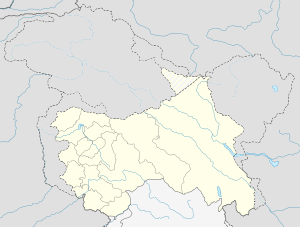 Gateway of Gulmarg  Gateway of Gulmarg Location in Jammu and Kashmir, India | |
| Coordinates: IN 34°05′N 74°35′E / 34.08°N 74.58°ECoordinates: IN 34°05′N 74°35′E / 34.08°N 74.58°E | |
| Country |
|
| State |
|
| District | Budgam |
| Population (2011) | |
| • Total | 5,470 |
| • Density | 290/km2 (800/sq mi) |
| Languages | |
| • Official | Urdu |
| Languages | |
| • Spoken | Kashmiri |
| Time zone | IST (UTC+5:30) |
| Pin Code | 193401 |
| Area code(s) | 01951, +91 |
| Vehicle registration | JK 04 |
Magam (Urdu;ماگام) (Hindi: मागम) is a town, Municipal committee, and Tehsil headquarters of the Budgam district. Magam is also known as The Gateway of Gulmarg. It is recognized for its market establishments, and local businesses. Magam is the largest business hub in Budgam district.
Geography
Magam is a town located in the district of Budgam, Jammu and Kashmir, India. It is a newly created administrative Tehsil administration, and is also known because of its presence on Gulmarg Highway.It is 24 kilometers away from Srinagar, the summer capital of the state. It has the largest marketplace and is considered business hub of the Budgam district. The Idara Abu Fazal Abbas Islamic Library, situated in Magam and established in 1985, is the largest Islamic private library in the state of Jammu and Kashmir. Magam is located at 34.08°N 74.58°E. It has an average elevation of 1569 meters (5147 feet). Some of the famous villages in the neighborhood of Magam are Adina, Kanihama(famous for Kani-Shawl), Tarhama (for Tarra-nag), Pethmakhama etc.
Demographics
As of 2011,[1] Magam had a population of 5,470, of which 18% was under 6 years of age. In terms of demographics, there is an approximately equal number of males and females. Magam has an average literacy rate of 51.22%, 27.28% lower than the national average of 78.5%. The male literacy rate in Magam is 57%, and female rate is 42%.
Education
Magam has three higher secondary schools: Government Boy's Higher Secondary Institute, Government Girls Higher Secondary Institute, and R.M.P. Higher Secondary Institute. At the secondary level, it has Green View Public High School, Alamdar Public School, and the New Convent School (CBSE). These institutes impart teaching in the arts, science, and commerce streams. It has recently established a Degree College, which started its class work in March 2012. The college also offers a professional course in Tourism and Travel Management. One of the great person from the adjacent area is the valley's great cardiologist namely "Kaiser Habib". He is often being visited by people from every part of the state of Jammu & Kashmir and even by people of other States of India.
Transport
Magam is well-connected with the State and District Highway roads. It is also connected through railway and from Srinagar to Gulmarg. Mazhom railway station is located 3 kilometers from Magam.The town has got a post office and the postal code is 193401.
References
- ↑ "Census of India 2001: Data from the 2001 Census, including cities, villages and towns (Provisional)". Census Commission of India. Archived from the original on 2004-06-16. Retrieved 2008-11-01.