Thaur
| Thaur | ||
|---|---|---|
 | ||
| ||
 Thaur Location within Austria | ||
| Coordinates: 47°17′42″N 11°28′19″E / 47.29500°N 11.47194°ECoordinates: 47°17′42″N 11°28′19″E / 47.29500°N 11.47194°E | ||
| Country | Austria | |
| State | Tyrol | |
| District | Innsbruck Land | |
| Government | ||
| • Mayor | Konrad Giner | |
| Area | ||
| • Total | 21.1 km2 (8.1 sq mi) | |
| Elevation | 633 m (2,077 ft) | |
| Population (1 January 2016)[1] | ||
| • Total | 3,884 | |
| • Density | 180/km2 (480/sq mi) | |
| Time zone | CET (UTC+1) | |
| • Summer (DST) | CEST (UTC+2) | |
| Postal code | 6065 | |
| Area code | 05223 | |
| Vehicle registration | IL | |
| Website | www.thaur.tirol.gv.at | |

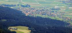
Thaur is a municipality in the district of Innsbruck-Land in the Austrian state of Tyrol located 5 km east of Innsbruck between Rum, Austria and Hall in Tirol.
Settlement of the area probably began around 1000 BC but the location was mentioned as “Taurane” for the first time in 827. Thaur is very religious even nowadays.
Population
| Historical population | ||
|---|---|---|
| Year | Pop. | ±% |
| 1869 | 1,120 | — |
| 1880 | 1,062 | −5.2% |
| 1890 | 1,092 | +2.8% |
| 1900 | 1,162 | +6.4% |
| 1910 | 1,199 | +3.2% |
| 1923 | 1,206 | +0.6% |
| 1934 | 1,379 | +14.3% |
| 1939 | 1,449 | +5.1% |
| 1951 | 1,807 | +24.7% |
| 1961 | 1,867 | +3.3% |
| 1971 | 2,409 | +29.0% |
| 1981 | 2,774 | +15.2% |
| 1991 | 3,230 | +16.4% |
| 2001 | 3,483 | +7.8% |
| 2011 | 3,760 | +8.0% |
References
External links
| Wikimedia Commons has media related to Thaur. |
- Municipality Thaur: Official website of the municipality in the Hall-Wattens region
This article is issued from Wikipedia - version of the 5/22/2016. The text is available under the Creative Commons Attribution/Share Alike but additional terms may apply for the media files.