Thái Bình
| Thái Binh thanh hoa | |
|---|---|
| Vu Lac | |
 Thái Binh Location of Thai Binh in Vietnam | |
| Coordinates: VN 20°26′46″N 106°20′32″E / 20.44611°N 106.34222°E | |
| Country |
|
| Province | Thái Bình |
| Established | 29 April 2004 |
| Area | |
| • Total | 67.7135 km2 (26.1443 sq mi) |
| Population (2013) | |
| • Total | 268,167 |
| • Density | 3,961/km2 (10,260/sq mi) |
Thái Bình (![]() listen) is a city in the Red River Delta of northern Vietnam. It is the capital of Thái Bình Province. The city is located 110 km from Hanoi. The city area is 67.7 square km, with a population of 210,000 people (2006).
listen) is a city in the Red River Delta of northern Vietnam. It is the capital of Thái Bình Province. The city is located 110 km from Hanoi. The city area is 67.7 square km, with a population of 210,000 people (2006).
History

In the 10th century, the area was the domain of the Tran clan, which rose in power to become the Trần Dynasty of Vietnam in the early 13th century. The town Thái Bình (Sino-Vietnamese: 太平) developed near the Keo Pagoda constructed in 1061.
Before the prime minister declared it a city in June 2004, Thai Binh was officially a town. The city is the center of economics and culture in its province. Thai Binh Medical College is considered one of the highest quality medical colleges in Vietnam.[1]
References
- ↑ BMJ: British Medical Journal - Volume 313, Issues 7061-7072 1996- Page 1115 "Data from Thai Binh reproductive health survey, April 1992, on 347 mothers delivering for first time from April 1987 to ... We thank the participating women in this survey, our colleagues at Thai Binh Medical College, and the staff of Centre for ..."
Coordinates: 20°26′46″N 106°20′32″E / 20.446111°N 106.342222°E
| Centrally-controlled municipalities |
| ||||||||||
|---|---|---|---|---|---|---|---|---|---|---|---|
| Provincial cities |
| ||||||||||
| Bắc Ninh Province | 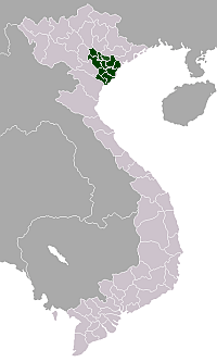 | |
|---|---|---|
| Hà Nam Province | ||
| Hải Dương Province | ||
| Hưng Yên Province | ||
| Nam Định Province | ||
| Ninh Bình Province | ||
| Thái Bình Province | ||
| Vĩnh Phúc Province | ||