Tetherow, Oregon
| Tetherow, Oregon | |
|---|---|
| Census-designated place | |
 Tetherow  Tetherow Location in the state of Oregon | |
| Coordinates: 44°2′20″N 121°22′0″W / 44.03889°N 121.36667°WCoordinates: 44°2′20″N 121°22′0″W / 44.03889°N 121.36667°W[1] | |
| Country | United States |
| State | Oregon |
| County | Deschutes |
| Area | |
| • Total | 2.11 sq mi (5.46 km2) |
| • Land | 2.11 sq mi (5.46 km2) |
| • Water | 0.0 sq mi (0.0 km2) |
| Elevation | 3,790 ft (1,160 m) |
| Population (2010) | |
| • Total | 45 |
| • Density | 21/sq mi (8.2/km2) |
| Time zone | Pacific (PST) (UTC-8) |
| • Summer (DST) | PDT (UTC-7) |
| FIPS code | 41-72820[2] |
| GNIS feature ID | 2584427[1] |
Tetherow is a census-designated place (CDP) in Deschutes County, Oregon, United States. It is part of the Bend, Oregon Metropolitan Statistical Area. The population was 45 at the 2010 census.[2]
Geography
Tetherow is located in central Deschutes County along the western edge of the city of Bend, the county seat and largest city in the county. According to the United States Census Bureau, the CDP has a total area of 2.11 square miles (5.46 km2), all land.[2]
References
- 1 2 U.S. Geological Survey Geographic Names Information System: Tetherow Census Designated Place
- 1 2 3 "Geographic Identifiers: 2010 Demographic Profile Data (G001): Tetherow CDP, Oregon". U.S. Census Bureau, American Factfinder. Retrieved December 14, 2015.
Municipalities and communities of Deschutes County, Oregon, United States | ||
|---|---|---|
| Cities | 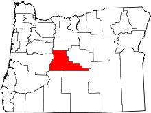 | |
| CDPs | ||
| Other unincorporated communities | ||
This article is issued from Wikipedia - version of the 7/30/2016. The text is available under the Creative Commons Attribution/Share Alike but additional terms may apply for the media files.