Terrebonne, Oregon
| Terrebonne, Oregon | |
|---|---|
| Census-designated place | |
|
Post office in Terrebonne | |
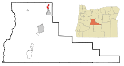 Location of Terrebonne, Oregon | |
| Coordinates: 44°20′57″N 121°10′48″W / 44.34917°N 121.18000°WCoordinates: 44°20′57″N 121°10′48″W / 44.34917°N 121.18000°W[1] | |
| Country | United States |
| State | Oregon |
| County | Deschutes |
| Area | |
| • Total | 1.0 sq mi (2.6 km2) |
| • Land | 1.0 sq mi (2.6 km2) |
| • Water | 0.0 sq mi (0.0 km2) |
| Elevation | 2,871 ft (875 m) |
| Population (2010) | |
| • Total | 1,257 |
| • Density | 1,239/sq mi (478.2/km2) |
| Time zone | Pacific (PST) (UTC-8) |
| • Summer (DST) | PDT (UTC-7) |
| ZIP code | 97760 |
| FIPS code | 41-72800[2] |
| GNIS feature ID | 1637864[3] |

Terrebonne is an unincorporated community and census-designated place (CDP) in Deschutes County, Oregon, United States. It is part of the Bend, Oregon Metropolitan Statistical Area. The population was 1,257 at the 2010 census.[4]
Geography
Terrebonne is located in northeastern Deschutes County along U.S. Route 97. It is 6 miles (10 km) north of Redmond, 24 miles (39 km) north of Bend, the county seat, and 20 miles (32 km) south of Madras. According to the United States Census Bureau, the CDP has a total area of 1.0 square mile (2.6 km2), all land,[4] a reduction from 4.5 square miles (12 km2) at the 2000 census.
Climate
This region experiences warm (but not hot) and dry summers, with no average monthly temperatures above 71.6 °F. According to the Köppen Climate Classification system, Terrebonne has a warm-summer Mediterranean climate, abbreviated "Csb" on climate maps.[5]
Demographics

As of the census[2] of 2000, there were 1,469 people, 531 households, and 409 families residing in the CDP. The population density was 325.3 people per square mile (125.5/km²). There were 561 housing units at an average density of 124.2 per square mile (47.9/km²). The racial makeup of the CDP was 94.49% White, 0.07% African American, 0.95% Native American, 0.14% Asian, 2.18% from other races, and 2.18% from two or more races. Hispanic or Latino of any race were 4.56% of the population.
| Historical population | |||
|---|---|---|---|
| Census | Pop. | %± | |
| 1930 | 75 | — | |
| 1950 | 198 | — | |
| 1960 | 378 | 90.9% | |
| 1970 | 521 | 37.8% | |
| 1980 | 900 | 72.7% | |
| 1990 | 1,143 | 27.0% | |
| 2000 | 1,469 | 28.5% | |
| 2010 | 1,257 | −14.4% | |
| source:[6] | |||
There were 531 households out of which 35.8% had children under the age of 18 living with them, 64.6% were married couples living together, 7.5% had a female householder with no husband present, and 22.8% were non-families. 20 3% of all households were made up of individuals and 7.3% had someone living alone who was 65 years of age or older. The average household size was 2.76 and the average family size was 3.13.
In the CDP the population was spread out with 28.4% under the age of 18, 5.4% from 18 to 24, 27.2% from 25 to 44, 26.7% from 45 to 64, and 12.3% who were 65 years of age or older. The median age was 39 years. For every 100 females there were 108.7 males. For every 100 females age 18 and over, there were 100.0 males.
The median income for a household in the CDP was $37,674, and the median income for a family was $49,375. Males had a median income of $26,359 versus $23,476 for females. The per capita income for the CDP was $17,698. About 3.9% of families and 7.6% of the population were below the poverty line, including 4.2% of those under age 18 and 14.4% of those age 65 or over.
Points of interest
References
- ↑ "US Gazetteer files: 2010, 2000, and 1990". United States Census Bureau. 2011-02-12. Retrieved 2011-04-23.
- 1 2 "American FactFinder". United States Census Bureau. Retrieved 2008-01-31.
- ↑ "US Board on Geographic Names". United States Geological Survey. 2007-10-25. Retrieved 2008-01-31.
- 1 2 "Geographic Identifiers: 2010 Demographic Profile Data (G001): Terrebonne CDP, Oregon". U.S. Census Bureau, American Factfinder. Retrieved December 14, 2015.
- ↑ Climate Summary for Terrebonne, Oregon
- ↑ Moffatt, Riley. Population History of Western U.S. Cities & Towns, 1850-1990. Lanham: Scarecrow, 1996, 216.
| Wikimedia Commons has media related to Terrebonne, Oregon. |
Municipalities and communities of Deschutes County, Oregon, United States | ||
|---|---|---|
| Cities | 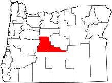 | |
| CDPs | ||
| Other unincorporated communities | ||