Tepezalá Municipality
| Tepezalá | |
|---|---|
| Municipality | |
 Municipality location in Aguascalientes | |
|
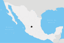
Tepezalá Location in Mexico | |
| Coordinates: 22°13′N 102°10′W / 22.217°N 102.167°WCoordinates: 22°13′N 102°10′W / 22.217°N 102.167°W | |
| Country |
|
| State | Aguascalientes |
| Municipal seat | Tepezalá |
| Area | |
| • Total | 231.70 km2 (89.46 sq mi) |
| Population (2015) | |
| • Total | 20,926 |
| • Density | 90/km2 (230/sq mi) |
Tepezalá is a municipality in the Mexican state of Aguascalientes. It stands at 22°13′N 102°10′W / 22.217°N 102.167°W. Its municipal seat is the town of Tepezalá.
Tepezala is located on the foothills of the eastern mountains of the state, a land rich in minerals and arid in vegetation that was on the old Silver Route during the 16th century, which brought so much wealth to the region and help conquer the inhospitable north of Mexico.
Demographics
As of 2010, the municipality had a total population of 19,668.[1]
As of 2010, the town of Tepezalá had a population of 4,511.[1] Other than the town of Tepezalá, the municipality had 132 localities, the largest of which (with 2010 populations in parentheses) were: San Antonio (3,345), classified as urban, and El Chayote (1,817), and Carboneras (1,261), classified as rural.[1]
References
- 1 2 3 "Tepezalá". Catálogo de Localidades. Secretaría de Desarrollo Social (SEDESOL). Retrieved 23 April 2014.