Tengnoupal
| Tengnoupal | |
|---|---|
| Village | |
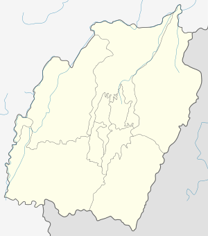 Tengnoupal  Tengnoupal Location in Manipur, India | |
| Coordinates: 24°19′41″N 93°59′10″E / 24.328°N 93.986°ECoordinates: 24°19′41″N 93°59′10″E / 24.328°N 93.986°E | |
| Country |
|
| State | Manipur |
| District | Chandel |
| Government | |
| • Type | Tribal chief |
| Elevation | 1,450 m (4,760 ft) |
| Population (2011) | |
| • Total | 2,158 |
| Languages | |
| • Official | Kuki |
| Time zone | IST (UTC+5:30) |
| PIN | 795131 |
| Vehicle registration | MN |
| Coastline | 0 kilometres (0 mi) |
| Website |
tengnoupal |
Tengnoupal is a Mate-ethnic village at the highest point of a road (NH-2) between Imphal and northwestern Myanmar (Burma); the National Highway passes through the village. The climate is predominantly cold all throughout the year and remains foggy during the rainy season.
Historical lineage
It was bombed by the British Royal Air Force(RAF) in 1942 during World War II. It was the most strategic location for the Army and Tengnoupal remained as the Army HQ.
The Recent Precedents
In the 1960s and 1970s, Tengnoupal was the District Head Quarter and it was shifted to Chandel in 1974.Though Tengnoupal is geographically strategical for installation of many Government infrastructures. One could see the political suppression of the Mate Tribe inhabiting Tengnoupal by both Kuki and Naga tribe. However,Tengnoupal remained as the Sub-Division and TD Block HQ. Tengnoupal, the Ooty-like high altitude hill-top Sub-Divisional head quarter was perfect for a get-away for nature lovers.
Political/Administration
It is the headquarters of Tengnoupal Sub-division. Some notable government machineries stationed in the village are:
1.SDO Office
2.Police Station, headed by an SDPO
3.Primary Health Centre.
5.Forest Range Office
6.24th Battalion Assam Rifles Headquarters.
The Chandel District was formerly known as Tengnoupal District until the change was effected on May 13, 1974.
Geography
The National Highway 2 snakes through Tengnoupal east to west. It is 69 km from Imphal. Nearest airport is Tulihal Airport. It is the highest point above sea-level on the Imphal-Moreh Highway.
Location (strategic significance)
The village is a transit point of some important state highways:
1.Tengnoupal-Sita-Sansak road
2.Tengnoupal-Joupi-New Samtal road
Demography
Tengnoupal, with total 300 household residing, has population of 2158 of which 1477 are males while 681 are females as per Population Census 2011.
In Tengnoupal village population of children with age 0-6 is 140 which makes up 6.49% of total population of village. Average Sex Ratio of Tengnoupal village is 461 which is lower than Manipur state average of 992. Child Sex Ratio for the Tengnoupal as per census is 750, lower than Manipur average of 936.
Tengnoupal village has lower literacy rate compared to Manipur. In 2011, literacy rate of Tengnoupal village was 76.02% compared to 79.21% of Manipur. In Tengnoupal Male literacy stands at 84.75% while female literacy rate was 56.36%. [1]
Point of Attraction
It is an ideal place for tacking and there is increasing inflow of tourist every seasons. During monsoon the place is foggy and makes it the best place for romance. Since Tengoupal is situated on the top most range of the Indo-Myanmar region one could get the bird's eye view of the beautiful sceneries of hills and the vast lusty plains of Kabaw-Valley (Myanmar).
.jpg)
Besides, during summer the cold wins sweep the hills of Tengnoupal which makes this place the most sought after for summer recreation for families.
In News
1.Tengnoupal basks in Chang Kut celebration [2]
2.Tengnoupal hops onto district demand bandwagon [3]
3. Tengnoupal bandh affecting border trade activities [4]
4. Tengnoupal indefinite bandh called off after talks with DIG, AR [5]
References
- ↑ http://www.census2011.co.in/data/village/270677-tengnoupal-manipur.html
- ↑ http://www.thesangaiexpress.com/page/items/44505/tengnoupal-basks-in-chang-kut-celebration
- ↑ http://e-pao.net/GP.asp?src=6..050811.aug11
- ↑ http://manipurtimes.com/news-article/the-peoples-chronicle-news/item/15599-tengnoupal-bandh-affecting-border-trade-activities
- ↑ http://ifp.co.in/page/items/25226/tengnoupal-indefinite-bandh-called-off-after-talks-with-dig-ar