Tell Maghas
| Tell Maghas تل مغاص Gawar | |
|---|---|
| Village | |
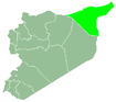
 Tell Maghas Location of Tell Maghas in Syria | |
| Coordinates: 36°36′56″N 40°23′17″E / 36.61556°N 40.38806°ECoordinates: 36°36′56″N 40°23′17″E / 36.61556°N 40.38806°E | |
| Country |
|
| Governorate | al-Hasakah |
| District | al-Hasakah |
| Subdistrict | Tell Tamer |
| Population (2004)[1] | 194 |
| Time zone | EET (UTC+2) |
| • Summer (DST) | EEST (UTC+3) |
| Geocode | C4394 |
Tell Maghas (Arabic: تل مغاص), also known as Gawar (كاور), is a village near Tell Tamer in western al-Hasakah Governorate, northeastern Syria. Administratively it belongs to the Nahiya Tell Tamer.
The village is inhabited by Assyrians belonging to the Assyrian Church of the East.[2] At the 2004 census, it had a population of 194.[1]
See also
References
- 1 2 "2004 Census Data for Nahiya Tell Tamer" (in Arabic). Syrian Central Bureau of Statistics. Retrieved 15 October 2015. Also available in English: UN OCHA. "2004 Census Data". Humanitarian Data Exchange. Retrieved 4 December 2015.
- ↑ Fernandez, Alberto M. (1998). "Dawn at Tell Tamer: The Assyrian Christian Survival on the Khabur River" (PDF). Journal of Assyrian Academic Studies. 12 (1): 34–47.
This article is issued from Wikipedia - version of the 1/25/2016. The text is available under the Creative Commons Attribution/Share Alike but additional terms may apply for the media files.