Tell Tamer
| Tell Tamer ناحية تل تمر Girê Xurma | |
|---|---|
| Town | |
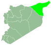
 Tell Tamer Location of Tell Tamer in Syria | |
| Coordinates: 36°39′38″N 40°22′17″E / 36.6606°N 40.3714°ECoordinates: 36°39′38″N 40°22′17″E / 36.6606°N 40.3714°E | |
| Country |
|
| Governorate | al-Hasakah |
| District | al-Hasakah |
| Subdistrict | Tell Tamer |
| Population (2004)[1] | 7,285 |
| Time zone | EET (UTC+2) |
| • Summer (DST) | EEST (UTC+3) |
| Geocode | C4409 |
Tell Tamer (Arabic: تل تمر, Syriac: ܬܠ ܬܡܪ, Kurdish: Girê Xurma[2]) also known as Tal Tamr or Tal Tamir, is a small town in western al-Hasakah Governorate, northeastern Syria. It is administrative center of the Tell Tamer Nahiya consisting of 13 municipalities.
Originally inhabited by Assyrians, the town is now predominantly populated by Kurds and recently settled Arab Bedouin, with the Assyrians remaining a substantial minority of about 20%. At the 2004 census, Tell Tamer had a population of 7,285.[1]
Located by the Khabur River at an intersection between the M4 Highway (Aleppo–Mosul) and the major road between al-Hasakah and Diyarbakır (Turkey), the town is a transport hub of major importance.
Etymology
The name of the town, "Tell Tamer", is derived from the Arabic and Aramaic words "tell/tella", both meaning "hill", and "tamer/tamra", both meaning "date". The name of the town therefore means "Hill of Dates".
Geography and climate
In the Upper Khabur Valley of Jazira in northeastern Syria, Tell Tamer is situated on the left (eastern) bank of Khabur River, just south of the small Zirgan river's estuary. About 3 kilometres (1.9 mi) to the east, the landscape ascends to the volcanic basalt plateau Ard al-Shaykh.
Tell Tamer lies on a direct line between the city of Ras al-Ayn some 35 kilometres (22 mi) to the northwest and the provincial capital al-Hasakah some 40 kilometres (25 mi) to the southeast. The intersection with the M4 highway (Aleppo–Mosul) and the nearby river crossing make Tell Tamer an essential transport hub.
History
Settled in the 1930s by Iraqi Assyrian refugees fleeing the Simele massacre in Iraq, who moved to French controlled Syria and settled in a 25 km stretch of the Khabur River in 35 settlements.
 Tal Tamer (1939)
 Assyrian men in Tal Tamer (1939)
 Assyrian woman cooking (1939)
 Assyrian woman spinning wool (1939)
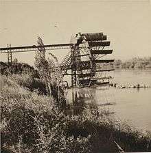 Tal Tamer watermill (1939)
Syrian Civil War
An Assyrian exodus from the town began in November 2012, when Free Syrian Army (Islamic Terrorist militants) soldiers threatened to invade the town. The exodus further continued when the Islamic State of Iraq and Syria took control of nearby roads just outside the town.
In October 2013, four Assyrians were stopped while driving in a car and kidnapped by Islamic State of Iraq and Syria terrorists.
According to the Syriac International News Agency, in May 2014, the Islamic State of Iraq and the Levant attacked an Assyrian village in the town, which prompted the Assyrians to call the Kurdish People's Protection Units to help protect them.[3]

Since ISIL militants captured the city of Ar-Raqqah, some Assyrians from there and from Al-Thawrah fled to Tell Tamer as refugees. However, more than 500 Assyrian families have also fled the town. Many Assyrians from the town emigrated mainly to the United States, Europe and Canada.
In February 2015 the town was taken by the Islamic State militia,[4] resulting in the abduction of about 90 residents.[5] during the al-Hasakah offensive.[6] Several thousand residents fled the city, mostly to the city of al-Hasakah.
On 23 February 2015, ISIL kidnapped around 220 Assyrians from villages surrounding Tell Tamer, and by 26 February, that number had increased to 350. On 1 March, ISIL released 19 of the kidnapped Assyrians.[7] On 24 March 5 more Assyrian hostages were released, raising the number of released Assyrian hostages to 24.[8]
Demographics
Its original inhabitants are Assyrians from the Upper Tyari tribe, who came to the area from Hakkari region in Turkey via Iraq.[9] As late as the 1960s, they still comprised virtually the entire population of the town.[10] The majority of the town's modern population is composed of by Arabs and Kurds, while local Assyrian leaders in the 1990s estimated their own community's presence in the town to be around 20%.[11]
Historical population estimates are as follows: 1,244 (1936); 1,250 (1960); 2,994 (1981); 5,030 (1993); 5,216 (1994); 5,405 (1995).[12]
The pre-war scholarly estimates actually placed the total number of Assyrians belonging to the Assyrian Church of the East living all over of Syria at around 30,000 individuals, with between 15,000 and 20,000 (i.e., 2/3, at most) of them living along the Khabur.[13]
Religion
The Assyrian "Church of Our Lady", located in the Old Town, at a prominent place near the actual Tell (hill), serves as the center of the Assyrian community. In the early 1980s the original church built of mud-brick in the 1930s was broken down and replaced by a new Italianate-style building. A large green-domed brick mosque built in the 1970s serves the growing Muslim community just to the south of the town center.[14]
Notable people
- Juliana Jendo, prominent Assyrian singer.
- Omar Souleyman, prominent Arabic singer.
See also
References
- 1 2 "2004 Census Data for Nahiya Tell Tamer" (in Arabic). Syrian Central Bureau of Statistics. Retrieved 15 October 2015. Also available in English: UN OCHA. "2004 Census Data". Humanitarian Data Exchange. Retrieved 4 December 2015.
- ↑ "ISIS Attacks Tell Tamer". Peyamner News Agency (in Kurdish). 15 February 2015. Retrieved 28 February 2015.
- ↑ "Assyrian citizens called the YPG to defend them against ISIS – Syriac International News AgencySyriac International News Agency". Syriac International News Agency. Retrieved 25 February 2015.
- ↑ Christians flee jihadists after Syria kidnappings 26 February 2015.
- ↑ Syrian sources say ISIS executed 15 Christians – with more killing to come, 26 February 2015.
- ↑ Islamic State 'abducts dozens of Christians in Syria' 24 February 2015.
- ↑ http://www.telegraph.co.uk/news/worldnews/islamic-state/11443872/Isil-frees-19-abducted-Christians.html
- ↑ "IS releases 24 Assyrian Christians so far". SOHR. Retrieved 3 March 2015.
- ↑ Fernandez 1998, p. 41.
- ↑ Fernandez 1998, p. 43.
- ↑ Fernandez 1998, p. 37.
- ↑ Fernandez 1998, p. 43 f..
- ↑ Fernandez 1998, p. 30.
- ↑ Fernandez 1998, p. 38.
Literature
- Fernandez, Alberto M. (1998). "Dawn at Tell Tamer: The Assyrian Christian Survival on the Khabur River" (PDF). Journal of Assyrian Academic Studies. 12 (1): 34–47.