Khirbet Kerak
| Khirbet al-Karak | |
.JPG) | |
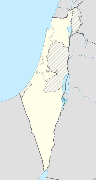 Shown within Israel | |
| Alternate name | Beth Yerah, Tell Beth Yerah[1] |
|---|---|
| Location |
|
| Coordinates | 32°43′05″N 35°34′19″E / 32.717958°N 35.571864°E |
| Area | c.250 Dunams |
| History | |
| Periods | Bronze Age - Crusader period |
| Site notes | |
| Archaeologists | Na'im Makhouly, Benjamin Mazar, Michael Avi-Yonah, Moshe Sheteklis, Emanuel Dunayevsky, Pesach Bar-Adon, P.L.O. Guy, Ruth Amiran, Rafi Greenberg |
| Website | Tel Bet Yerah Research and Excavation Project |
Khirbet Kerak (Arabic: خربة الكرك Khirbet al-Karak, "the ruin of the fortress") or Beth Yerah (Hebrew: בית ירח , "House of the Moon (god)") is a tell (archaeological mound) located on the southern shore of the Sea of Galilee in modern-day Israel.[2] The tell spans an area of over 50 acres—one of the largest in the Levant—and contains remains dating from the Early Bronze Age (c. 3000 BC - 2000 BC) and from the Persian period (c. 450 BC) through to the early Islamic period (c. 1000 AD).[2][3][4]
"Khirbet Kerak ware" is a type of Early Bronze Age Syro-Palestinian pottery first discovered at this site. It is also found in other parts of the Levant (including Jericho, Beth Shan, Tell Judeideh, and Ugarit).[5] Khirbet Kerak culture appears to have been a Levantine version of the Early Transcaucasian Culture.[6]
Location
The tell of Khirbet Kerak lies where the Sea of Galilee empties into the Jordan river and rises 15 meters above the level of the Sea of Galilee.[2][7] It is triangular in shape and approximately 1.2 km by 380 m (at its widest point), covering 60-75 acres. The Jordan river runs to the south, although it previously (until the medieval period at the earliest[8]) ran north and west of it.[9]
History
Early Bronze Age (3300/3500-2200 BCE) - The 2009 discovery at the tell of a stone palette with Egyptian motifs, including an ankh,[10] points to trade/political relations with the First dynasty of Egypt, at approximately 3000 BCE.[11][12] Excavators have identified four levels of occupation from the Early Bronze Age (EB). Architectural development shows the procession from (sometimes oval) pit dwellings (I) to mud-brick (II), to basalt foundations with mud-brick (III), and then on to basalt structures (IV), over approximately 1000 years. The basalt houses belong to the same phase as the Khirbet al-Kerak pottery, dated to the Early Bronze Age III. From the earliest phases, the settlement was protected from the south and west by a city wall (the north and east facing the Sea of Galilee). The wall consisted of three connecting parallel walls, forming a massive wall, 25 feet (7.6 m) thick, built of mud-bricks. The gate was on the south and was built of basalt.[13] Evidence of an urban, orthogonal layout was found, dating to the EB II,[14] supporting the claim that the city was one of the regional urban centers of the period.[15]
A large (90×120 feet) building ("the circles building") was built in the EBIII, at the northern part of the tel. Of this building only the basalt foundations of the walls remain, in the form of a pavement 30 feet (9.1 m) wide. In this pavement, ten sunken large circles were found. Each circle is intersected by two partition walls forming four compartments. In the courtyard were ovens in which Khirbet al-Kerak pottery was found. The building is generally identified as a public granary.[13] At full capacity, the granary could hold an estimated 1700 tons of grain.[16] Below this building, remains dated to both EB I(b) and EB II were found. At some point, the building was parceled out to various artisans during EB III––clearly not the original purpose for which the structure was built.[14]
Middle Bronze Age (2200–1550 BC) - Around 2000 BC, the city was destroyed or abandoned.[4] From the Middle Bronze Age I, a paved street, a potters workshop and other remains were excavated. Middle Bronze Age II is represented by a tomb. Parts of the city walls are also dated to the MB.[13]
Biblical period - There are no signs of habitation from 1200-450 BC until the site's reuse during the Persian period.[4]
Bet Yerah
Beth Yerah means "House of the Moon (god)".[17] Though it is not mentioned in the Hebrew Bible or other Bronze or Iron Age sources,[2] the name may preserve, at least in part, the Canaanite toponym of Ablm-bt-Yrh, "the city/fort (qrt) of his-majesty Yarih". As Ablm (Heb. Abel), this location is mentioned in the 14th century BCE Epic of Aqht, and is thought to be a reference to the Early Bronze Age structure extant at Khirbet Kerak.[18]
The name Bet Yerah has generally been accepted and applied to the site of Khirbet Kerak, though the evidence for its being located there is circumstantial.[19] Established in the Hellenistic period (c. 4th century BCE), Bet Yerah ceased to exist with the end of that period (c. 1st century BCE).[20] It was given the Greek name Philoteria by Ptolemy II Philadelphus for his sister, as indicated by remains dating to the Ptolemaic rule (3rd century BCE).[20][21] Hellenistic remains identified as those of ancient Philoteria by Amihai Mazar consist of, "a considerable number of spacious town-houses built on an orthogonal plan within the confines of the Early Bronze Age fortifications. The total extent of the settlement was about 700 meters from north to south, and 200 meters from east to west. Ceramic and other finds of the 3rd-2nd centuries BCE were abundant in this settlement, and some houses had remains of decorated wall plaster."[22] Four villas in Philoteria/Bet Yerah dating to the late Hellenistic period are the oldest known examples of the big mansion (domus), a type of domestic architecture seen in Roman-Byzantine period Palestine.[23] One of them measures 22 x 12 metres and consists of 11 rooms decorated with marble, stucco, and mosaics that were accessed by way of an entrance to a colonnaded courtyard.[23]
During the Roman period, a fortress was built there and the place became known and named for this feature.[24] The Jerusalem Talmud mentions Bet Yerah as sitting alongside Sinnabri (al-Sinnabra), describing both as walled cities,[7][25][26] but also uses the name Kerakh to refer to Bet Yerah.[24] Kerakh, meaning "fortress," was the Aramaic name for the site in the Roman period, and it is from this name that the Arabic Khirbet al-Kerak ("ruins of the castle") is derived.[24]
Al-Sinnabra
Al-Sinnabra or Sinn en-Nabra, as it is known in Arabic, was known in the Hellenistic times by the Greek name Sennabris.[7][27] It was a twin city of Bet Yerah.[27] In the Byzantine period, a church was constructed there and it shows signs of having been reused as a dar, or manor house, during the early Islamic period.[28]
An Arab Islamic palatial complex or qasr in al-Sinnabra, known by the same name, served as a winter resort to Mu'awiya, Marwan I, and other caliphs in Umayyad-era Palestine (c. 650-704 AD).[29][30][31] For decades, part of this complex was misidentified as a Byzantine era (c. 330-620 CE) synagogue; excavations carried out in 2010 confirmed an architectural analysis made by Donald Whitcomb in 2002 suggesting the building to be the qasr of al-Sinnabra.[32][33][34][35] Constructed in the 7th century by Mu'awiya and Abdel Malik, another Umayyad caliph who also commissioned the building of the Dome of the Rock in the Old City of Jerusalem, it likely represents the earliest Umayyad complex of this type yet to be discovered.[36][37][38]
During the Crusades, it was the site of the 1113 Battle of Al-Sannabra,[39] and in the lead up to the Battle of Hittin in 1187, Saladin and his forces passed through al-Sinnabra before moving on to command the roads around Kafr Sabt.[40]
Archaeology
.JPG)
The tell was first surveyed in the 1920s first by Eleazar Sukenik and then later by William Foxwell Albright.[41] [42] In 1933, Na'im Makhouly, a Christian Palestinian from Nazareth, who was an inspector for the Mandate Department of Antiquities at the time of the construction of the Samak-Tiberias highway that cut across the tell, conducted a salvage excavation.[43]
During the 1940s, parts of the tell were excavated by Benjamin Mazar, Michael Avi-Yonah, Moshe Sheteklis, and Emanuel Dunayevsky.[44] In 1946, in the northern quadrant of the tell, a fortified compound consisting of a series of large structures, including a bathhouse adjoined to large apsidal hall that is decorated with colorful mosaics, was discovered just above the granary (AKA the Circles Building), an Early Bronze Age structure uncovered in previous excavations.[22] [36]
Between 1950 and 1953,[45] [46] [47] P.L.O. Guy and Pesach Bar-Adon, two Israeli archaeologists excavated the compound, falsely identifying a building there as a 5th-6th century synagogue, because of the presence of a column base engraved with a seven-branched candelabrum.[30][34][36][37]
Excavations by the Oriental Institute of the University of Chicago in 1960 uncovered a Byzantine church to the north of the fortified compound.[28]
In 1976, Ruth Amiran conducted a salvage excavation on the tell. More salvage excavations were carried out by Nimrod Getzov in 1994 and 1995.[48]
In the summer of 2003, excavations were renewed in the northern part of the site with a pilot excavation in the granary.[49] Excavations undertaken by Israeli archaeologists headed by Raphael Greenberg from Tel Aviv University's Institute of Archaeology in 2010 confirmed that the fortified compound was in fact the Arab Islamic palatial complex of al-Sinnabra.[31][34][35]
References
| Wikimedia Commons has media related to Tel Beth Yerah. |
- ↑ Barbara Ann Kipfer. Barbara Ann Kipfer, ed. Encyclopedic dictionary of archaeology (Illustrated ed.). Springer, 2000. p. 277. ISBN 978-0-306-46158-3.
- 1 2 3 4 Eric M. Meyers, American Schools of Oriental Research (1997). The Oxford encyclopedia of archaeology in the Near East, Volume 1 (Illustrated ed.). Oxford University Press. p. 312.
- ↑ The Holy Land: An Archaeological Guide from Earliest Times to 1700, Jerome Murphy O'Connor, Oxford University Press, 1980, p.159
- 1 2 3 Milgrom, Jacob; Wright, David Pearson; Freedman, David Noel; Hurvitz, Avi (1995). Pomegranates and golden bells: studies in biblical, Jewish, and Near Eastern ritual, law, and literature in honor of Jacob Milgrom (Illustrated ed.). Eisenbrauns. pp. 630–632. ISBN 978-0-931464-87-4.
- ↑ Khirbet Kerak Ware ancientneareast.net
- ↑ Ian Shaw; Robert Jameson (2002). Ian Shaw; Robert Jameson, eds. A dictionary of archaeology (6th, illustrated, reprint ed.). Wiley-Blackwell. ISBN 0-631-23583-3.
- 1 2 3 Milgrom, Jacob; Wright, David Pearson; Freedman, David Noel; Hurvitz, Avi (1995). Pomegranates and golden bells: studies in biblical, Jewish, and Near Eastern ritual, law, and literature in honor of Jacob Milgrom (Illustrated ed.). Eisenbrauns. p. 630, footnote #2. ISBN 978-0-931464-87-4.
- ↑ Hestrin, Ruth (1992). E.Stern, ed. האנצקלופדיה החדשה לחפירות ארכיאולוגיות בארץ ישראל [The New Encyclopedia of Archaeological Excavations in the Holy Land] (in Hebrew). I. pp. 175–181.
- ↑ Josephus, Flavius; Mason, Steve (2003). Life of Josephus (Reprint, illustrated ed.). Brill. p. 193. ISBN 978-0-391-04205-6.
- ↑ Raphael, Greenberg; Wengrow, David; Paz, Sarit (June 2010). "Cosmetic connections? An Egyptian relief carving from Early Bronze Age Tel Bet Yerah (Israel)". Antiquity. Retrieved 2010-07-11.
- ↑ Greenberg, Rafi. גן לאומי תל בית ירח [Bet Yerah National Park] (in Hebrew). Israel Antiquities Authority.
- ↑ Siegel, Judy (2009-07-09). "New discovery links ancient Egypt and Jordan valley site". Jpost.com. Retrieved 2010-07-04.
- 1 2 3 Negev, Avraham, ed. (2001). Beth Yerah. Archaeological encyclopedia of the Holy Land. pp. 88–89. ISBN 0-8264-1316-1.
- 1 2 Greenberg, Raphael (2005-03-30). "Tel Bet Yerah". Excavations and Surveys in Israel. Israel Antiquities Authority.
- ↑ Encyclopedia of Prehistory, p.97
- ↑ Encyclopedia of Prehistory, p.92
- ↑ Milgrom, p. 638.
- ↑ Baruch Margalit (1989). Baruch Margalit, ed. The Ugaritic poem of Aqht: text, translation, commentary. Walter de Gruyter. ISBN 978-0-89925-472-2. ISBN 0-89925-472-1.
- ↑ Douglas L. Esse (1991). Subsistence, trade, and social change in early Bronze Age Palestine (Illustrated ed.). Oriental Institute of the University of Chicago. p. 35. ISBN 978-0-918986-66-5.
- 1 2 Zeev Safrai (1994). The economy of Roman Palestine (Illustrated ed.). Routledge. ISBN 978-0-415-10243-8. ISBN 0-415-10243-X.
- ↑ Chancey, Mark A. (2002). The myth of a Gentile Galilee. Cambridge University Press. p. 98. ISBN 978-0-521-81487-4. Retrieved 2010-07-11.
- 1 2 Amihai Mazar. "al-Sinnabra Overview". The Shelby White-Leon Levy Program for Archaeological Excavations. Retrieved 2010-03-16.
- 1 2 Moxnes, Halvor (1997), Constructing early Christian families: family as social reality and metaphor, CRC Press, pp. 49, 52, ISBN 978-0-203-44049-0
- 1 2 3 L. SUKENIK. "The Ancient City of Philoteria (Beth Yerah)". Journal of the Palestine Oriental Society. p. 107.
- ↑ Gil, 1997, p. 78, footnote #5.
- ↑ Lightfoot, John (2007). From the Talmud and Hebraica, Volume 1. Cosimo Inc. p. 142. ISBN 978-1-60206-406-5.
- 1 2 Ugarit-Forschungen, Volume 8. Verlag Butzon & Bercker. 1977. p. 179.
- 1 2 Whitcomb in Schuzman, 2009, p. 245.
- ↑ Whitcomb in Schuzman, 2009, p. 241.
- 1 2 "Individual Scholarship: 2001-2002 Annual Report - Donald S. Whitcomb". The Oriental Institute of the University of Chicago. July 30, 2007. Retrieved 2010-03-16.
- 1 2 "Ruins thought to be synagogue was Umayyad palace: 7th century Arab palace identified in Israel". Al-Arabiya. March 16, 2010. Retrieved 2010-03-16.
- ↑ Chancey, Mark A. (2005). Greco-Roman culture and the Galilee of Jesus (Illustrated ed.). Cambridge University Press. p. 110, footnote #74. ISBN 978-0-521-84647-9.
- ↑ Whitcomb in Schuzman, 2009, p. 246.
- 1 2 3 "Israeli archaeologists identified Caliph Mu'awiya's Lakeside Palace". Tel Aviv University: Division for Press Relations, Spokesperson & Communication Guidelines. March 15, 2010. Retrieved 2010-03-18.
- 1 2 Agence France Presse (March 16, 2010). "Ruins of 7th century Arab palace identified in Israel". Zimbio. Retrieved 2010-03-16.
- 1 2 3 "The Umayyad Qasr". Tel Bet Yerah Research and Excavation Project. Retrieved 2010-03-18.
- 1 2 "Tibériade: identification des vestiges d'un palais omeyyade". RTBF.be. March 16, 2010. Retrieved 2010-03-16.
- ↑ "Identifican el palacio de los primeros omeyas en el mar de Galilea". European Press Photo Agency. March 16, 2010. Retrieved 2010-03-16.
- ↑ Tyerman, Christopher (2006). God's war: a new history of the Crusades (Illustrated ed.). Harvard University Press. p. 203. ISBN 978-0-674-02387-1.
- ↑ Lane-Poole, Stanley (1985). Saladin and the Fall of the Kingdom of Jerusalem. The Other Press. p. 188. ISBN 978-983-9541-55-7.
- ↑ L. Sukenik, The Ancient City of Philoteria (Beth-Yerah), Journal of the Palestine Oriental Society, vol. 11, pp. 101-108, 1922
- ↑ W. F. Albright, Some Archaeological and Topographical Results of a Trip through Palestine, Bulletin of the American Schools of Oriental Research, no. 11, pp. 1-14, 1923
- ↑ http://www.tau.ac.il/humanities/archaeology/projects/betyerah/whatsnew.html
- ↑ B. Maisler, M. Stekelis, and M. Avi-Yonah, The Excavations at Beth Yerah (Khirbet el-Kerak) 1944-1946, Israel Exploration Journal, vol. 2, pp. 165-173 and pp. 219-29, 1951
- ↑ P. Bar-Adon, Beth Yerah (News and Notes), IEJ, vol. 3, pp. 132, 1953
- ↑ P. Bar-Adon, Beth Yerah (News and Notes), IEJ, vol. 4, pp. 128-129, 1954
- ↑ P. Bar-Adon, Beth Yerah (News and Notes), IEJ, vol. 5, pp. 273, 1955
- ↑ Nimrod Getzov et al., The Tel Bet Yerah Excavations 1994-1995 (IAA Reports S. No. 28), Israel Antiquities Authority, 2006, ISBN 965-406-186-4
- ↑ TBYREP
Bibliography
- Gil, Moshe (1997). A history of Palestine, 634-1099. Cambridge University Press. ISBN 978-0-521-59984-9.
- David Pearson Wright; David Noel Freedman; Avi Hurvitz (1995). Jacob Milgrom; David Pearson Wright; David Noel Freedman; Avi Hurvitz, eds. Pomegranates and golden bells: studies in biblical, Jewish, and Near Eastern ritual, law, and literature in honor of Jacob Milgrom (Illustrated ed.). Eisenbrauns. ISBN 978-0-931464-87-4.
- Peregrine, Peter Neal; Ember, Melvin, eds. (2002). Encyclopedia of Prehistory. 8: South and Southwest Asia. Human Relations Area Files Inc. ISBN 0-306-46262-1.
- Whitcomb, Donald (2009). Jeffrey Schuzman, ed. Nomads, Tribes and the State in the Ancient Near East (PDF). p. 241. ISBN 978-1-885923-61-5.
- Emanuel Eisenberg et al., Bet Yerah, the Early Bronze Age Mound: v. 1: Excavation Reports 1933-1986, Israel Antiquities Authority, 2006, ISBN 965-406-197-X