Teignbridge
For the constituency, see Teignbridge (UK Parliament constituency).
Coordinates: 50°34′55″N 3°37′41″W / 50.582°N 3.628°W
| Teignbridge District | |
|---|---|
| Non-metropolitan district | |
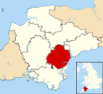 Teignbridge shown within Devon | |
| Sovereign state | United Kingdom |
| Constituent country | England |
| Region | South West England |
| Non-metropolitan county | Devon |
| Status | Non-metropolitan district |
| Admin HQ | Newton Abbot |
| Incorporated | 1 April 1974 |
| Government | |
| • Type | Non-metropolitan district council |
| • Body | Teignbridge District Council |
| • Leadership | Leader & Cabinet (Conservative) |
| • MPs |
Anne Marie Morris Mel Stride |
| Area | |
| • Total | 246.3 sq mi (637.9 km2) |
| Area rank | 56th (of 326) |
| Population (mid-2014 est.) | |
| • Total | 127,357 |
| • Rank | 167th (of 326) |
| • Density | 520/sq mi (200/km2) |
| • Ethnicity | 96.2% White British |
| Time zone | GMT (UTC0) |
| • Summer (DST) | BST (UTC+1) |
| ONS code |
18UH (ONS) E07000045 (GSS) |
| OS grid reference | SX8475477137 |
| Website |
www |
Teignbridge is a local government district in Devon, England. Its council is based in Newton Abbot.
Other towns in the district include Ashburton, Dawlish and Teignmouth. It is named for the old Teignbridge hundred.
The district was formed on 1 April 1974, under the Local Government Act 1972, as a merger of the Ashburton, Buckfastleigh, Dawlish, Newton Abbot and Teignmouth urban districts along with Newton Abbot Rural District and part of St Thomas Rural District.
Settlements
Teignbridge contains the following towns and villages:
- Abbotskerswell
- Ashburton
- Ashcombe
- Ashton
- Bickington
- Bishopsteignton
- Bovey Tracey
- Bridford
- Brimley
- Broadhempston
- Buckfastleigh
- Buckland in the Moor
- Christow
- Chudleigh
- Cockwood
- Coffinswell
- Combe Fishacre
- Combeinteignhead
- Dainton
- Dawlish
- Dawlish Warren
- Denbury
- Doddiscombsleigh
- Dunchideock
- Dunsford
- Exminster
- Forder Green
- Gabwell
- Gappah
- Haytor vale
- Heathfield
- Hennock
- Holcombe
- Humber
- Ide
- Ideford
- Ilsington
- Ipplepen
- Kenn
- Kennford
- Kenton
- Kingskerswell
- Kingsteignton
- Liverton
- Lustleigh
- Luton
- Mamhead
- Manaton
- Moretonhampstead
- Nadderwater
- Netherton
- Newton Abbot
- North Bovey
- North Whilborough
- Ogwell
- Pathfinder Village
- Ponsworthy
- Poundsgate
- Powderham
- Ringmore
- Shaldon
- Shillingford Abbot
- Shillingford St George
- Sigford
- South Knighton
- Starcross
- Stokeinteignhead
- Tedburn St Mary
- Teign Village
- Teigngrace
- Teignmouth
- Torbryan
- Trusham
- Water
- Whitestone
- Widecombe-in-the-Moor
- Woodland
This article is issued from Wikipedia - version of the 11/23/2016. The text is available under the Creative Commons Attribution/Share Alike but additional terms may apply for the media files.