Tasikmalaya Regency
| Tasikmalaya Regency Kabupaten Tasikmalaya | ||
|---|---|---|
| Regency | ||
| Other transcription(s) | ||
| • Sundanese | ᮊᮘᮥᮕᮒᮦᮔ᮪ ᮒᮞᮤᮊ᮪ᮙᮜᮚ | |
|
Rice field in Tasikmalaya, West Java | ||
| ||
|
Nickname(s): Pearl of the East Preanger München van Java (Munich of Java) | ||
| Motto: Sukapura Ngadaun Ngora | ||
 Tasikmalaya Regency Location of Tasikmalaya Regency in Indonesia | ||
| Coordinates: 7°10′S 107°56′E / 7.167°S 107.933°E | ||
| Country | Indonesia | |
| Province | West Java | |
| Government | ||
| • Regent | H. Uu Ruzhanul Ulum S.E | |
| Area | ||
| • Total | 2,712.52 km2 (1,047.31 sq mi) | |
| Elevation | 430 m (1,410 ft) | |
| Population (2014) | ||
| • Total | 1,876,544 | |
| Time zone | WIB (UTC+7) | |
| Area code(s) | +62 265 | |
| Website | http://www.tasikmalayakab.go.id | |
.jpg)

Tasikmalaya Regency (pronounced [ˈtasɪʔməˈlaja]) (Indonesian: Kabupaten Tasikmalaya) is a regency in the province of West Java, Indonesia. It covers an area of 2,712.52 km2, and had a population of 1,675,675 at the 2010 Census; the latest official estimate (as at 2014) was 1,876,544. Located in the southeastern region of Priangan (Preanger), the Regency is by far the biggest and the most important regency in East Preanger (Indonesian: Priangan Timur). The Regency was previously administered from Tasikmalaya City, which however is now administratively independent of the Regency (the area and population of the Regency exclude the City), and the administrative centre of the Regency is now at Singaparna to the west of the city.
Most of the Regency features green fields, predominantly occupied by agriculture and forestry, whilst farmers settled as the majority of its population.[1] Tasikmalaya regency is well known for its handicrafts (Indonesian: kerajinan anyaman), salak (zalacca),[2] whilst nasi tutug oncom (hot steamed rice mixed with oncom) known as the Regency's famous dish. The Regency is also known as a major religious centre in West Java, which has more than 800 pesantren (traditional Islamic boarding schools).[3]
History
Toponomy

Whilst the single word of the name does not convey any apparent meaning in its local languages, many believed that the name Tasikmalaya means either "a large area of sand" or "a large area of mountains".
It presumed to begin at Sukapura,[4] a place at earlier time called Tawang or Tawang-Galunggung. Tawang means paddy fields, or literary "a wide range of an open space". When Mount Galunggung erupted and left its volcanic deposits everywhere nearby, the open space of Sukapura became mountainous or hilly, by mounds of sand scattered over its land. These new contours of the land are believed to be the beginning of the naming Tasikmalaya. It is either derived from a conflation of Sundanese language tasik and (ma)layah, meaning, literary "an ocean of hills",[4] or from Sundanese language tasik, jeung, and laya, meaning "large tracts of sand" (Sundanese: keusik ngalayah, Indonesian: hamparan pasir). Other believes that the name is also defined as "an ocean of hills"[5] but with different theory, where Tasikmalaya is believed to be originated from Sundanese language tasik (lake, sea), and malaya (a chain of mountains or highlands). However, there is not such certain information of when the name was first originated.
Ancient origins

As from the 7th century to the 8th, there was living in this Regency, a known realm with an unknown form of governance that had its central located nearby Mount Galunggung. This realm has a power of authority to officiate coronations for heads of particular kingdoms, namely for the sovereigns of Galuh Kingdom. The rulers of the realm who charged during those centuries were Batara Semplakwaja, Batara Kuncung Putih, Batara Kawindu, Batara Wastuhayu, and the last, to whom this governance later changed into monarchy, is Batari Hyang.[6]
This Kingdom was named Galunggung, taken from the name of the mountain where the kingdom resides. According to Geger Hanjuang inscription, this kingdom was established on 13th Bhadrapada 1033 Shaka or 21 August 1111, and Batari Hyang was the first Galunggung Kingdom's accession to the throne. The Queen owned a famous teaching, known as Sang Hyang Siksakanda ng Kareksian. This teaching of Batari Hyang was still used as an official doctrine in the era of Prabu Siliwangi who reigns Pakuan Pajajaran. The Kingdom of Galunggung was lasted to its next sixth ruler, each from its hereditary succession.[6]
Modern period

Further events in the course of the Regency's history, are when the future governance of Tasikmalaya Regency, Sukakerta, was facing an opportunity to secede from its sovereign ruler, Pajajaran Kingdom. Prabu Surawisesa, the new succeeding king Sri Baduga Maharaja Prabu Siliwangi, was ruled Pajajaran Kingdom at that time. His Kingdom was encountered an expansive threat from Banten Sultanate and Demak. This expansion had initiated the lower region to secede from the Kingdom. However, Sukakerta, is believed, to had already been liberated itself from Pajajaran.[6]
Other focal events happened after a 10 years-long fight in the region of Priangan. It was when three major forces (Mataram, Banten, and VOC) having conflicts in the island of Java in the early 17th century. Wirawangsa as the head of Sukakerta, was assigned as the Regent of Sukapura and was honoured a nobility name of Wiradadaha I by Sultan Agung of Mataram. Upon the promotion of its leader, the regency changed its name to Sukapura and the capital of the regency, where earlier located at Dayeuh tengah, was moved to Leuwiloa, Sukaraja.[6]
Years later, under the governance of Raden Tumenggung Surialaga (1813–14) the capital of the regency was brought to Tasikmalaya, but in 1832, under the governance of Wiradadaha VIII, its capital was moved to Manonjaya. Next, after some consideration, particularly economically, the capital of the regency was again switched back to Tasikmalaya. In 1913, the name of the Regency, Sukapura, was finally changed hereafter into Tasikmalaya by the government regent R.A.A Wiratanuningrat (1908–1937).[6]
The date of August 21 has been assigned to be the date of Tasikmalaya Regency's anniversary, following the fact revealed on the Geger Hanjuang inscription. The inscription, as it tells, had been made to mark the establishment of the Kingdom of Galunggung and as the mark of the inauguration of its first sovereign, Queen Batari Hyang. The inscription tells that the Kingdom was established on 21 August 1111, as well as the Queen's inauguration.[6]
Government Regent history (1641 to 1937)
- 1641–1674 : Raden Ngabehi Wirawangsa (Raden Tumenggung Wiradadaha I)
- 1674 : Raden Jayamanggala (Raden Tumenggung Wiradadaha II)
- 1674–1723 : Raden Anggadipa I (Raden Tumenggung Wiradadaha III)
- 1723–1745 : Raden Subamanggala (Raden Tumenggung Wiradadaha IV)
- 1745–1747 : Raden Secapati (Raden Tumenggung Wiradadaha V)
- 1747–1765 : Raden Jaya Anggadireja (Raden Tumenggung Wiradadaha VI)
- 1765–1807 : Raden Djayamanggala II (Raden Tumenggung Wiradadaha VII)
- 1807–1837 : Raden Anggadipa II (Raden Tumenggung Wiradadaha VIII)
- 1837–1844 : Raden Tumenggung Danudiningrat
- 1844–1855 : Raden Tumenggung Wiratanubaya
- 1855–1875 : Raden Tumenggung Wiraadegdana
- 1875–1901 : Raden Tumenggung Wirahadiningrat
- 1901–1908 : Raden Tumenggung Prawirahadingrat
- 1908–1937 : Raden Tumenggung Wiratanuningrat
Governance
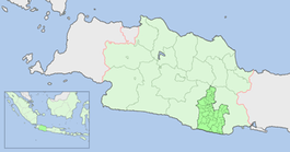
Tasikmalaya Regency is divided into 39 local Districts (Indonesian: Kecamatan, Sundanese: Kacamatan) and Singaparna is the administrative centre of the Regency. These 39 districts are subdivided into 351 villages.[7]
|
 |
|
Tasikmalaya Regency is divided into 39 districts (kecamatan), listed below with their populations at the 2010 Census:[9]
- Cipatujah (62,858)
- Karangnunggal (80,935)
- Cikalong (61,181)
- Pancatengah (44,618)
- Cikatomas (47,729)
- Cibalong (30,483)
- Parungponteng (33,472)
- Bantarkalong (34,245)
- Bojongasih (19,178)
- Culamega (22,913)
- Bojonggambir (38,341)
- Sodonghilir (62,580)
- Taraju (37,357)
- Salawu (57,523)
- Puspahiang (32,675)
- Tanjungjaya (42,336)
- Sukaraja (48,792)
- Salopa (48,335)
- Jatiwaras (47,827)
- Cineam (33,288)
- Karangjaya (12,374)
- Manonjaya (60,254)
- Gunungtanjung (27,567)
- Singaparna (65,582)
- Sukarame (38,957)
- Mangunreja (36,758)
- Cigalongtang (67,668)
- Leuwisari (36,492)
- Sariwangi (30,309)
- Padakembang (35,581)
- Sukaratu (43,875)
- Cisayong (52,728)
- Sukahening (29,373)
- Rajapolah (44,479)
- Jamanis (32,251)
- Ciawi (57,593)
- Kadipaten (32,761)
- Pagerageung (51,223)
- Sukaresik (33,184)
Geography


The land of the Regency is predominantly hilly, especially in the southern area of the Regency. Some are mountainous, as appeared in the northwestern part where Galunggung highlands reside. It is only 13.05% of the region of where its low-lying areas are elevated from zero to 200 metres. Meanwhile, the average elevation of the regency is 200 to 500 metres.[10] The rest is elevated into the highest point of Mount Galunggung 2,168 metres.[11]
The Regency is traversed by volcanic chains of Java island, where land naturally grants rich and fertile soil, and provides an abundance of water resources. Tasikmalaya Regency is also lied on a low-cavity mountainside, which supplies the Regency more rainfall catchment and water absorption area. These advantages are supported by the Regency's tropical rainforest climate where the region experiences heavy rainfall.
The area is known for producing silk goods printed with batik, paper umbrellas, and handbags woven by hand from bamboo and pandanus leaves. The production of handicrafts for domestic and international consumption is an important local industry; in 1998 and 1999, export of handicrafts earned 2.6 billion rupiah for the region.
The regency was a major centre of early support and organization for Darul Islam, an Islamist group formed in 1948 to resist Dutch attempts to retake Java after World War II, and, after the Dutch were defeated, to establish a state in Indonesia governed by Islamic law.[12]
Climate
Like the rest of Preanger Regencies, the climate of Tasikmalaya Regency is normally a tropical rainforest climate.[13] It receives an average annual precipitation of 2.072 mm.[14] Although it experiences heavy rainfall[13] the Regency gets considerably an equable amount of heat. The average daily temperature of the regency are mildly varied, it ranges from 20° to 34 °C at lowland areas and 18° to 22 °C at the upland areas.[14]
Location
Followingthe excision of Tasikmalaya City, the residual Tasikmalaya Regency comprises an area of 2,552.19 km2.[10] It is bounded on the east by Garut Regency, marked by Galunggung highlands, from southwest along to the northwest. Far to the north, the Regency borders with Majalengka Regency and continues to the east with Ciamis Regency and Tasikmalaya City, the latter which it surrounds on three sides. Finally, to the south, Tasikmalaya Regency is bounded by the Indian Ocean. Tasikmalaya Regency's greatest distance from north to the south is about 75 km, and about 56.25 km from east to the west.[15]
 |
Garut Regency | Majalengka Regency/Ciamis Regency | Tasikmalaya (City)/Ciamis Regency | |
| Garut Regency | |
Ciamis Regency | ||
| ||||
| | ||||
| Garut Regency | Indian Ocean | Ciamis Regency |
Places of interest

Tasikmalaya Regency is one of Indonesian foremost tourist destinations. It has a number of tourist attractions. They are accessible, even though most of them are located deep in the rural area of the Regency. Tasikmalaya Regency's tourist destinations mainly offer their local and natural beauty other than established recreational facility. In the southern area, where the Regency borders to Indian Ocean, tourist destinations are primarily the coastline of the Regency, which features caves and a number of beaches. To the interior where the land mostly hilly and characterised by tropical rainforest, waterfall, natural hot springs, and archaeological sites are the tourist most visited places. Among Tasikmalaya Regency's tourist destinations are Kampung Naga (Dragon Village). It features an exotic and idyllic traditional village where the inhabitant lives within a strong ancient Sundanese tradition. Whilst Mount Galunggung's volcanic crater offers a magnificent scenery, featuring a tranquil lake surrounded by rainforests. A number of natural hot springs are issued nearby the mountain, and became parts of the Regency's tourist destinations.[16]
List of tourist destinations in Tasikmalaya Regency
There are more than 70 spots of tourist destinations in Tasikmalaya Regency, some of them are listed below.[16]
|
|
|

Jasper Geopark

At Pasirgintung village, Cibuniasih subdistrict, Pancatengah district there are a lot of Red Jasper rocks previously, but now only about 120 rocks. The administration will conserve it as Jasper Geopark. Jasper has class-7 hardness.[17]
See also
References
- ↑ "Population and Labour force – West Java" (PDF). West Java Government. 2008. p. 88. Retrieved 6 January 2011.
- ↑ "Agriculture – West Java" (PDF). West Java Government. 2008. p. 330. Retrieved 6 January 2011.
- ↑ Christomy 1959, p. 22.
- 1 2 "Toponimi Jawa Barat" (PDF) (in Indonesian). West Java Government. pp. 64, 110. Retrieved 6 January 2011.
- ↑ Permadi 1975, p. 3.
- 1 2 3 4 5 6 "Sejarah Singkat Kabupaten Tasikmalaya" (in Indonesian). Tasikmalaya Regency Government. Retrieved 6 January 2011.
- ↑ "Government – West Java" (PDF). West Java Government. 2008. p. 39. Retrieved 6 January 2011.
- ↑ "Kabupaten Tasikmalaya" (PDF) (in Indonesian). West Java Central Agency for Statistic. 2004. p. 19. Retrieved 6 January 2011.
- ↑ Biro Pusat Statistik, Jakarta, 2011.
- 1 2 3 "Selayang Pandang Kabupaten Tasikmalaya" (in Indonesian). West Java Government. Retrieved 6 January 2011.
- ↑ "Geographical Condition – West Java" (PDF). West Java Government. 2008. p. 14. Retrieved 6 January 2011.
- ↑ Horikoshi, Hiroko (1975). The Dar ul-Islam movement in West Java (1948–62): an experience in the historical process. Indonesia 20:58-86.
- 1 2 "Updated world map of the Koppen-Geiger climate classification" (PDF). Hydrol. Earth Syst. Sci.,. 2007. Retrieved 6 January 2011.
- 1 2 "Peta Jawa Barat" (in Indonesian). West Java Government. Retrieved 6 January 2011.
- ↑ "Peta Jawa Barat" (in Indonesian). West Java Government. Retrieved 6 January 2011.
- 1 2 "Peta Obyek Wisata Tasik" (in Indonesian). Tasikmalaya Regency Government. Retrieved 6 January 2011.
- ↑ Jasper Geopark
Notes
- Christomy, Tommy (1959), "Signs of the Wali: Narratives at the sacred sites in Pamijahan, West Java", 201, (Canberra, AU), 2008, ISBN 978-1-921313-69-1. Retrieved 6 January 2011.
- Permadi, Agus (September 1975), "Prasasti Geger Hanjuang; Ngahanjuang-siangkeun Hari Jadi Tasikmalaya", Mangle, 495, (Bandung, ID), 2009, cited in Miftahul Falah (August 21, 2009), "Etimologi Tasikmalaya", (in Indonesia). Retrieved 6 January 2011.
External links
| Wikimedia Commons has media related to Tasikmalaya Regency. |
- Tasikmalaya Regency Government official site
- West Java Government official site
-
 Tasikmalaya travel guide from Wikivoyage
Coordinates: 7°20′S 108°12′E / 7.333°S 108.200°E