Tasiilaq
| Tasiilaq Ammassalik | |
|---|---|
|
Tasiilaq | |
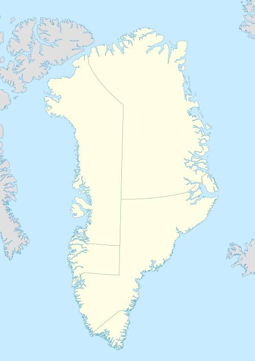 Tasiilaq Location within Greenland | |
| Coordinates: 65°36′49″N 37°37′52″W / 65.61361°N 37.63111°WCoordinates: 65°36′49″N 37°37′52″W / 65.61361°N 37.63111°W | |
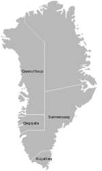
| State |
|
| Constituent country |
|
| Municipality |
|
| Founded | 1894 |
| Population (2013) | |
| • Total | 2,017[1] |
| Time zone | UTC-03 |
| Postal code | 3913 |
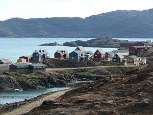
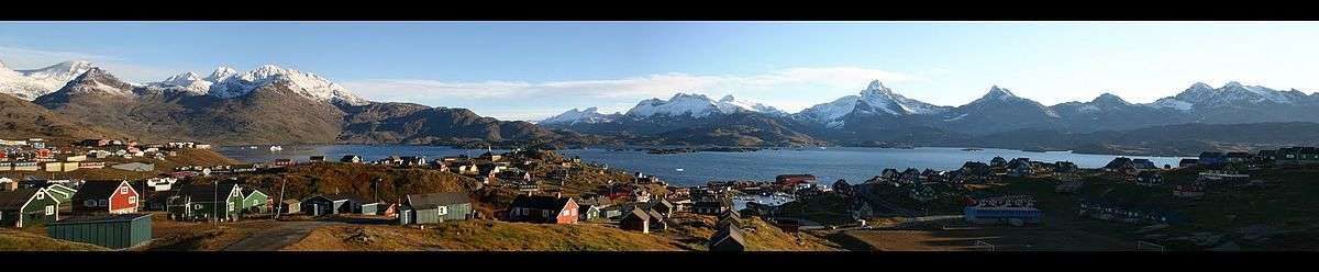
Tasiilaq, formerly Ammassalik and Angmagssalik, is a town in the Sermersooq municipality in southeastern Greenland. With 2,017 inhabitants as of 2013,[1] it is the most populous community on the eastern coast, and the seventh-largest town in Greenland. The Sermilik Station, dedicated to the research of the nearby Mittivakkat Glacier, is located near the town.
History
Prehistory to the fifteenth century
The people of Saqqaq culture were the first to reach eastern Greenland, arriving from the north,[2] through what is now known as Peary Land and Independence Fjord, to be surpassed by the Dorset culture. Thule migrations passed through the area in the fifteenth century,[2] finding the southeastern coast uninhabited.
Eighteenth and nineteenth centuries

Due to back migrations to the more densely populated western coast, the southeastern coast was deserted for another two hundred years−the region wasn't settled until late eighteenth century,[3] with the village surviving as the only permanent settlement in the nineteenth century. Population increased however from the 1880s, dispersing over several villages in the area.
The permanent settlement was founded in 1894[4] as a Danish trading station.[5] The town was previously known as Ammassalik (old spelling: Angmagssalik). The official name change took place in 1997.
Geography
Tasiilaq is located approximately 106 km (65.9 mi) south of the Arctic Circle, on the southeastern coast of Ammassalik Island, on the shore of a natural harbour in Tasiilaq Fjord,[6] named Kong Oscars Havn[5] by Alfred Gabriel Nathorst in 1883. The fjord is an inlet of the long Ammassalik Fjord emptying into the North Atlantic to the east of the town. The large Sermilik Fjord lies further to the west.
Population
With 2,017 inhabitants as of 2013, Tasiilaq is one of the fastest-growing towns in Greenland,[1] with migrants from the smaller towns and settlements reinforcing the trend. Together with Nuuk, it is the only town in the Sermersooq municipality exhibiting stable growth patterns over the last two decades. The population increased by over 37% relative to the 1990 levels, and by over 18% relative to the 2000 levels.[1]

Transport

Air
Air Greenland operates helicopter services from Tasiilaq Heliport to neighboring Kulusuk Airport (24 km/15 mi away), which offers connections to Nuuk, Ittoqqortoormiit via Nerlerit Inaat Airport, and to Iceland.[7] The heliport serves as a local helicopter hub with flights to several villages in the region: Isortoq, Kuummiit, Sermiligaaq, and Tiniteqilaaq.[7]
Sea
In the summer, the cargo boats of Royal Arctic Line connect Tasiilaq with Kulusuk,[8] providing an ad-hoc alternative for the helicopter flights of Air Greenland.[5]
Twin towns
Climate
Tasiilaq has a tundra climate, with long, cold and snowy winters and short, cool drier summers. From time to time, Tasiilaq is affected by piteraqs. On February 6, 1970 the worst documented piteraq ever hit Tasiilaq, causing heavy damage and nearly ruining the town.[9]
| Climate data for Tasiilaq, Greenland (1961-1990) | |||||||||||||
|---|---|---|---|---|---|---|---|---|---|---|---|---|---|
| Month | Jan | Feb | Mar | Apr | May | Jun | Jul | Aug | Sep | Oct | Nov | Dec | Year |
| Average high °C (°F) | −4.2 (24.4) |
−4.2 (24.4) |
−4.3 (24.3) |
0.0 (32) |
4.2 (39.6) |
7.7 (45.9) |
10.4 (50.7) |
9.8 (49.6) |
6.2 (43.2) |
1.7 (35.1) |
−1.9 (28.6) |
−4.0 (24.8) |
1.78 (35.22) |
| Average low °C (°F) | −11.2 (11.8) |
−11.6 (11.1) |
−12.3 (9.9) |
−8.1 (17.4) |
−2.7 (27.1) |
0.6 (33.1) |
2.5 (36.5) |
2.4 (36.3) |
0.1 (32.2) |
−3.5 (25.7) |
−7.8 (18) |
−10.7 (12.7) |
−5.19 (22.65) |
| Average precipitation mm (inches) | 120 (4.72) |
99 (3.9) |
98 (3.86) |
75 (2.95) |
63 (2.48) |
51 (2.01) |
47 (1.85) |
64 (2.52) |
78 (3.07) |
83 (3.27) |
99 (3.9) |
102 (4.02) |
979 (38.55) |
| Source: Danish Meteorological Institute[10] | |||||||||||||
Cityscape
References
| Wikimedia Commons has media related to Tasiilaq. |
- 1 2 3 4 5 Statistics Greenland, Population in localities
- 1 2 eastgreenland.com History of East Greenland
- ↑ "Lonely Planet".
- ↑ "Studying a Disappearing Race in the Far North; Danish Ethnologist Returns from East Greenland After Spending Eighteen Months Among the Natives." (PDF). The New York Times: SM10 (Magazine Section). 17 March 1907. Retrieved 08-02-2009. Check date values in:
|access-date=(help) - 1 2 3 O'Carroll, Etain (2005). Greenland and the Arctic. Lonely Planet. pp. 206–207. ISBN 1-74059-095-3.
- ↑ Tasiilaq, Saga Map, Tage Schjøtt, 1992
- 1 2 Air Greenland booking
- ↑ Royal Arctic Line, schedule
- ↑ Danish Meteorological Institute, The Observed Climate of Greenland, 1958-99, pp. 96-98
- ↑ Danish Meteorological Institute (Danish)