Tartar, Switzerland
| Tartar | ||
|---|---|---|
| Former municipality of Switzerland | ||
| ||
 Tartar | ||
|
Location of Tartar 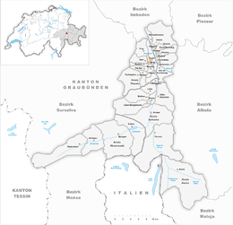 | ||
| Coordinates: 46°43′N 9°25′E / 46.717°N 9.417°ECoordinates: 46°43′N 9°25′E / 46.717°N 9.417°E | ||
| Country | Switzerland | |
| Canton | Graubünden | |
| District | Hinterrhein | |
| Area | ||
| • Total | 1.58 km2 (0.61 sq mi) | |
| Elevation | 995 m (3,264 ft) | |
| Population | ||
| • Total | 168 | |
| • Density | 110/km2 (280/sq mi) | |
| Postal code | 7422 | |
| SFOS number | 3667 | |
| Surrounded by | Cazis, Masein, Portein, Präz, Sarn | |
| Website |
www SFSO statistics | |

Tartar is a municipality in the district of Hinterrhein in the Swiss canton of Graubünden. On 1 January 2010 the municipalities of Portein, Präz, Sarn and Tartar merged into the municipality of Cazis.[1]
History
Tartar is first mentioned around 1290-98 as in Tartere.[2]
Geography
Tartar has an area, as of 2006, of 1.6 km2 (0.62 sq mi). Of this area, 51.9% is used for agricultural purposes, while 38% is forested. Of the rest of the land, 8.2% is settled (buildings or roads) and the remainder (1.9%) is non-productive (rivers, glaciers or mountains).[3]
The municipality is located in the Thusis sub-district, of the Hinterrhein district. Tartar is located on the lower Heinzenberg mountains at an elevation of 994 m (3,261 ft). It consists of the haufendorf (an irregular, unplanned and quite closely packed village, built around a central square) village of Tartar made up of the sections of Oberschauenberg, Valeina, Pro Biet and the farm house group of Foppa. The municipalities of Portein, Präz, Sarn, and Tartar merged on 1 January 2010 into the municipality of Cazis.
Demographics
Tartar has a population (as of 2007) of 168, of which 4.8% are foreign nationals. Over the last 10 years the population has decreased at a rate of -4%.[3]
As of 2000, the gender distribution of the population was 50.6% male and 49.4% female.[4] The age distribution, as of 2000, in Tartar is; 17 people or 10.8% of the population are between 0 to 9 years old. 14 people or 8.9% are 10 to 14, and 7 people or 4.4% are 15 to 19. Of the adult population, 14 people or 8.9% of the population are between 20 to 29 years old. 21 people or 13.3% are 30 to 39, 23 people or 14.6% are 40 to 49, and 22 people or 13.9% are 50 to 59. The senior population distribution is 20 people or 12.7% of the population are between 60 to 69 years old, 10 people or 6.3% are 70 to 79, there are 8 people or 5.1% who are 80 to 89, and there are 2 people or 1.3% who are 90 to 99.[5]
In the 2007 federal election the most popular party was the SVP which received 53.4% of the vote. The next three most popular parties were the SPS (16.8%), the CVP (15.3%) and the FDP (14.5%).[3]
In Tartar about 67.4% of the population (between age 25-64) have completed either non-mandatory upper secondary education or additional higher education (either University or a Fachhochschule).[3]
Tartar has an unemployment rate of 1.05%. As of 2005, there were 7 people employed in the primary economic sector and about 2 businesses involved in this sector. 2 people are employed in the secondary sector and there is 1 business in this sector. 9 people are employed in the tertiary sector, with 3 businesses in this sector.[3]
The historical population is given in the following table:[2]
| year | population |
|---|---|
| 1808 | 108 |
| 1850 | 170 |
| 1900 | 146 |
| 1920 | 206 |
| 1950 | 188 |
| 2000 | 158 |
Languages
Most of the population (as of 2000) speaks German (97.5%), with Italian being second most common ( 1.9%) and Romansh being third ( 0.6%).[3]
| Languages in Tartar | ||||||
| Languages | Census 1980 | Census 1990 | Census 2000 | |||
| Number | Percent | Number | Percent | Number | Percent | |
| German | 98 | 93.33% | 144 | 89.44% | 154 | 97.47% |
| Romanish | 6 | 5.71% | 4 | 2.48% | 1 | 0.63% |
| Italian | 0 | 0.00% | 4 | 2.48% | 3 | 1.90% |
| Population | 105 | 100% | 161 | 100% | 158 | 100% |
References
- ↑ Amtliches Gemeindeverzeichnis der Schweiz, Mutationsmeldungen 2009 / Répertoire officiel des communes de Suisse, Mutations 2009 / Elenco ufficiale dei Comuni della Svizzera, Mutazione 2009 (PDF) (Report). Federal Statistical Office. 2009. nden. Retrieved 6 March 2010.
- 1 2 Tartar in German, French and Italian in the online Historical Dictionary of Switzerland.
- 1 2 3 4 5 6 Swiss Federal Statistical Office accessed 08-Oct-2009
- ↑ Graubunden in Numbers (German) accessed 21 September 2009
- ↑ Graubunden Population Statistics (German) accessed 21 September 2009
| Wikimedia Commons has media related to Tartar, Switzerland. |
External links
- Official website (German)
- Tartar in German, French and Italian in the online Historical Dictionary of Switzerland.