Tarrant County, Texas
| Tarrant County, Texas | |||
|---|---|---|---|
| County | |||
| Tarrant County | |||
|
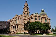
The Tarrant County Courthouse at Fort Worth in 2012 | |||
| |||
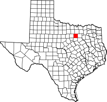 Location in the U.S. state of Texas | |||
 Texas's location in the U.S. | |||
| Founded | 1850 | ||
| Named for | Edward H. Tarrant | ||
| Seat | Fort Worth | ||
| Largest city | Fort Worth | ||
| Area | |||
| • Total | 902 sq mi (2,336 km2) | ||
| • Land | 864 sq mi (2,238 km2) | ||
| • Water | 39 sq mi (101 km2), 4.3% | ||
| Population | |||
| • (2010) | 1,809,034 | ||
| • Density | 2,095/sq mi (809/km²) | ||
| Congressional districts | 6th, 12th, 24th, 26th, 33rd | ||
| Time zone | Central: UTC-6/-5 | ||
| Website |
www | ||


Tarrant County is a county located in the U.S. state of Texas. As of the 2010 census, it had a population of 1,809,034.[1] It is the third-most populous county in Texas and the sixteenth-most populous in the United States. Its county seat is Fort Worth.[2]
Tarrant County, one of 26 counties created out of the Peters Colony, was established in 1849 and organized the next year.[3] The county was named in honor of General Edward H. Tarrant of the Republic of Texas militia.[4]
Tarrant County is part of the Dallas–Fort Worth–Arlington, TX Metropolitan Statistical Area.
Geography
According to the U.S. Census Bureau, the county has a total area of 902 square miles (2,340 km2), of which 864 square miles (2,240 km2) is land and 39 square miles (100 km2) (4.3%) is water.[5]
Adjacent counties
- Denton County (north)
- Dallas County (east)
- Ellis County (southeast)
- Johnson County (south)
- Parker County (west)
- Wise County (northwest)
Demographics
| Historical population | |||
|---|---|---|---|
| Census | Pop. | %± | |
| 1850 | 664 | — | |
| 1860 | 6,020 | 806.6% | |
| 1870 | 5,788 | −3.9% | |
| 1880 | 24,671 | 326.2% | |
| 1890 | 41,142 | 66.8% | |
| 1900 | 52,376 | 27.3% | |
| 1910 | 108,572 | 107.3% | |
| 1920 | 152,800 | 40.7% | |
| 1930 | 197,553 | 29.3% | |
| 1940 | 225,521 | 14.2% | |
| 1950 | 361,253 | 60.2% | |
| 1960 | 538,495 | 49.1% | |
| 1970 | 716,317 | 33.0% | |
| 1980 | 860,880 | 20.2% | |
| 1990 | 1,170,103 | 35.9% | |
| 2000 | 1,446,219 | 23.6% | |
| 2010 | 1,809,034 | 25.1% | |
| Est. 2015 | 1,982,498 | [6] | 9.6% |
| U.S. Decennial Census[7] 1850–2010[8] 2010–2014[1] | |||
As of the census[9] of 2000, there were 1,446,219 people, 533,864 households, and 369,433 families residing in the county. The population density was 1,675 people per square mile (647/km²). There were 565,830 housing units at an average density of 655 per square mile (253/km²). The racial makeup of the county was 71.23% White, 12.80% Black or African American, 0.57% Native American, 3.64% Asian, 0.16% Pacific Islander, 9.09% from other races, and 2.51% from two or more races. 19.73% of the population were Hispanic or Latino of any race.
There were 533,864 households out of which 36.80% had children under the age of 18 living with them, 52.60% were married couples living together, 12.20% had a female householder with no husband present, and 30.80% were non-families. 24.90% of all households were made up of individuals and 5.90% had someone living alone who was 65 years of age or older. The average household size was 2.67 and the average family size was 3.22. As of the 2010 census, there were about 5.2 same-sex couples per 1,000 households in the county.[10]
In the county, the population was spread out with 28.10% under the age of 18, 10.00% from 18 to 24, 33.50% from 25 to 44, 20.10% from 45 to 64, and 8.30% who were 65 years of age or older. The median age was 32 years. For every 100 females there were 98.10 males. For every 100 females age 18 and over, there were 95.60 males.
The median income for a household in the county was $46,179, and the median income for a family was $54,068. Males had a median income of $38,486 versus $28,672 for females. The per capita income for the county was $22,548. About 8.00% of families and 10.60% of the population were below the poverty line, including 13.80% of those under age 18 and 8.70% of those age 65 or over.
Government and infrastructure
The JPS Health Network (Tarrant County Hospital District) operates the John Peter Smith Hospital and health centers.
Countywide law enforcement is provided by the Tarrant County Sheriff's Office and Tarrant County Constable's Office. All cities in the county provide their own police services, with three exceptions: Westlake contracts service from the Keller Police Department, and Haslet and Edgecliff Village contracts service from the Sheriff's Office. DFW Airport, the Tarrant County Hospital District, and the Tarrant Regional Water District also provide their own police forces.
Since the disbandment of the North Tarrant County Fire Department, no countywide firefighting services exist; all municipalities provide their own fire departments. Most cities also operate their own ambulances, with Fort Worth being a notable exception - the city contracts paramedic apparatus from private entity Medstar. CareFlite air ambulance services operate from Harris Methodist Hospital in Fort Worth.
Civil and Family Courts
Eleven civil courts serve Tarrant County: the 17th, 48th, 67th, 96th, 141st, 153rd, 236th, 342nd, 348th, and 352nd District Courts, as well as three County Courts at Law. Seven family courts also serve the county: the 231st, 233rd, 322nd, 323rd, 324th, 325th, and 360th District Courts. These courts, along with related services, are based at the Tarrant County Civil Courts Building, located in downtown Fort Worth.
Criminal Courts
There are twenty criminal courts in Tarrant County, including six state-level criminal courts: the 213th, 297th, 371st, 372nd, 396th, and 432nd District Courts, all of which are located at the Tim Curry Criminal Justice Center in Fort Worth. The county also operates ten County Criminal Courts and four Criminal District Courts.
Lower Courts
Tarrant County is divided into eight precincts, each served by a Justice of the Peace (JP). JP Courts in Tarrant County are located in: Fort Worth (Pcts. 1, 5, 6, 8), Arlington (Pct. 2), Southlake (Pct. 3), Lake Worth (Pct. 4), and Mansfield (Pct. 7).
Two Magistrate Courts operate from the Tim Curry Criminal Justice Center in Fort Worth. The courts are located in the building's basement so that inmates from the nearby Tarrant County Corrections Center may be transported between the two buildings more securely.
Three County Courts at Law and two Probate Courts operate in the Old Tarrant County Courthouse as well as the Justice of the Peace Precinct One.
County Commissioners
| Office | Name | Party | |
|---|---|---|---|
| County Judge | B. Glen Whitley | Republican | |
| Commissioner, Precinct 1 | Roy Charles Brooks | Democratic | |
| Commissioner, Precinct 2 | Andy H. Nguyen | Republican | |
| Commissioner, Precinct 3 | Gary Fickes | Republican | |
| Commissioner, Precinct 4 | J.D. Johnson | Republican | |
County government
| Office | Name | Party | |
|---|---|---|---|
| District Attorney | Sharen Wilson | Republican | |
| County Clerk | Mary Louise Garcia | Republican | |
| District Clerk | Thomas Wilder | Republican | |
| Sheriff | Dee Anderson | Republican | |
| Tax Assessor | Ron Wright | Republican | |
Justice of the Peace
| Office | Name | Party | |
|---|---|---|---|
| Precinct 1 | Ralph Swearingin Jr. | Republican | |
| Precinct 2 | Mary Tom Curnutt | Republican | |
| Precinct 3 | Russell B. Casey | Republican | |
| Precinct 4 | Jacquelyn Wright | Republican | |
| Precinct 5 | Sergio De Leon | Democratic | |
| Precinct 6 | Gary Ritchie | Republican | |
| Precinct 7 | Matt Hayes | Republican | |
| Precinct 8 | Lisa R. Woodard | Democratic | |
Politics
| Year | Republican | Democratic |
|---|---|---|
| 2016 | 51.8% 345,683 | 43.2% 288,001 |
| 2012 | 57.1% 348,920 | 41.4% 253,071 |
| 2008 | 55.4% 348,420 | 43.7% 274,880 |
| 2004 | 62.4% 349,462 | 37.0% 207,286 |
| 2000 | 60.7% 286,921 | 36.8% 173,758 |
| 1996 | 50.9% 208,312 | 41.6% 170,431 |
| 1992 | 38.9% 183,387 | 33.1% 156,230 |
| 1988 | 61.2% 242,660 | 38.2% 151,310 |
| 1984 | 67.2% 248,050 | 32.6% 120,147 |
| 1980 | 56.9% 173,466 | 39.7% 121,068 |
| 1976 | 50.0% 124,433 | 49.2% 122,287 |
| 1972 | 68.6% 151,596 | 31.3% 69,187 |
| 1968 | 42.9% 81,786 | 41.8% 79,705 |
| 1964 | 36.7% 56,593 | 63.0% 97,092 |
| 1960 | 54.8% 72,813 | 44.7% 59,385 |
Since the late 20th century, majority-white residents of Tarrant County have supported Republican Party presidential candidates. Since 1960 the majority of voters supported the Republican presidential candidate in every election except 1964, when the county voted for Democrat Lyndon Johnson, a Texas native.
The two Texas State Senators serving from Tarrant County are Senator Konni Burton (R - Colleyville), succeeding Wendy Davis (D - Fort Worth) in 2015, and Kelly Hancock (R - Fort Worth). The first Republican elected to the State Senate from Tarrant County since Reconstruction was Betty Andujar in 1973. Minorities had been disenfranchised by laws passed by white conservatives at the turn of the century, weakening the Republican Party at the time.[12][13] Disfranchisement continued until after passage of national civil rights legislation in the mid-1960s.
In Arlington all three of the Texas House of Representatives districts were won by Republicans in 2010. In District 94, Diane Patrick was unseated in the Republican primary held on March 4, 2014 by Tony Tinderholt, who had no general election opposition.[14] In District 96, Bill Zedler was renominated on March 4; he had served from 2003 to 2009 and since 2011. Since 2001, Republican Charlie Geren has represented Fort Worth in the state House, first in District 89 and since 2003 in District 99.
Major political parties:
- Republican Party of Tarrant County official website
- Democratic Party of Tarrant County official website
Education
Colleges and universities
Primary and secondary schools
Public schools in Texas are organized into Independent School Districts and charter schools. Tarrant County is also home to dozens of private high schools and nearly 100 lower-level private schools.[15]
Independent school districts
- Arlington Independent School District
- Birdville Independent School District
- Carroll Independent School District
- Castleberry Independent School District
- Eagle Mountain-Saginaw Independent School District
- Everman Independent School District
- Fort Worth Independent School District
- Grapevine-Colleyville Independent School District
- Hurst-Euless-Bedford Independent School District
- Keller Independent School District
- Kennedale Independent School District
- Lake Worth Independent School District
- White Settlement Independent School District
- Azle Independent School District (partial)
- Burleson Independent School District (partial)
- Crowley Independent School District (partial)
- Godley Independent School District (partial)
- Mansfield Independent School District (partial)
- Northwest Independent School District (partial)
Charter schools
- Richard Milburn Academy
- Crosstimbers Academy
- Westlake Academy
Private schools
- Fort Worth Christian School
- Nolan Catholic High School
- Temple Christian School
- Trinity Valley School
- Key School, Inc.
- Fort Worth Country Day School
- Trinity Baptist Temple Academy
- Faith Christian Academy - Grapevine
- Southwest Christian School
Transportation
Major highways
 I-20
I-20 I-30
I-30 I-35W
I-35W I-820
I-820 US 81
US 81 US 287
 Bus. US 287
 US 377
 SH 10
SH 10 SH 26
SH 26 SH 97
SH 97 SH 114
 SH 121
 FM 156
 FM 157
 SH 161
 SH 180
 SH 183
 SH 303
 SH 360
 FM 1220
 FM 1886
Airports
Dallas/Fort Worth International Airport is partially in the cities of Grapevine and Euless in Tarrant County and Irving in Dallas County.
Fort Worth Alliance Airport is a city-owned public-use airport located 14 miles (23 km) north of the central business district of Fort Worth on Interstate-35W. Billed as the world's first purely industrial airport, it was developed in a joint venture between the City of Fort Worth, the Federal Aviation Administration and Hillwood Development Company, a real estate development company owned by H. Ross Perot, Jr. Alliance Airport has 9600 ' and 8200 ' runways.
Fort Worth Meacham International Airport is located at the intersection of Interstate 820 and U.S. Business Highway 287 in northwest Fort Worth, 5 miles from the downtown business district. Meacham International Airport has two parallel runways and a crosswind runway.
Fort Worth Spinks Airport is located 14 miles south of the downtown business district. The airport is located at the intersection of Interstate-35W and HWY 1187 and serves as a reliever airport for Fort Worth Meacham International Airport and Dallas-Fort Worth International Airport.
Communities
Cities (multiple counties)
- Azle (partly in Parker County)
- Burleson (mostly in Johnson County)
- Crowley (small part in Johnson County)
- Fort Worth (small parts in Denton, Parker and Wise counties)
- Grapevine (small parts in Dallas and Denton counties)
- Grand Prairie (partly in Dallas County and a small part in Ellis County)
- Haslet (small part in Denton County)
- Mansfield (small parts in Ellis and Johnson counties)
- Newark (mostly in Wise County)
- Southlake (small part in Denton County)
Cities
Towns
- Edgecliff Village
- Flower Mound (mostly in Denton County)
- Lakeside
- Pantego
- Trophy Club (mostly in Denton County)
- Westlake (small part in Denton County)
- Westover Hills
Census-designated places
- Briar (partly in Wise and Parker counties)
- Pecan Acres (small part in Wise County)
- Rendon
Historical census-designated places
Unincorporated communities
Historical communities
Ghost towns
Notes
- Italicize indicates that the city is a principal city of DFW or a county seat
- The term "town" is used only in reference to relative population. Under Texas law, all incorporated places are officially designated "cities".
See also
- List of museums in North Texas
- National Register of Historic Places listings in Tarrant County, Texas
References
- 1 2 "State & County QuickFacts". United States Census Bureau. Retrieved December 26, 2013.
- ↑ "Find a County". National Association of Counties. Retrieved 2011-06-07.
- ↑ "Texas: Individual County Chronologies". Texas Atlas of Historical County Boundaries. The Newberry Library. 2008. Retrieved May 27, 2015.
- ↑ W. Kellon Hightower. "Handbook of Texas Online - TARRANT COUNTY". Tshaonline.org. Retrieved 2010-07-22.
- ↑ "2010 Census Gazetteer Files". United States Census Bureau. August 22, 2012. Retrieved May 11, 2015.
- ↑ "County Totals Dataset: Population, Population Change and Estimated Components of Population Change: April 1, 2010 to July 1, 2015". Retrieved July 2, 2016.
- ↑ "U.S. Decennial Census". United States Census Bureau. Retrieved May 11, 2015.
- ↑ "Texas Almanac: Population History of Counties from 1850–2010" (PDF). Texas Almanac. Retrieved May 11, 2015.
- ↑ "American FactFinder". United States Census Bureau. Retrieved 2011-05-14.
- ↑ Where Same-Sex Couples Live, June 26, 2015, retrieved July 6, 2015
- ↑ http://uselectionatlas.org/RESULTS/
- ↑ "Nixon v. Condon. Disfranchisement of the Negro in Texas", The Yale Law Journal, Vol. 41, No. 8, June 1932, p. 1212, accessed March 21, 2008
- ↑ Texas Politics: Historical Barriers to Voting, accessed April 11, 2008 Archived April 2, 2008, at the Wayback Machine.
- ↑ "Republican primary election returns (House District 94), March 4, 2014". enr.sos.state.tx.us. Retrieved March 9, 2014.
- ↑ Texas Private Schools, accessed 2008-08-23
External links
- Tarrant County official website
- Headlines from Tarrant County from The Dallas Morning News
- Historic images of Tarrant County
- Tarrant County in Handbook of Texas Online from The University of Texas at Austin
- Tarrant County profile from The County Information Project
- Sketch of the Tarrant County Courthouse from A pictorial history of Texas, from the earliest visits of European adventurers, to A.D. 1879, hosted by the Portal to Texas History.
 |
Wise County | Denton County | | |
| Parker County | |
Dallas County | ||
| ||||
| | ||||
| Johnson County | Ellis County |
Municipalities and communities of Tarrant County, Texas, United States | ||
|---|---|---|
| Cities |
| |
| Towns | ||
| CDPs | ||
| Unincorporated communities | ||
| Historical communities | ||
| Ghost towns | ||
| Footnotes | ‡ This populated place also has portions in an adjacent county or counties ‡‡ Previously considered a census-designated place | |

Coordinates: 32°46′N 97°17′W / 32.77°N 97.29°W