Tanquary Fiord
| Tanquary Fiord | |
|---|---|
 Location | |
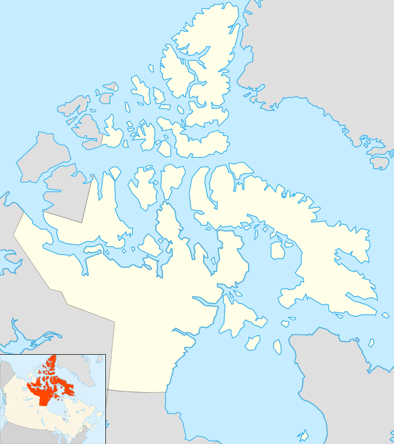
| Location | Ellesmere Island |
| Coordinates | 81°24′17″N 077°03′55″W / 81.40472°N 77.06528°WCoordinates: 81°24′17″N 077°03′55″W / 81.40472°N 77.06528°W |
| Ocean/sea sources | Nansen Sound |
| Basin countries | Nunavut, Canada |
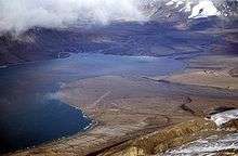
Tanquary Fiord is a fjord on the north coast of the Canadian Arctic Archipelago's Ellesmere Island, Nunavut, Canada. It is located in the Quttinirpaaq National Park and extends 30 mi (48 km) in a north-westerly direction.
History
Radiocarbon dating methods suggest that between 10,000 and 4,100 BP, deglaciation occurred, followed by a period of glacial readvance and the formation of ice shelves until 2,400 BP. Until 1,400 BP, a period of glacial retreat occurred, and since then glacial readvance and nearby ice rises have marked the area.[1]
Radiocarbon analysis of charcoal undertaken by the Geological Survey of Canada has shown that Inuit were present at Tanquary Fiord around 1070 BP at the latest.[2]
Geography
The head of the Tanquary Fiord is the convergence point of four river valleys, three of which end in a floodplain and one in a river delta. Carbon dating findings show that the fjord was free of glacial ice approximately 6,500 years ago.[3] In the past 40 years, the terminal points of side glaciers have receded.[4]
Tanquary Fiord has 65 frost-free days per year (enough to grow lettuce), which is considered remarkable for its latitude. Summer temperatures of 18 °C (64 °F) have been recorded.[5]
Human activity
In 1963, the Defence Research Board began 'Operation Tanquary' in the area, with a focus on oceanography. The operation concluded in 1972.[6] As the fjord is in a remote location, there is little human habitation. A Warden Station is staffed by Parks Canada during the summer months,[7] and Tanquary Fiord Airport is located nearby. It is possible to reach the area via charter aircraft, or increasingly, via icebreaker cruise ships.[8] In 1947, a meteorological station was installed at Eureka, about 175 km (109 mi) southwest of the fiord.[9]
References
- ↑ Lyons, J. & Mielke, J. (1973). "Holocene History of a Portion of Northernmost Ellesmere Island" (PDF). University of Calgary. Retrieved July 20, 2010.
- ↑ Hattersley-Smith, G. "An Archaeological Site on the North Coast of Ellesmere Island" (PDF). University of Calgary. Retrieved July 20, 2010.
- ↑ Hattersley-Smith, G. & Long, A. "Postglacial Uplift at Tanquary Fiord, Northern Ellesmere Island, Northwest Territories" (PDF). University of Calgary. Retrieved July 20, 2010.
- ↑ Hattersley-Smith, G. (1968). "Glacial features of Tanquary Fiord and adjoining areas of northern Ellesmere Island, N.W.T.". Defence Research Telecommunications Establishment Ottawa (Ontario). Retrieved July 20, 2010.
- ↑ Serreze, Mark; Barry, Roger Graham (2005). The Arctic climate system. Cambridge: Cambridge University Press. p. 219. ISBN 978-0-521-81418-8. Retrieved July 20, 2010.
- ↑ van Steenburgh, W. "Canada" (PDF). University of Calgary. Retrieved July 20, 2010.
- ↑ "Quttinirpaaq National Park of Canada: Hours of Operation". Parks Canada. 2009. Retrieved July 20, 2010.
- ↑ "Quttinirpaaq National Park of Canada: How to Get There". Parks Canada. 2009. Retrieved July 20, 2010.
- ↑ Mills, William (2003). Exploring polar frontiers: a historical encyclopedia. Santa Barbara: ABC-CLIO. p. 211. ISBN 978-1-57607-422-0. Retrieved July 20, 2010.