Tanggula Pass
| Tanggu La | |
|---|---|
|
Chinese: 唐古拉山口 Tánggǔlā Shānkǒu | |
|
Tanggu La marker on Qinghai–Tibet Highway, | |
| Elevation |
5,072 meters (railway) 5,231 meters (road) |
| Location | Tibet Autonomous Region and Qinghai Province, China |
| Range | Tanggula Mountains |
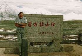
The Tanggu La, Tangla Pass, or Tanggu Pass (Chinese: 唐古拉山口; pinyin: Tánggǔlā Shānkǒu) is a wide mountain pass over 5000 metres elevation in China used by the Qinghai–Tibet Highway and Qinghai–Tibet Railway to cross the Tanggula Mountains. These mountains form part of the watershed separating the Yangtze River to the north and a zone of endorheic basins with internal drainage to the south. They also separate Tibet Autonomous Region and Qinghai Province.
The Qinghai–Tibet Highway reaches its highest elevation, 5,231 metres (17,162 feet) in Tanggu Pass at 32°52′24″N 91°55′03″E / 32.87333°N 91.91750°E. On August 24, 2005, rail track for the Qinghai–Tibet Railway was completed 28 kilometres to the WNW of the highway, reaching 5072 meters (16,640 feet) at 33°00′38″N 91°39′51″E / 33.01056°N 91.66417°E. Tanggula Railway Station 1 km from this summit is—at 5,068 metres—the world's highest, 255 m higher than Cóndor station, Peru.[1]
The Qinghai-Tibet railway connects Xining, Qinghai Province to Lhasa. The 1,080-kilometre (670 mi) section from Golmud to Lhasa was opened on July 1, 2006. The rail cars have personal oxygen supplies to prevent altitude sickness.
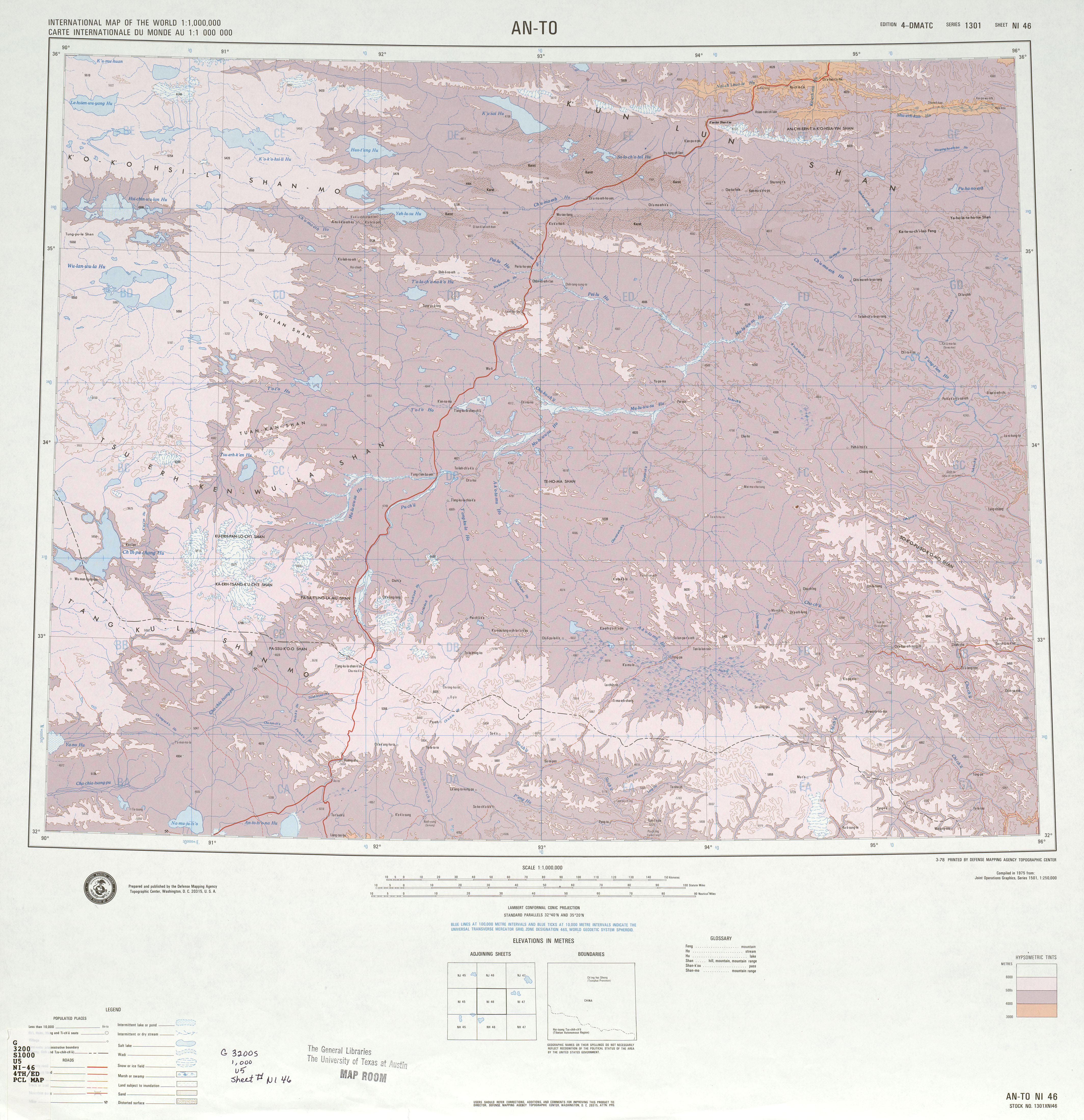
For a satellite image showing the separate highway and railroad routes over the pass, click here:. The rail route is highlighted in grey, with the 5,072 meter summit at the + crosshairs. The highway route is highlighted in yellow, with the 5,231 metre highway summit inside the largest box symbol.
Climate
| Climate data for Zhidamsumo, 33 57N 092 37E, Elevation: 5048m | |||||||||||||
|---|---|---|---|---|---|---|---|---|---|---|---|---|---|
| Month | Jan | Feb | Mar | Apr | May | Jun | Jul | Aug | Sep | Oct | Nov | Dec | Year |
| Record high °C (°F) | 0 (32) |
0 (32) |
7 (45) |
12 (54) |
16 (61) |
17 (63) |
17 (63) |
17 (63) |
17 (63) |
15 (59) |
3 (37) |
2 (36) |
17 (63) |
| Average high °C (°F) | −7 (19) |
−5 (23) |
−1 (30) |
5 (41) |
8 (46) |
11 (52) |
13 (55) |
13 (55) |
11 (52) |
3 (37) |
−2 (28) |
−6 (21) |
3 (37) |
| Average low °C (°F) | −24 (−11) |
−24 (−11) |
−18 (0) |
−12 (10) |
−6 (21) |
0 (32) |
2 (36) |
1 (34) |
−1 (30) |
−10 (14) |
−19 (−2) |
−24 (−11) |
−11 (12) |
| Record low °C (°F) | −37 (−35) |
−31 (−24) |
−27 (−17) |
−22 (−8) |
−13 (9) |
−3 (27) |
−2 (28) |
−3 (27) |
−7 (19) |
−20 (−4) |
−26 (−15) |
−32 (−26) |
−37 (−35) |
| Source: Weatherbase[2] | |||||||||||||
References
- ↑ Xinhua News Agency (August 24, 2005). New height of world's railway born in Tibet. Retrieved August 25, 2005.
- ↑ "Mean Temp Data". Weatherbase. Retrieved 7 Nov 2011.
External links
- Tangula Railtours
- NI-46, "Am-To" (Map) (4th ed.). International Map of the World 1:1,000,000. U.S. Defense Mapping Agency. 1975. Retrieved 2011-06-11. (Published before construction of railway.)
- i46-3 (Map). 1:500,000. Topographic Series (in Russian). USSR. Topographic Service of the Armed Forces. 1978. Retrieved 2011-06-12. (Published before construction of railway. Highway pass elevation given as 5,149 m.)