Tamenglong district
| Tamenglong district | |
|---|---|
| district | |
|
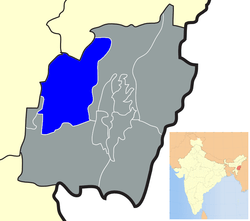
Location of Tamenglong district in Manipur | |
| Coordinates: 24°59′N 93°29′E / 24.983°N 93.483°ECoordinates: 24°59′N 93°29′E / 24.983°N 93.483°E | |
| Country |
|
| State | Manipur |
| Headquarters | Tamenglong |
| Area | |
| • Total | 4,391 km2 (1,695 sq mi) |
| Population (2011) | |
| • Total | 140,143 |
| • Density | 32/km2 (83/sq mi) |
| Languages Manipuri | |
| • Dominating | Zeliangrong (Naga) |
| Time zone | IST (UTC+5:30) |
| ISO 3166 code | IN-MN-TA |
| Website |
tamenglong |
Tamenglong district (Pron:/tæmɛŋˈlɒŋ/) is one of the nine districts of Manipur state in northeastern India. As of 2011 it is the least populous district in the state.[1]
Geography
This district is bounded by Nagaland state on the north, by Senapati district on the north and east, by Churchandpur district on the south and by Imphal West district and Assam state on the west. Tamenglong town is the headquarters of this district. The district occupies an area of 4391 km.
Economy
In 2006 the Ministry of Panchayati Raj named Tamenglong one of the country's 250 most backward districts (out of a total of 640).[2] It is one of the three districts in Manipur currently receiving funds from the Backward Regions Grant Fund Programme (BRGF).[2]
Divisions
The district is divided into four sub-divisions: Tamenglong, Tamei, Tousem and Nungba. Under Nungba Sub-division, Khoupum is a very populated area and a home town of Manipur Dy. Chief Minister Shri. Gaikhangam Gangmei
Demographics
According to the 2011 census Tamenglong district has a population of 140,143,[1] roughly equal to the nation of Saint Lucia.[3] This gives it a ranking of 607th in India (out of a total of 640).[1] The district has a population density of 32 inhabitants per square kilometre (83/sq mi) .[1] Its population growth rate over the decade 2001-2011 was 25.69%.[1] Tamenglong has a sex ratio of 953 females for every 1000 males,[1] and a literacy rate of 70.4%.[1]
Languages
Sino-Tibetan languages spoken in Tamenglong district include:
- Northern Kukish languages
- Zeme languages
- Zeme language
- Inpui language
- RONGMEI Main
References
- 1 2 3 4 5 6 7 "District Census 2011". Census2011.co.in. 2011. Retrieved 2011-09-30.
- 1 2 Ministry of Panchayati Raj (September 8, 2009). "A Note on the Backward Regions Grant Fund Programme" (PDF). National Institute of Rural Development. Retrieved September 27, 2011.
- ↑ US Directorate of Intelligence. "Country Comparison:Population". Retrieved 2011-10-01.
Saint Lucia 161,557 July 2011 est.
External links
 |
Dima Hasao district, Assam | Peren district, Nagaland | | |
| Cachar district, Assam | |
Senapati district | ||
| ||||
| | ||||
| Churachandpur district |