Taldou District
| Taldou District منطقة تلدو | |
|---|---|
| District | |
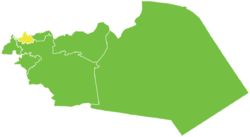 Map of Taldou District within Homs Governorate | |
| Coordinates (Taldou): 34°52′59″N 36°30′00″E / 34.8831°N 36.5°ECoordinates: 34°52′59″N 36°30′00″E / 34.8831°N 36.5°E | |
| Country |
|
| Governorate | Homs |
| Seat | Taldou |
| Subdistricts | 3 nawāḥī |
| Area | |
| • Total | 264.1 km2 (102.0 sq mi) |
| Population (2004)[1] | |
| • Total | 90,139 |
| • Density | 340/km2 (880/sq mi) |
| Geocode | SY0407 |
Taldou District (Arabic: منطقة تلدو, translit. manṭiqat Taldou) is a district of the Homs Governorate in central Syria. Administrative centre is the town of Taldou.[2]
The district was formed in 2010 from three sub-districts formerly belonging to Homs District. At the 2004 census, these sub-districts had a total population of 90,139.[1]
Sub-districts
The district of Taldou is divided into three sub-districts or nawāḥī (population as of 2004[1]):
- Taldou Nahiyah (ناحية تلدو): population 71,503.[3]
- Kafr Laha Nahiyah (ناحية كفرلاها): population 20,041.
- Al-Qabu Nahiyah (ناحية القبو): population 18,636.[4]
References
- 1 2 3 "2004 Census Data". UN OCHA. Retrieved 15 October 2015.
- ↑ The formation of Taldou District
- ↑ "Taldou nahiyah population". Cbssyr.org. Retrieved 2012-06-19.
- ↑ "Kabu nahiyah population". Cbssyr.org. Retrieved 2012-06-19.
This article is issued from Wikipedia - version of the 10/18/2015. The text is available under the Creative Commons Attribution/Share Alike but additional terms may apply for the media files.