Tell Hamis
| Tell Hamis تل حميس Til Hemîs | |
|---|---|
| Town | |
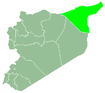
 Tell Hamis Location of Tell Hamis in Syria | |
| Coordinates: 36°45′31″N 41°23′56″E / 36.7586°N 41.3989°ECoordinates: 36°45′31″N 41°23′56″E / 36.7586°N 41.3989°E | |
| Country |
|
| Governorate | al-Hasakah |
| District | al-Qamishli |
| Subdistrict | Tell Hamis |
| Population (2004)[1] | 5,161 |
| Time zone | EET (UTC+2) |
| • Summer (DST) | EEST (UTC+3) |
| Geocode | C4639 |
Tell Hamis (Arabic: تل حميس, Kurdish: Til Hemîs), is a town in northeastern Hasakah Governorate, northeastern Syria. Wadi Jarrah flows though the town. It is the administrative center of Nahiya Tell Hamis consisting of 129 localities.
At the 2004 census, Tell Hamis had a population of 5,161.[1] The inhabitants of the town are predominantly Arabs.[2]
Syrian Civil War
After falling to the Islamic State of Iraq and the Levant, it was retaken by Kurdish YPG forces and the Syriac Military Council (MFS) on February 27, 2015.[3][4]
References
- 1 2 "2004 Census Data for Nahiya Tell Hamis" (in Arabic). Syrian Central Bureau of Statistics. Retrieved 15 October 2015. Also available in English: UN OCHA. "2004 Census Data". Humanitarian Data Exchange. Retrieved 4 December 2015.
- ↑ "Kurdish forces regain new villages near Qamishli after ISIS withdrawal". Aranews. 2015. Retrieved 30 May 2015.
- ↑ "Kurdish forces 'capture strategic IS Syria bastion'". AFP. 27 February 2015. Retrieved 27 February 2015.
- ↑ https://twitter.com/SyriacMFS/status/572109237121359872
This article is issued from Wikipedia - version of the 9/28/2016. The text is available under the Creative Commons Attribution/Share Alike but additional terms may apply for the media files.