Tainan
| Tainan 臺南市 | |||
|---|---|---|---|
| Special municipality | |||
| Tainan City | |||
|
Clockwise from top: Downtown Tainan, Statue of Yoichi Hatta, THSR Tainan Station, Dan zai noodles, Fort Provintia, Beehive firework in Yanshui. | |||
| |||
| Etymology: Chinese: táinán (Taiwan south) | |||
| Nickname(s): The Phoenix City (鳳凰城),[1] The Prefecture City (府城) | |||
.svg.png) | |||
| Country | Taiwan | ||
| Region | Southern Taiwan | ||
| Seat | Anping District and Xinying District[2] | ||
| Districts | |||
| Government | |||
| • Type | Tainan City Government | ||
| • Mayor | William Lai (DPP) | ||
| • Deputy Mayor | Hsu He-chun[3] | ||
| Area[4][5] | |||
| • Special municipality | 2,191.65 km2 (846.20 sq mi) | ||
| • Urban | 259 km2 (100 sq mi) | ||
| Area rank | 7 out of 22 | ||
| Population (2016)[6] | |||
| • Special municipality | 1,885,252 | ||
| • Rank | 6 of 22 | ||
| • Density | 860/km2 (2,200/sq mi) | ||
| • Urban[7] | 1,170,000 | ||
| • Urban density | 4,500/km2 (12,000/sq mi) | ||
| Time zone | National Standard Time (UTC+8) | ||
| Postal code | 700-745 | ||
| Area code(s) | (0)6 | ||
| ISO 3166 code | TW-TNN | ||
| Bird | Pheasant-tailed jacana | ||
| Flower | Phalaenopsis | ||
| Tree | Delonix regia | ||
| Website | www.tainan.gov.tw/tainanE (English) | ||


.svg.png)
| Tainan City | |||||||||||||||||||||||||||||
| Chinese name | |||||||||||||||||||||||||||||
|---|---|---|---|---|---|---|---|---|---|---|---|---|---|---|---|---|---|---|---|---|---|---|---|---|---|---|---|---|---|
| Traditional Chinese | 臺南市 or 台南市 | ||||||||||||||||||||||||||||
| Simplified Chinese | 台南市 | ||||||||||||||||||||||||||||
| Hanyu Pinyin | Táinán Shì | ||||||||||||||||||||||||||||
| |||||||||||||||||||||||||||||
| Japanese name | |||||||||||||||||||||||||||||
| Kanji | 台南市 | ||||||||||||||||||||||||||||
| Kana | たいなんし | ||||||||||||||||||||||||||||
| Kyūjitai | 臺南市 | ||||||||||||||||||||||||||||
| |||||||||||||||||||||||||||||
Tainan, officially Tainan City (Chinese: 臺南市; pinyin: Táinán Shì; Pe̍h-ōe-jī: Tâi-lâm-chhī), is a special municipality located in southern Taiwan, facing the Taiwan Strait in the west and south. Tainan is the oldest city in Taiwan and also commonly known as the "Capital City" (Chinese: 府城; pinyin: Fǔchéng; Pe̍h-ōe-jī: Hú-siâⁿ) for its over 200 years of history as the capital of Taiwan under Koxinga and later Qing dynasty rule. Tainan's complex history of comebacks, redefinitions and renewals inspired its popular nickname "the Phoenix City".[8]
Tainan was initially established by the Dutch East India Company as a ruling and trading base called Fort Zeelandia during the period of Dutch rule on Taiwan. After Dutch colonists were defeated by Koxinga in 1661, Tainan remained as the capital of the Tungning Kingdom until 1683 and afterwards the capital of Taiwan Prefecture under the rule of Qing Dynasty until 1887, when the new provincial capital was moved to Taipei. Tainan has been historically regarded as one of the oldest cities in Taiwan, and its former name, Tayouan, has been claimed to be the origin of the name "Taiwan". It is also one of Taiwan's cultural capitals, for its rich folk cultures including the famous local snack food, extensively preserved Taoist rites and other living local traditions covering everything from child birth to funerals. The city houses the first Confucian school–temple, built in 1665,[9] the remains of the Eastern and Southern gates of the old city, and countless other historical monuments. Tainan claims more Buddhist and Taoist temples than any other city in Taiwan.
History
Early History
Archaeological excavations in the township of Zuozhen suggest that the Tainan region has been inhabited for at least 20,000 to 31,000 years. The indigenous Siraya tribe dominated the region by the 16th century. The Sakam people of the Sinkan sub-tribe inhabited in the area of the present-day city.[10] Other Sirayan sub-tribes, including the Soelangh, Mattauw and Baccloangh inhabited in the surrounding area.
By the late 16th century, Chinese merchants and fishermen had set up several bases along the west coast of the island, including a sandbar across the Taikang Inner Sea (Chinese: 臺江內海; Pe̍h-ōe-jī: Tâi-kang lāi-hái) off the bay of Sakam village (modern-day Fort Provintia). The Chinese adopted Taioan (modern-day Anping) as the name of the sandbar.[10][11][12] Slightly north of Taioan, along the shoreline near Bassemboy (北線尾; Pak-siàn-bóe), Japanese traders established bases for trade with China.[11] The early Chinese and Japanese also traded with the Sirayan people. Salt and food was exchanged for deer hides and dried deer meat. The Siraya people were influenced by both Chinese and Japanese cultures and lifestyles. They started to use Chinese words in their language, use Japanese tantō in ritual events, and also migrated inland due to the influx of newcomers. By the time the Europeans arrived, the influence of Chinese and Japanese traders and fishermen was already prominent.[11][13]
Dutch Colony
Early Dutch colonists had attempted but failed to control Macau and the Penghu islands. In July 1622, the Dutch East India Company textile merchant Cornelis Reyersz sailed to Taiwan in search of a suitable location to build a trading post. In 1624 he established a small fort named 'Orange' on the sandy peninsula they called Tayouan (modern-day Anping). The fort was then expanded and renamed Fort Zeelandia. The settlement was initially designed as a base to attack their Spanish rivals and as a trading post between China and Batavia in Indonesia. Later the post became the center of Dutch trade between China, Japan and Europe.[11][13] During the governorship of Pieter Nuyts (1627–29), there was hostility between the Dutch and Japanese merchants, leading at one point to Nuyts being held hostage by a Japanese trader, Hamada Yahee.[12][13]
The Dutch pacification campaign on Formosa was a series of military actions and diplomatic moves undertaken in 1635 and 1636. They aimed at subduing hostile aboriginal villages in the south-western region of the island. In 1642 the Dutch seized the Spanish garrison at Santisima Trinidad in Keelung. The Dutch East India Company became the first authority to claim control of the whole of Formosa, with Fort Zeelandia as the seat of government.[14]
Tensions arose between the Dutch and the Chinese inhabitants of Taiwan due to heavy Dutch taxation and Dutch participation in plunder during the collapse of the Ming Dynasty. Eventually this led to the brief, but bloody, Guo Huaiyi Rebellion in 1652.[13] The Dutch crushed the revolt only with the help of the local Sinkanese.
The settlements near to Fort Zeelandia expanded as a result of the Dutch trading post in the area. In 1653, the Dutch built a new fort, Fort Provintia, in the Sakam area as a center for an agricultural colony. The Dutch encouraged Chinese farmers to migrate to Taiwan to grow rice and sugar cane. The Dutch settlement in southern Taiwan was so successful that, by the 1650s, it had overtaken Batavia.[11]
Kingdom of Tungning
Koxinga (also known as Zheng Chenggong) was a Ming loyalist and chief commander of the Ming troops on the maritime front for the later emperors of the withering dynasty. In 1661, Koxinga attacked the Dutch colonists in Taiwan. After a nine-month siege, the Dutch Governor of Taiwan, Frederik Coyett, surrendered Fort Zeelandia to Koxinga on 1 February 1662.[11] This effectively ended 38 years of Dutch rule on Taiwan. Koxinga then devoted himself to transforming Taiwan into a military base for loyalists who wanted to restore the Ming Dynasty.
Koxinga set about making Taiwan a base for the Ming loyalist movement. Fort Provintia was renamed Tungtu, and Fort Zeelandia became Anping. Koxinga set up military colonies on the surrounding plains to help feed his forces.[15] Many suburbs surrounding Tainan City today include in their names "Ying", "Jia", and "Tian", all derived from this event. After the death of Koxinga in 1662, his son, Zheng Jing, changed the name of Dongdu to Dong Ning. His chief minister, Chen Yonghua, introduced Chinese bureaucracy, built the first Confucius temple on the island, and introduced the method of salt production to coastal areas. The British were invited to set up a trading post in Anping to continue trade between Taiwan, Japan and South East Asia. This helped to maintain the region as a center of trade.
Qing Dynasty

The death of Zheng Jing in 1681 was followed by a struggle for succession. Seizing the advantage presented by the infighting, on July 17, 1683, Qing naval commander Shi Lang defeated the Tungning fleet in the Battle of Penghu. Two days later, Qing troops landed at Tungning and encountered little resistance. In 1684 the kingdom was incorporated into the Qing Empire as part of Fujian province, ending two decades of rule by the Zheng family.[13] Taiwan Prefecture was established, with its prefectural seat Taiwan-fu at modern-day Tainan.
In 1721, Chinese peasants and indigenous tribes rose in rebellion against Qing misrule. The rebels, led by Zhu Yigui, captured Tainan without a fight. Turmoil ensued as the rebels soon fought amongst themselves. It was only after a Qing army was dispatched from mainland China that order was restored. Zhu was captured and executed. As Qing law prohibited the building of city walls in Taiwan, Qing authorities decided to create a defensive boundary around the city by growing bamboo around the perimeter. After several further uprisings across the island, work on a city wall began in the late 1780s.[10]
A flood in 1823 brought rich silt from nearby rivers, which formed a widespread new fertile plain across the Taijiang bay area between Tainan and Anping. A canal system called Go-tiau-kang (五條港; Pe̍h-ōe-jī: Gō͘-tiâu-káng) was built to keep the port in Tainan functioning but prevented large ships from entering the bay.[10]
After 174 years of restrictions on trade with the Europeans, the Qing reopened Anping port as part of the Tianjin treaty following the Second Opium War in 1858. The Anping Customs house was established in 1864. Western merchants built trading posts near the remains of Fort Zeelandia.
Following the murder of 54 Japanese sailors by Paiwan aborigines near the southwestern tip of Taiwan in 1871, the punitive Japanese Expedition of 1874 to Taiwan revealed the fragility of the Qing dynasty's hold on Taiwan. As a result, the Qing sent the imperial commissioner Shen Baozhen to Taiwan to strengthen its defense. In Tainan, Shen made several efforts to modernize the defenses including inviting French engineers to design the Eternal Golden Castle in Erkunshen. He also recommended setting up a telegraph cable link between Tainan and Amoy.[10][13] Some parts of the castle were built using bricks taken from Fort Zeelandia.[16]
After over 200 years of development Tainan, known as Taiwan-fu, had become the largest city in Taiwan and a Chinese city with foreign influence. The following is a description of the city by the Scottish missionary William Campbell upon his first arrival to the island in 1871:
As to Taiwan-fu itself, I may say that the brick wall which surrounds it is about fifteen feet in thickness, twenty-five in height, and some five miles in circumference. Lofty watch-towers are built over the four main gateways, and large spaces within the city are given to the principal temples and yamens—or quarters occupied by the civil and military mandarins. There is much need in Taiwan-fu for the carrying out of a City Improvement Scheme. Pleasant walks, no doubt, there are, and some of the shops have an appearance which is decidedly attractive; but, as a rule, the streets are narrow, winding, ill-paved, and odorous.[17]
In 1885, the Qing government commenced work to develop the island into Taiwan Province. The capital of the island, or "Taiwan-fu", was moved to Toatun (modern-day Taichung), and therefore the old Taiwan-fu was renamed to the name it bears today – Tainan(-fu), the seat of Tainan Prefecture.
Empire of Japan


As a consequence of the Chinese losing the first Sino-Japanese War in 1895, Taiwan and the Penghu Islands were ceded to Japan by the Treaty of Shimonoseki. The Republic of Formosa was proclaimed in Tainan in May 1895, in an effort to pre-empt the Japanese occupation. A Japanese army arrived at Tainan in October 1895. Liu Yongfu and the other Republican leaders fled, leaving the city in disarray. A Scottish missionary, Thomas Barclay, was chosen by local elites and foreign merchants to negotiate the Japanese entry into the city. As a result, Tainan was taken without resistance. Under Japanese rule, Tainan was initially administered under Tainan Ken (臺南縣).[10] With a population of about 50,000 in 1904, Tainan was Taiwan's most populous city.[18]
The anti-Japanese uprising known as the Tapani Incident began in Ta-pa-ni (modern-day Yujing), on April 9, 1915. The revolt, led by Yu Qingfang, spread quickly across the whole island and was supported by both Chinese and indigenous Taiwanese. The Japanese crushed the uprising. Many villages were destroyed and thousands of people were killed during the repression which followed. Yu Qingfang was captured on August 22, 1915. More than 800 people were sentenced to death in Tainan. Over 100 of them were executed while the rest were pardoned by the new Taishō Emperor. The place where the rebellion began, Xilai Temple in Tainan (臺南西來庵), was demolished.[10] The event marked a turning point in Japanese policy, from forced pacification to modernisation and integration of Taiwan into the Japanese Empire.
The Japanese renamed the city to Tainan Chō (臺南廳) in 1901, and then Tainan Shū (臺南州) in 1920. Tainan Prefecture included modern-day Yunlin, Chiayi, and the wider region of Tainan. Tainan served as the capital city. The Japanese transformed Tainan by building modern infrastructure, including schools, a courthouse, city hall, new telecommunication facilities, an extensive freight and passenger rail network, a new Anping canal replacing the Go-tiau-kang, an airport, and an irrigation system across the Tainan and Chiayi regions. Modern urban designs were introduced; old narrow streets and city walls were demolished and replaced with wide streets that form the cityscape of the modern-day Tainan city center.[12] They also introduced much needed sanitary reforms.[19]
Republic of China

The Republic of China (ROC) took over Taiwan on 25 October 1945 after World War II. Tainan City and Tainan County were established and became separate local entities under Taiwan Province in 1946. There was civil unrest in Tainan as part of the February 28 Incident in 1947. Tang De-Jhang, a Japanese mixed blood and Japanese educated lawyer, was a member of government which set up "The February 28 Incident Commission" and a popular candidate for city mayor, was accused of being a separatist and arrested by the ROC army on March 11. He was tortured and executed the next day in the park in front of Tainan City Hall (now named Tang De-jhang Memorial Park). Tang was posthumously pronounced not guilty by court later in March.[20] Like other regions in Taiwan, many people in Tainan suffered for their real or perceived opposition to the Kuomintang (KMT, Chinese Nationalist Party) during the autocratic era.
The city held its first councilor and mayoral elections in 1950. In the 1960s, Tainan was overtaken by Kaohsiung as the economic center of southern Taiwan due to the redevelopment of Kaohsiung port. While Tainan City struggled through the second half of twentieth century, the county, especially the river south region, benefited from national priority development programmes. The completion of the National Highway No. 1 was followed by the building of many industrial parks and other road improvements. As a result, the city sprawled inland into North, East and then the Yongkang and Rende districts.
In 1992, a redevelopment plan in the West district, to widen Haian Rd and build an underground plaza proved a failure as lack of geological surveying and overall planning meant that the works ran into a layer of groundwater. The development destroyed part of the historic Go-tiau-kang area. As a consequence, the Zhongzheng Road district, previously the most popular shopping precinct in Tainan since Japanese rule, went into decline due to the poor quality of the environment. By the mid-1990s, there was a growing awareness of the need to protect Tainan's historical and cultural treasures. Since then, the government and civil societies have worked to protect Tainan's heritage. It is an ongoing issue for Tainan to protect its past while reviving its old business center.
Following the establishment of the Southern Taiwan Science Park in 1995, the outskirt of the city saw a rapid growth in population through the 2000s. The city became more prosperous after the completion of several major transport infrastructure plans. The city center shifted eastward in the mid-1990s, closer to the densely populated Yongkang, East and North districts. There are several redevelopment plans to transform these districts into the new business centers of the city.
On March 19, 2004, President Chen Shui-bian was shot whilst campaigning for re-election in Tainan. The city has been a major center for the pro-independent movement since the end of Japanese rule. On October 21, 2008, Chinese ARATS Vice President Zhang Mingqing was injured when he encountered protesters in Tainan Confucius Temple.[21]
On 25 December 2010, Tainan County and Tainan City merged to become Tainan special municipality.
On February 6, 2016, the area was hit by a 6.4 magnitude earthquake, causing 116 fatalities[22] and major damage, including building collapses (see 2016 Kaohsiung earthquake).
Culture

Tainan claims its name as one of the Taiwanese cultural capitals for its abundant historic monument and citizen lifestyle. The city is dotted by Taoist temples, Buddhist temples and churches. Many of them are among the oldest in Taiwan. The city also has its own unique traditions and cuisines developed by Chinese frontiers over its long history.
Folk cultures
The lives of Tainan citizens are closely related to many Chinese gods and temples. Parents bring their children to the "Weaving Maid goddess" (Chinese: 七娘媽; Pe̍h-ōe-jī: Chhit-niû-má), the children’s goddess, to wish for good will. Traditionally Chinese people step into adulthood when they are 16. In Tainan, there is a large ritual celebration for all 16-year-olds on the seventh day of the seventh lunar month, the goddess's birthday. This extended celebration is unique to Tainan: In the past, families with children working in the harbor took the advantage of this ceremony to show the employers that their children should be paid in adult rate after this day.
Before any form of exam people visit a temple of Wenchangdijun, the literacy god, to pray for good luck. One of the Wenchang temples is on the top floor of the Fort Provintia. Many final year high school students preparing for university exams visit the temple in June, before the exam. Those asking for marriage visit Yuelao, the god for marriages. People also visit temples for many reasons, from simply praying for good luck to celebrating god’s birthday to even consulting with the other world.[23]
A wedding ceremony in Tainan is a series of complex processes that are very exact and detailed. Both groom and bride need to prepare 12 specific gifts representing different meanings during their engagement ceremony with more to come in the wedding. People believe this complexity is a sign of being civilized.[23]
Anping residents use a special symbol called Sword Lion to keep bad spirits away. During Zheng’s regime, Anping was one of Koxinga's main naval stations. When returning home from military drills, soldiers would put lion-face shields on the main gates of their houses and insert their swords crosswise in the lion’s mouth. Locals incorporate this symbol into the design of their houses as a symbol of security.[24]
Tainan cuisine
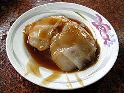
Many well-known Taiwanese food dishes originated in Tainan. Since Tainan was a center of sugar production, Tainan cuisine tends to be sweeter than other Taiwanese cuisines. For example, eel noodle soup has a distinctive sweet and sour taste. Milkfish dishes are very popular in Tainan, where locals also call it "Koxinga's fish" (Chinese: 國姓魚; Pe̍h-ōe-jī: kok-sèng-hî). People believe the Chinese name of the fish (虱目魚; sat-ba̍k-hî) was given by Koxinga, and this name has been loaned into Japanese as sabahī (サバヒー). The fish are bred in farms located in the coastal outskirts of the city. Many Tainan restaurants and snack stands have histories that trace back to the Qing or Japanese eras.[23]
On Guo Hua Street (國華街), a lot of restaurants and street vendors sell local cuisine, including such dishes as "savory rich pudding" (碗粿), oyster omelette, gua bao, and popiah. Local people tend to have these dishes either in the morning or at noon.
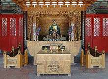
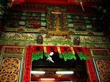
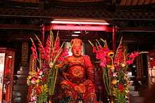
Temples

Tainan is famous for its diversity and density of temples and shrines. Some of them are the only of its kind on Taiwan Island. In all, there are officially listed seven Buddhist temples and eight Taoist shrines (七寺八廟).[10] As of 2015, Tainan has the most numbers of registered temples among other municipalities, cities or counties in Taiwan, reaching 1,613 temples.[25]
The seven Buddhist temples are:
- Kaiyuen Temple, originally the royal gardens of the Tungning Kingdom, became a Buddhist temple in 1690.
- Zhuxi Temple, founded in the Tungning Kingdom period.
- Fahua Temple, founded in the Tungning Kingdom period.
- Mituo Temple, founded in the Tungning Kingdom period.
- Longshan Temple, founded in the Qing Dynasty.
- Chongqing Temple, founded in the Qing Dynasty.
- Huangbo Temple, founded in the Qing Dynasty but demolished by the Japanese. The worshiped statues were migrated to the Altar of Heaven temple.
The eight Taoist shrines are:
- Grand Matsu Temple (大天后宮), in honor of the sea goddess Mazu. Originally the residence of the King Ningjing of the Tungning Kingdom.
- Sidian Wumiao (祀典武廟), the Official God of War temple, built in 1665.
- Dongyue Dian (東嶽殿), the God of Hell temple, built in 1673.
- Fuchenghuang Miao (府城隍廟), the temple of the Prefecture City God, built in 1669.
- Longwang Miao (龍王廟), the shrine of the East Sea Dragon God, built in 1716 but demolished by the Japanese.
- Fengshen Miao (風神廟), the Wind God temple, built in 1739. It is the only Wind God temple on Taiwan Island.[10]
- Yaowang Miao (藥王廟), the Medicine God temple, built in 1685.
- Shuixian Gong (水仙宮), the Water Gods temple, built in Qing Dynasty after Go-tiau-kang was constructed.
There are many other well-known temples and shrines not on this list, such as the Altar of Heaven temple (天壇) and the re-built Xilai temple (西來庵) etc. They are all the centers of religion in Tainan.
Due to its abundant numbers of temples and shrines, the traditional temple decoration crafters and their business flourishes in Tainan. There are masters still passing their knowledge to maintain the temples in the traditional way.[23]
Music
Nanyin and Shisanyin were the first types of Chinese music introduced to Tainan; Nanyin is performed mostly for entertainment while Shisanyin is performed in the Confucius worship ceremony. There are two Nanyin clubs in Tainan: Zhenshengshe, a 200-year-old club once dissolved in the 1980s for ten years which then returned with the support from younger generation musicians and Nanshengshe, a 95-year-old club performing globally.[23]
Music performance is being promoted in Tainan. Tainan City has its own Chinese orchestra[26] and symphony orchestra. There are also private performance groups such as Chimei Mandolin Performance Group, Chimei Philharmonic Orchestra[27] and Chang Jung Christianity University Symphony Orchestra.[28]
Ten Drum Art Percussion Group (十鼓擊樂團) is a percussion performance group established in the year 2000. The group is dedicated in producing percussion performances that highlights the history, the culture and the image of Taiwan. The group first performed internationally in the festivals during the 2000 Sydney Olympic Games. Following this event, the group has performed in many occasions both internationally and domestically. The group has its own campus located in an old sugar factory in Rende District. The campus provides education on percussion performances at all levels and regular performances to general public.[29]
Museums and parks
On top of its plentiful living culture, Tainan host several museums and parks. The National Museum of Taiwan Literature is in the former city hall; National Museum of Taiwan History is in the Annan district; Chimei Museum is in the Rende district; Taijiang National Park follows the coast; Anping Historic Scenic Park includes the entire old Anping town and the north ward of Anping harbor; and Siraya National Scenic Area includes the Wusanto Reservoir built by Yoichi Hatta. In the city center, many historic monuments from Zheng’s regime, Qing dynasty, and the Japanese colonial era are preserved including the Confucius temple, two major city gates and former city hall.
Tourism
Tainan has a tangible sense of history and is a pleasing city, the site of several spectacular religious festivals. As well as its string of forts, the first capital of Taiwan has some 300 ancient sanctuaries, from the island's first Confucian temple to its first Taoist temple.


Taiwan Confucian Temple
The Taiwan Confucian Temple (or the Scholarly Temple) was built in 1665 by Cheng Ching, son of Koxinga, to offer lectures and cultivate intellectuals. It was the first learning institute for children when Taiwan was ruled by the Qing Dynasty. As a result, it is also called the First Academy of Taiwan.
The temple is a popular tourist attraction and preserves ancient Confucian ceremonies, which are conducted regularly. The grounds include storerooms for the ritual implements and musical instruments that are used in these ceremonies.
National Museum of Taiwan History
The National Museum of Taiwan History is located in the Annan District. The construction of the Exhibition and Education Building began in 2005, and opened on 29 October 2011.The main objectives of this museum include collection, categorization, preservation, research, exhibition, education and promotion of artifacts related to Taiwan's history and culture for both locals and visitors.
National Museum of Taiwan Literature
The National Museum of Taiwan Literature researches, catalogs, preserves, and exhibits local literary artifacts as part of its multilingual, multi-ethnic focus. The museum is housed in the former Tainan City Hall, constructed in 1916 and famous for its historical significance.
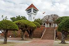
Fort Provintia
Fort Provintia was built in 1653 by the Dutch during their colonization of Taiwan and was eventually surrendered to Koxinga. Since 1945, the site has been known as "Chihkan Tower", a phonetic derivation from "Sakam" (also spelled "Chakam" or "Sakkam"). In addition to the site's architectural and artistic significance, its library of dictionaries and business transactions documents the Siraya language spoken by the native inhabitants of the region during Dutch rule.
Shopping and Recreation
As Tainan is the one of the larger metropolitan areas in Taiwan, it has many department stores, shopping malls and prestigious boutiques. Several of the best-known luxury brands have branches or counters in Tainan. Flower Night Market is a good place to enjoy the Taiwanese lifestyle. It is one of the most famous night markets and it is often considered to be the largest night market of Taiwan; however, unlike the others, this night market is open for business three days a week - Thursday, Saturday, and Sunday.
Bee hives
In Yanshui District, the most important and prominent fireworks in Lantern Festival are the so-called "bee hives", essentially multiple launchers of bottle rockets. These rocket forts are actually thousands of bottle rockets arranged row atop row in an iron-and-wooden framework. The setup looks like a beehive full of unleashed gunpowder. When the contraption is ignited, rockets shoot out rapidly in all directions. Dazzling explosives whiz and whirl across the sky and often into the crowd itself, both thrilling and intimidating the spectators.
Climate
Tainan has a humid subtropical climate (Köppen climate classification Cwa) that borders on a tropical savanna climate (Köppen climate classification Aw). Unlike the rest of southern Taiwan, Tainan is the only municipality of Political Southern Taiwan that consists of a subtropical climate, with the other two administrative divisions Kaohsiung city and Pingtung County both having a tropical savanna climate with noticeably warmer winter months, mostly due to Tainan's northerly location and Chianan Plain's strong radiative cooling during nighttime especially during the winter, when the sky is often cloudless. Still, the city is characterized by year-round high relative humidity and temperatures (although temperatures do dip somewhat in the winter months), with a rainy season (April to September) and a dry season (October to March).
| Climate data for Tainan (1981–2010) | |||||||||||||
|---|---|---|---|---|---|---|---|---|---|---|---|---|---|
| Month | Jan | Feb | Mar | Apr | May | Jun | Jul | Aug | Sep | Oct | Nov | Dec | Year |
| Average high °C (°F) | 22.9 (73.2) |
23.8 (74.8) |
26.4 (79.5) |
29.1 (84.4) |
31.3 (88.3) |
32.1 (89.8) |
32.9 (91.2) |
32.5 (90.5) |
32.0 (89.6) |
30.7 (87.3) |
27.7 (81.9) |
24.1 (75.4) |
28.79 (83.83) |
| Daily mean °C (°F) | 17.6 (63.7) |
18.6 (65.5) |
21.2 (70.2) |
24.5 (76.1) |
27.2 (81) |
28.5 (83.3) |
29.2 (84.6) |
28.8 (83.8) |
28.1 (82.6) |
26.1 (79) |
22.8 (73) |
19.1 (66.4) |
24.31 (75.77) |
| Average low °C (°F) | 14.1 (57.4) |
15.1 (59.2) |
17.5 (63.5) |
21.2 (70.2) |
24.1 (75.4) |
25.7 (78.3) |
26.4 (79.5) |
26.0 (78.8) |
25.3 (77.5) |
23.0 (73.4) |
19.6 (67.3) |
15.6 (60.1) |
21.13 (70.05) |
| Average rainfall mm (inches) | 17.3 (0.681) |
28.1 (1.106) |
38.5 (1.516) |
79.5 (3.13) |
173.6 (6.835) |
371.5 (14.626) |
357.7 (14.083) |
395.1 (15.555) |
178.0 (7.008) |
27.8 (1.094) |
16.7 (0.657) |
14.4 (0.567) |
1,698.2 (66.858) |
| Average rainy days (≥ 0.1 mm) | 3.7 | 4.7 | 5.0 | 7.2 | 9.2 | 13.1 | 12.2 | 15.3 | 9.5 | 2.5 | 2.2 | 2.8 | 87.4 |
| Average relative humidity (%) | 76.9 | 78.1 | 76.3 | 76.8 | 78.9 | 77.5 | 78.8 | 79.7 | 78.2 | 75.8 | 76.0 | 75.5 | 77.2 |
| Mean monthly sunshine hours | 179.4 | 158.3 | 178.8 | 172.8 | 186.9 | 181.7 | 210.8 | 189.1 | 179.2 | 196.2 | 172.6 | 175.0 | 2,180.8 |
| Source: Central Weather Bureau[30] | |||||||||||||
Cityscape

.jpg)

The Great Cross Street
The earliest plan of the city was designed by Dutch colonist. Cornelis Jansz. Plockhoy, the designer of this new settlement, laid a 25-30m wide main street (on today’s Minquan Rd Sec. 2) across the settlement and radial roads than ran deep into agricultural developments .[11] The Han Chinese settlement “Heliaogang Jie” (today’s Zhongyi Rd) later crossed the main street of Provintia and formed the so-called Shizi Dajie (十字大街) or The Great Cross Street.[10] With the fall of the Ming dynasty, new migrants flooded into the settlement. Chinese population boomed from 5,000 to 35,000 between 1640 and 1661. As a result, farmers, deer hunters, traders and craftsmen each formed a colony on the cross street.[31]
Due to the Chinese tradition where different trades and regions worship different Taoist gods, the city later developed into neighborhoods, each with own center temple.[31] Now, after 300 years of Chinese migration, the city has become a showcase of both Taoist and Chinese Buddhist temples. Although the city has transformed dramatically since the late 19th century, the temples remain because of their importance to the locals. Some of the early administration centers have also been transformed into temples for political and social reasons. An administrative building of the Tungning Kingdom became temple of the sea goddess, and the location where Tungning Kingdom performed annual ceremonies of prayer to Heaven is now the Altar of Heaven Temple. Castle Provintia, one of two Dutch forts in Tainan, now has a sea god temple and a literacy god temple built on top of it, creating East-West fusion architecture. Many Han Chinese religious and historic monuments can be found near the old cross street centered by the Castle Provintia.
Japanese Redevelopment Program
The cityscape of modern Tainan was founded under the urban redevelopment programs carried out by Japanese colonial government. The city center adopted a Baroque design similar to the Paris renovation in mid 19th century, the plan connected major facilities via a system of wide streets and five square-roundabouts. Among the five squares, Taishō Park (大正公園, modern-day Tang De-jhang Memorial Park) at the center is the most important crossing point. The square is surrounded by the city hall, the fire brigade and the weather bureau. It is connected by a number of avenues heading towards the train station, the airport, military bases and the dock at the end of the Anping cannel. With the police station and the court nearby, this area demonstrated the power of the colonial government within the city.[31] The financial district was located in Shirokanechō (白金町) and Ōmiyachō (大宮町) between Taishō park and Anping cannel along Ginzadōri (銀座通り),[12] the modern day Zhongzheng Rd. It was the busiest street of the city from Japanese rule to the mid-1990s. Many Colonial Baroque style historic buildings from Japanese era can be found in this part of the city.
Three Ring Belts
A three-belt system was adopted by the provincial city official:[32] the green boulevard ring, the blue belt Anping cannel and the Zhonghua road system. The green boulevard ring and Zhonghua road system first appeared on the 1937 city redevelopment plan proposed by the Japanese colonial government.
The green boulevard was a Japanese response to the garden city trend of early 20th century urban planning.[31] This system connects the Shuipingwen Park to the west, Tainan Park to the north, NCKU to the east and the Athletic park complex to the south. Zhonghua Rd system is an arterial road system, the system now connects major new development areas surrounding old city center. The Anping cannel blue belt was created after the completion of the Fifth redevelopment area. The project of Fifth redevelopment area filled the floodplain of old Taijiang lagoon and extended the Japanese Anping cannel into Kunshen lagoon to form an artificial island, this area is also known as New Anping. In contrast to the low rise old city center, many high rise buildings are built along these three rings.
The River South Region
Beyond the city center, Tainan city can be divided into two regions: the River South Region and the River North Region, bounded by the Zengwen River.
River South Region belongs to the Tainan metropolitan area. Satellite towns spread across the region in a radial pattern from the city center. Southern Taiwan Science Park Tainan campus is located at the north of the region. According to the Council for Economic Planning and Development, this region is designated to grow further into suburban sprawl.[33]
The River North Region
This region is one of the major agricultural centers in Taiwan. There are several regional centers; some of them are as old as Tainan city. These centers are: Xinying, Yujing, Jiali and Madou.
Xinying was the seat of the former Tainan County Government and currently serves as the administration center for the region. Yujing is a regional center for the hilly districts east of the city; it is famous for its mango and was the scene of the Tapani incident. Jiali is the regional center of the coastal Tainan. It was the base of the Soelangh sub-tribe. Near the bank of the Zengwen River, Madou is the regional center of the lower plain area that bears the name of the river. The town was home to the Mattauw sub-tribe.
Government and Politics
Tainan City is a special municipality, which is the highest level local government under Local Government Law of Republic of China. Technically it is at the same level as Province, although Province is being streamlined. The city is led by the elected city mayor and supervised by the city council. Its subdivisions qu or districts do not have the autonomy power, instead they are administration units only. Further to the citywide election, there are urban villages (里 li) and neighborhood (鄰 lin) functioning as primary local autonomy entity.
Currently there are two administration centers, one in Anping District and another in Xinying District. They are former Provincial Tainan city government and Tainan county government respectively. Administration centers manages citywide affairs and developments such as education and city planning. Apart from administration centers, there are district offices functioning as local access point to the governmental services.
The city has generally been seen as a powerbase for the Democratic Progressive Party, especially in nationwide elections. Although before the merger, the Kuomintang (KMT) have always had more seats in the provincial Tainan city council and KMT won the presidential elections (2008) by a narrow margin in the city. On the other hand, Democratic Progressive Party always dominated former Tainan county. In the first municipal election, after the merger, DPP dominated the political demographics of the city. William Lai, a former member of the Legislative Yuan from the DPP won the first mayoral election in 2010.
 Tainan City Government - Yonghua Civic Center |
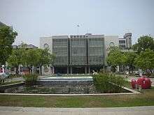 Tainan City Government - Minjhih Civic Center |
 Tainan District Court |
 Taiwan High Court Tainan Branch Court |

City mayor

In 2001, Hsu Tain-Tsair of the Democratic Progressive Party was elected with 43% of the vote. His closest rival was the Kuomintang legislator Chen Rong-sheng, who garnered 37%. In 2005. Mayor Hsu was re-elected, polling 46% to Chen Rong-sheng's 41%. In 2010, William Lai of the DPP was elected mayor.
Presidential elections
A majority of city residents have voted for the winning candidates in many presidential elections since the position was first chosen by popular vote in 1996.
1996 Presidential election
In common with every other city and county in the Republic of China, with the exception of Nantou, a majority of Tainan residents voted for eventual winner Lee Teng-hui and vice-president Lien Chan.
Administrative districts
| Historical population | ||
|---|---|---|
| Year | Pop. | ±% |
| 1985 | 1,640,669 | — |
| 1990 | 1,710,234 | +4.2% |
| 1995 | 1,788,612 | +4.6% |
| 2000 | 1,842,337 | +3.0% |
| 2005 | 1,866,727 | +1.3% |
| 2010 | 1,873,794 | +0.4% |
| 2015 | 1,885,541 | +0.6% |
| Source:"Populations by city and country in Taiwan". Ministry of the Interior Population Census. | ||

- Annan District was originally the An-Shun township of Tainan County, but was merged into Tainan City in 1946. In 2004, Central District and West District were merged into the new West Central district.
Economy
Industry
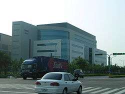
Once reliant on traditional manufacturing industries, the region became a major high-tech industrial hub after the establishment of Southern Taiwan Science Park in 1995. Optoelectronics, integrated circuits, green energy and biotechnology are the park's dominant industries. Prominent companies are Chimei-Innolux, United Microelectronics and TSMC. With the establishment of Tainan Technology Park, Shugu (Tree Valley) LCD Park and Yonkang Technology Park, the city became a major center for the optoelectronics industry in Taiwan with a complete supply chain.[34]
Tainan still plays an important role in auto parts, food processing, textiles, plastics and other traditional manufacturing. Notable companies include Uni-President, Chi Mei and Tainan Spinning, which have headquarters in the city. Overall, industrial production accounted for 62.6% of the gross city product in 2010.[35]
Agriculture
Agriculture is important to the city especially the River North Region. While fishery and fish farming signify the coastal districts, rice and fruit farms shaped the landscape of the inland agriculture region. The city is famous for its milkfish, oyster, rice, mango, sugar cane, pomelo (文旦), pineapple and lotus seed. A state-funded agricultural research center was established in Xinhua District to ensure the market competitiveness of the crop.[36] The headquarters of the World Vegetable Center, a NPO that aims to improve crop quality in poorer countries, is in Shanhua District.[37]
Once a dominant industry, salt and sugar production are declining to almost non-existence. Taiyen (Taiwan salt) co. and Taiwan Sugar Corp., both headquartered in Tainan, transformed to businesses in biotechnology, quality agriculture, retail and tourism.
Orchid growing is one of the most symbolic agriculture industry for its well-known brand name in the floristry world. A nationally founded special plantation district with R&D resources is established in Houbi District.[38]
Tourism
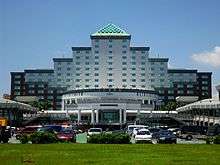
Tourism is an industry with increasing importance. As the first capital of Taiwan, the wealth resource of cultural heritage and its potential is under exploration. In the first half of 2013, there were over 7 million tourist visited attractions in the city.[39] There are high=end hotels in the city, including the Shangri-la Hotel near Tainan train station.
Retail
Retail and services is the largest employment sector in Tainan, margined at 52% in 2010.[35] The city center hosts five department stores including two Shin Kong-Mitsukoshi, two FE21s and Focus square. Apart from the city center, there are shopping precincts around the city, with the strongest presence in East, North and Yongkang districts. 'Dream Mall' is a joint development project between Uni-President Corp. and Tainan Spinning Ltd. It was the largest shopping center in the city when it opened Feb 12, 2015 and the precinct will host the new headquarters of Tainan Spinning and a new five-star hotel. The precinct is in the designated East Tainan second CBD near the border of the East and Yongkang districts.
Transportation
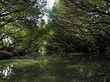
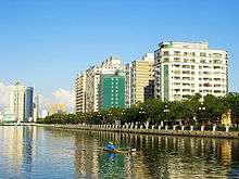 Tainan Canal, Anping |


Rail
Tainan Station is a major stop on the Taiwan Railways Administration (TRA) Western Line, with direct connections to Taipei, Kaohsiung, Taichung, Hsinchu, and Keelung. There are also local trains to reach closer destinations.
Taiwan High Speed Rail Tainan Station is located just outside the city center, in Gueiren district. The service is accessible to the city center via TRA Shalun Line and two THSR Shuttle Bus Lines.[40] Using the High Speed Rail system passengers can reach Taipei in under ninety minutes.
Public Transport
Original plan for Tainan MRT system is muted due to the construction cost and the question of insufficient ridership.[41] Upgrading current railway and buses are now considered as alternative citywide modern public transport options.
Tainan has three major bus operators. They are Singing Bus Co., Shinan Buses and Kaohsiung Buses operating in river north region, intercity routes and metropolitan routes respectively. In 2012, the city government called to restructure Singing Bus and Shinan Buses route to form a Tainan City Bus System. This new system, which set to start operation in 2013, has six main routes connecting the city and eight main interchanges. From the main routes 66 branch routes then spread out to service local communities. City government hope this new system will boost the public transports ridership and progress into metro-bus system in the future.[42][43]
A project to transform the railway in the city center into underground is underway as part of the National wide TRA Rapid Transit Systematization in the Metropolitan Areas Project. This project will help increase service frequency by eliminate potential disruption between road and rail traffic. Further to underground transformation, two new stations are planned to serve East district commuters.[44] Together with the Shalun HSR link, this section of TRA corridor will become the backbone of the rail transit system in Tainan.[43]
Road
National Highway Nos. 1 and 3 run close by and connect via local highways to the city itself. Tainan City has a total of 142.9 kilometres (88.8 mi) of highways, including national, local, and rural highways.[45]
Air
Tainan Airport (TNN) is located in the South District is close center city only six kilometers. As a regional airport, it currently operate both domestic and international flights to Hong Kong, Kinmen, Magong and Wuhan.[46] Previously there were also services to Taipei's Songshan Airport (TSA), but these were dropped in light of falling revenues (generally agreed to be a result of the High Speed Rail commencing operation in 2007).[47]
Education


- National Cheng Kung University (國立成功大學), second best university in Taiwan, is located in the East District. It is famous for its engineering programs. In 1931, NCKU was established as Tainan Technical College, located on the present Cheng-Kung Campus, with a total area of 183,000 square metres. As the number of colleges expanded, it was upgraded to a provincial university in 1956, then national university in 1971.[48] Today, National Cheng Kung University serves nearly 21,000 students through 9 colleges, 39 departments, and 49 graduate institutes.[49]
- National University of Tainan (國立臺南大學) NUTN used to be the Institute of Teachers' In-service Education in 1988, promoted and renamed National Tainan Teachers College in 1991. In 2004, it was established as National University of Tainan until now. The motto of NUTN includes benevolence, intelligence, sincerity and uprightness.
- Tainan National University of the Arts (國立臺南藝術大學) TNNUA exists to prepare talented individuals for careers in visual and performing arts, sound and image design, building arts, conservation arts, and art history and critique. The university emphasizes learning through individual attention and independent work creation. It is a public institution first established in 1996.
- Tainan Theological College and Seminary (臺南神學院) was established in 1876 by Thomas Barclay.[50]
- Chang Jung Christian University is a private university affiliated with the Presbyterian Church in Taiwan. CJU offers masters and doctoral degree programs and aims to promote fraternity, justice, and service for Taiwan. It is located south of the city, in Gueiren.
- Southern Taiwan University of Science and Technology (南台科技大學), founded in 1969, is located near the northeastern border of Tainan City, within a 30-minute driving distance from the Tainan Airport.
- The Tainan University of Technology (臺南應用科技大學) is a private university founded in 1964. The university offers graduate degrees in music, visual art, and applied sciences.
Senior high schools
Public
- National Tainan First Senior High School
- National Tainan Second Senior High School
- National Tainan Girls' Senior High School
- National Hsin Hua Senior High School
- National Chia-Chi Girls' Senior High School
- National Tainan Commercial Vocational School
- National Tainan Industrial Vocational School
- The Affiliated Senior Industrial Vocational Continuing Education High School of National Cheng Kung University
- National Tainan Marine & Fishery Vocational School
- Municipal Tainan Nan-Ning Senior High School
- Municipal Tainan Tu-Cheng High School
Private
- Feng-Ho Senior High School
- Chang Jung High School
- Sheng Kung Girls' High School
- Nan Ying Vocational High School of Business & Technology
- Salesian Technical School
- Chang Jung Girls' Senior High School
- Deguang Catholic High School
- Kuang Hua Girls' Senior High School
- Tainan Liuhsin Senior High School
- Kuen-Shan Senior High School
- Ying-Hai High School
Notable natives
The following is a non-exhaustive list of famous people born in Tainan, educated there, prominent in the life of the city, or otherwise associated with the city.
- Momofuku Ando (安藤百福) (1910–2007), founder of Nissin Foods and inventor of instant noodles[51]
- Thomas Barclay (1849–1935), Christian missionary, lived in the city from 1875 to 1935
- William Campbell (1841–1921), Christian missionary, lived in the city from 1871 to 1917
- George Chang (張燦鍙) (born 1936), politician, former mayor of Tainan (1997–2001)
- Chin-Feng Chen (陳金鋒) (born 1977), first Taiwanese-born player to play Major League Baseball
- Chen Wei-Ling (陳葦綾), 2008 Olympic bronze medal-winning weightlifter
- Mao Gao-wen (毛高文) (born 1936), chemist, former president of National Tsinghua University (1981–1987) and Minister of Education (1987–1993)
- Hsu Shih-Hsien (許世賢) (1908–1983), first female Taiwanese PhD
- Chin-Lung Hu (胡金龍), MLB infielder for the New York Mets
- Jutoupi (born 1966), recording artist
- Kao Ching-yuen (高清愿) (born 1929), businessman, founder and chairman of Uni-president
- Hong-Chih Kuo (郭泓志), MLB pitcher for the Los Angeles Dodgers
- Tai-Yuan Kuo (郭泰源), retired pitcher for the Seibu Lions, foreign player with the most wins in Nippon Professional Baseball history
- Ang Lee (李安) (born 1954), Academy Award–winning film director
- Chen-Yuan Lee (李鎮源) (1915–2001), pharmacologist and political activist, famous for research on snake venom
- Lien Heng (連橫) (1878–1936), historian, writer of The General History of Taiwan
- En-Yu Lin (林恩宇), baseball pitcher currently playing for Tohoku Rakuten Golden Eagles
- Lin Hsin-i (林信義) (born 1946), businessman and politician, Minister of Economic Affairs (2000–2002), Vice Premier (2002–2004)
- Lin Mosei (林茂生) (1887–1947?), first Taiwanese philosophy PhD, academic, educator and calligrapher thought to have been killed following the February 28 Incident.
- Ong Iok-tek (王育德) (1924–1985), scholar and authority of the Taiwanese Hokkien dialects
- Judy Ongg (翁倩玉) (born 1950), actress, singer, author and artist
- Shi Wen-long (許文龍) (born 1928), businessman, founder of Chi Mei Corporation
- Su Nan-cheng (蘇南成) (born 1936), politician, former mayor of Tainan (1977–1985) and advisor to Chen Shui-bian
- Robert Swinhoe (1836–1877), first British consul sent to Tainan 1861; ornithologist, highly regarded researcher writer on the natural history and zoology of Taiwan and China.
- Chien-Ming Wang (王建民), MLB pitcher for the Toronto Blue Jays
- Wu Hui Ju (吳蕙如), archer and also a member of the team that won the bronze medal for Chinese Taipei in 2004 Summer Olympics in the women's team archery competition
- Jacky Wu (吳宗憲) (born 1962), entertainer and talk-show host
- Shone An(安钧璨)(1983-2015), singer, actor and host.
- Lisa Su (born 1969), Chief Executive Officer of Advanced Micro Devices
- Chou Tzu-yu (周子瑜) (born 1999), singer, member of Twice
Sports

Tainan is home to the Uni-President Lions, who play their home games at the Tainan Municipal Baseball Stadium.[52] It is also the birthplace of Chien-Ming Wang, Hong-Chih Kuo, Tai-Yuan Kuo, En-Yu Lin, and many other prominent Taiwanese baseball players.
International relations
Twin towns — Sister cities
The following municipals are sister cities to Tainan City:[53]
 Monterey, California, United States (1965)
 Gwangju, South Korea (1968)[54]
- San Jose, California United States (1977)
- Kansas City, Missouri United States (1978)
 Pasay City, Philippines (1980)
- Cavite City, Philippines (1980)
- Tagaytay City, Philippines (1980)
- Trece Martires City, Philippines (1980)
- Columbus, Ohio United States (1980)
 Santa Cruz de la Sierra, Bolivia (1981)
 Port Elizabeth, Eastern Cape, South Africa (1982)
- Orlando, Florida United States (1982)
 Gold Coast, Queensland, Australia (1982)
- Fairbanks, Alaska United States (1983)
- Laredo, Texas United States (1985)
- Oklahoma City, Oklahoma, United States (1986)
- Huntsville, Alabama United States(1986)
- Carbondale, Illinois United States(1991)
.svg.png) Leuven, Belgium (1993)
Leuven, Belgium (1993)- Snohomish County, Washington United States (1998)
 Ra'anana, Israel (1999)[55]
 Zacapa, Guatemala (2003)
 Elbląg, Poland (2004)[56][57]
 Ribe, Denmark (2005)
 Keçiören, Turkey (2005)
- Cagayan de Oro, Philippines (2005)
Friendship cities
Tainan City also celebrates friendly relationships with four other municipalities, although they are not considered official sister cities.
 Sendai, Japan (2006)
- Nikkō, Tochigi, Japan (2009)
 Almere, Netherlands (2009)
Domestic
 Kinmen, Fujian (1981)
- Penghu County, Taiwan (2004) (Friendship city)
Relative location
 |
|
| ||
| Taiwan Strait (South China Sea) Fujian, |
|
| ||
| ||||
| | ||||
| |
See also
References
- ↑ Tainan University of Technology official site
- ↑ "臺南市政府全球資訊網". Tainan.gov.tw. Archived from the original on January 18, 2013. Retrieved 2013-01-23.
- ↑ Shih, Hsiu-chuan (14 Feb 2014). "Jiang backs curriculum changes". Taipei Times. p. 3. Retrieved 2 January 2015.
- ↑ "《中華民國統計資訊網》縣市重要統計指標查詢系統網" (in Chinese). Retrieved 13 June 2016.
- ↑ "Demographia World Urban Areas PDF (April 2016)" (PDF). Demographia. Retrieved 13 June 2016.
- ↑ "台南市統計月報" (PDF) (in Chinese). Retrieved 13 June 2016.
- ↑ "Demographia World Urban Areas PDF (April 2016)" (PDF). Demographia. Retrieved 13 June 2016.
- ↑ Chang, Winnie (April 1994). "Rise of the Phoenix?". Taiwan Today. Retrieved 2012-01-10.
- ↑ "Tainan Confucian Temple". Council for Cultural Affairs. Archived from the original on 2008-05-01. Retrieved 2008-08-19.
- 1 2 3 4 5 6 7 8 9 10 蔡玉仙; et al., eds. (2007). 府城文史 (in Chinese). Tainan City Government. ISBN 9789860094343.
- 1 2 3 4 5 6 7 Shih Shou-chien, ed. (2003). 福爾摩沙 : 十七世紀的臺灣、荷蘭與東亞 [Ilha Formosa: the Emergence of Taiwan on the World Scene in the 17th Century] (in Chinese). National Palace Museum. ISBN 9789575624415.
- 1 2 3 4 Kato, Mitsutaka (2007) [1940]. 昨日府城 明星台南: 發現日治下的老臺南 (in Chinese). Translated by 黃秉珩. 臺南市文化資產保護協會. ISBN 9789572807996.
- 1 2 3 4 5 6 Rubinstein, Murry A., ed. (2007). Taiwan: A New History (expanded ed.). New York: M.E. Sharpe. ISBN 9780765614940.
- ↑ "Anping Harbor National Historical Park". Tainan City Government. Retrieved 2010-03-31.
- ↑ Shih (2003).
- ↑ "Anping Harbor National Historical Park". Tainan City Government. Retrieved 2010-03-25.
- ↑ Campbell, William (1915). Sketches from Formosa. London: Marshall Brothers. pp. 16–17. OL 7051071M.
- ↑ Takekoshi, Yosaburō (1907). "Chapter XIII: Population and future development of the island resources". Japanese rule in Formosa. London, New York, Bombay and Calcutta: Longmans, Green, and co. p. 200. OCLC 753129. OL 6986981M.
- ↑ Chamberlain, B.; Mason, W.B. (1903). A Handbook for Travellers in Japan (7th ed.). London: J. Murray. p. 553. OL 25302448M.
- ↑ "湯德章". Archived from the original on January 21, 2010. Retrieved 2010-04-17.
- ↑ "張銘清訪台遇襲事件". Retrieved 2010-04-18.
- ↑ Kuo-fang, Huang; Hsu, Elizabeth (13 February 2016). "Remains of last unaccounted-for quake victim found". Focus Taiwan. The Central News Agency. Retrieved 18 February 2016.
- 1 2 3 4 5 "台南市文資導讀". Tainan City Government. Retrieved 2011-05-12.
- ↑ "Sword Lion". Anping Harbor National Historical Park. Retrieved 2011-05-12.
- ↑ Lee Hsin-fang; Chung, Jake (15 Jul 2015). "Tainan has most of nation's 12,106 temples". Taipei Times. p. 5.
- ↑ "Tainan Traditional Orchestra". Tainan Traditional Orchestra. Retrieved 6 November 2011.
- ↑ "Chimei Orchestra (Chinese)". Chimei Museum. Archived from the original on November 1, 2011. Retrieved 6 November 2011.
- ↑ "Chang Jung University Orchestra". Chang Jung University. Archived from the original on December 27, 2013. Retrieved 6 November 2011.
- ↑ "Ten Drum Official Website (Chinese)". Ten Drum Art Percussion Group. Ten Drum Art Percussion Group. Retrieved 6 November 2011.
- ↑ 中央氣象局 (in Chinese). Cwb.gov.tw. 2011-01-31. Retrieved 2014-01-22.
- 1 2 3 4 金山, 翁 (2002). 台南市都市設計規劃綱要之研究 1 都市空間的溯源與演化. 財團法人成大建築文教基金會.
- ↑ "Green and blue belts reference" (PDF). Archived from the original (PDF) on April 25, 2012. Retrieved 2011-11-02.
- ↑ "CEPD". Retrieved 2011-11-02.
- ↑ "LCD manufacturing in Tainan". Tainan City Government. Archived from the original on May 20, 2009. Retrieved 20 November 2011.
- 1 2 "Report on the economic structure to CPED". Tainan City Government. Retrieved 20 November 2011.
- ↑ "Tainan District Agricultural Research & Extension Station, COA". COA. Archived from the original on March 6, 2014. Retrieved 18 May 2013.
- ↑ "AVRDC". Retrieved 18 May 2013.
- ↑ "Taiwan Orchid Plantation". Taiwan Orchid Plantation. Retrieved 20 November 2011.
- ↑ "臺南市觀光遊憩景點遊客人次統計" (PDF). Tainan City Government Tourism Bureau Official Website. Tainan City Government Tourism Bureau. Retrieved 14 September 2013.
- ↑ "Transfer Information". Taiwan High Speed Rail. Retrieved 2012-12-06.
- ↑ "MRT Plans" (in Chinese). Bureau of High Speed Rail. Retrieved 2008-08-20.
- ↑ "Tainan City Bus System". Retrieved 24 March 2013.
- 1 2 "Tainan Public Transport Plan". Tainan City Government. Tainan City Government. Retrieved 23 March 2013.
- ↑ "The Tainan Urban District Railway Underground Project". Retrieved 24 March 2013.
- ↑ "2005 statistics" (PDF). Tainan City Government. Archived from the original (PDF) on September 10, 2008. Retrieved 2008-08-19.
- ↑ "Airlines". Tainan National Airport. Retrieved 2008-08-20.
- ↑ Lin, Judy (1 Mar 2008). "FAT to sell investments to cover costs". Taipei Times. p. 12. Retrieved 2008-08-20.
- ↑ "Brief History". National Cheng Kung University. Retrieved 2008-08-20.
- ↑ "Organization". National Cheng Kung University. Retrieved 2008-08-20.
- ↑ "Introduction". Tainan Theological College and Seminary. Archived from the original on May 22, 2007. Retrieved 2008-08-20.
- ↑ "Inventor of the Week: Momofuku Ando". MIT. Archived from the original on August 3, 2008. Retrieved 2008-08-19.
- ↑ "Parking near the Municipal Stadium" (in Chinese). Uni-President Lions. Retrieved 2008-08-20.
- ↑ "姊妹市暨友誼市". Tainan City Government (in Chinese). Archived from the original on 2013-07-01. Retrieved 2013-08-01.
- ↑ Gwangju Sister Cities
- ↑ "Ra'anana: Twin towns & Sister cities - Friends around the World". raanana.muni.il. Archived from the original on February 28, 2010. Retrieved 24 March 2010.
- ↑ "Elbląg - Podstrony / Miasta partnerskie". Elbląski Dziennik Internetowy (in Polish). Archived from the original on 2011-03-15. Retrieved 2013-08-01.
- ↑ "Elbląg - Miasta partnerskie". Elbląg.net (in Polish). Retrieved 2013-08-01.
External links
 Tainan travel guide from Wikivoyage
 Geographic data related to Tainan at OpenStreetMap
- Tainan City Government Official Website
- Tainan City Travel Information
- Tainan City Dynamic Bus Information System
- The Confucian temple in Tainan
Districts of Tainan | ||
|---|---|---|
| Districts | | |
Note: Although Hanyu Pinyin is the national standard; East, South, West Central, and North District uses English instead. | ||
| Special municipalities (6) |  | |
|---|---|---|
| Provincial cities (3) | ||
| Counties (13) | ||
| ||
Coordinates: 22°59′N 120°11′E / 22.983°N 120.183°E