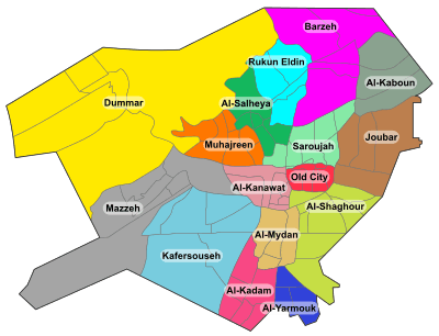
Tadamon, Syria
Tadamon (Arabic: التضامن; also spelled Tadamoun or Tadamun) is a neighborhood and district of the al-Midan municipality of Damascus, Syria.[2][3] According to the Syria Central Bureau of Statistics, Tadamon had a population of 86,793 in the 2004 census.[1] The neighborhood has been active in the Syrian civil war.
References
|
|---|
|
| |
|
| |
|---|
| | Districts: |
- Al-Abbas
- Barza al-Balad
- Ish al-Warwar
- Al-Manara
- Masakin Barzeh
- An-Nuzha
|
|---|
|
|
|
| |
|---|
| | Districts: |
- Al-Arin
- Dahiyet Dummar
- Dummar al-Gharbiyah
- Dummar al-Sharqiyah
- Al-Wuroud
|
|---|
|
|
|
| |
|---|
| | Districts: |
- Jobar Gharbi
- Jobar Sharqi
- Al-Istiqlal
- Al-Ma'muniyah
|
|---|
|
|
|
| |
|---|
| | Districts: |
- Fardos
- Al-Ikhlas
- Kafr Souseh al-Balad
- Al-Liwan
- Mezzeh al-Basatin
- Al-Waha
|
|---|
|
|
|
| |
|---|
| | Districts: |
- Al-Jalaa
- Fe'alat al-Gharbiyah
- Fe'alat al-Sharqiyah
- Mezzeh 86
- Mezzeh al-Qadimeh
- Mezzeh Jabal
- Al-Rabwa
- Al-Sumariyah
|
|---|
|
|
|
|
|
| Muhajirin |
|---|
| | Districts: |
- Abu Rummaneh
- A-Haboubi
- Al-Maliki
- Al-Marabit
- Al-Mastaba
- Al-Rawda
- Shura
|
|---|
|
|
|
| |
|---|
| | Districts: |
- Al-Masaneh'
- Qabun
- Tishrin
|
|---|
|
|
|
| |
|---|
| | Districts: |
- Al-Asali
- Dahadil
- Jouret al-Shreibati
- Al-Mustafa
- Al-Qadam
- Qadam Sharqi
- Al-Sayyidah Aisha
|
|---|
|
|
|
|
|
| |
|---|
| | Districts: |
- Asad ad-Din
- Ayyubiyah
- Al-Fayhaa
- Al-Naqshabandi
|
|---|
|
|
|
| |
|---|
| | Districts: |
- Abu Jarash
- Al-Madaris
- Al-Mazra'a
- Qasyoun
- Shaykh Muhyi ad-Din
- Ash-Shuhada
|
|---|
|
|
|
|
|
|
|
| |
|---|
| | Districts: |
- Al-Faluja
- Hittin
- Al-Karmil
- An-Naseriyah
- March 8th
- Al-Taqqadum
|
|---|
|
|