Tacna
| Tacna San Pedro de Tacna | |||
|---|---|---|---|
|
Top:Monument at Battle of Tacna in Intiorko Hills, 2nd left:Ferroviaria Railroad Station, 2nd right:Cerrado Peru Arena (Coliseo Cerrado Peru), 3rd left:Tacna Cathedral, 3rd right:Tacna Municipal Hall, Bottom:Jorge Basadre Stadium (Estadio Jorge Basadre) | |||
| |||
|
Nickname(s): La Ciudad Heroica (The Heroic City) | |||
 Tacna | |||
| Coordinates: 18°03′20″S 70°14′54″W / 18.05556°S 70.24833°W | |||
| Country |
| ||
| Region | Tacna Region | ||
| Province | Tacna Province | ||
| District | Tacna District | ||
| Government | |||
| • Mayor | Ing. Fidel Carita Monroy (2011–2014) | ||
| Elevation | 552 m (1,811 ft) | ||
| Population | |||
| • Estimate (2015)[1] | 293,116 | ||
| Demonym(s) | Tacneño | ||
| Time zone | PET (UTC-5) | ||
| Website | www.munitacna.gob.pe | ||


Tacna is a city in southern Peru and the regional capital of the Tacna Region. A very commercially active city, it is located only 35 km (22 mi) north of the border with Arica y Parinacota Region from Chile, inland from the Pacific Ocean and in the valley of the Caplina River. It is Peru's tenth most populous city.
Initially called San Pedro de Tacna, it has gained a reputation for patriotism, with many monuments and streets named after heroes of Peru's struggle for independence (1821–1824) and the War of the Pacific (1879–1883). Residents of Tacna are known in Spanish as tacneños.
History
Francisco Antonio De Zela, a royal accountant (similar in function to a modern-day income tax auditor), initiated the push for Peruvian Independence from Spain in 1811 in Tacna, leading to a series of commemorative actions for the city, culminating in the 1828 declaration of Tacna as the "Heroic City" (La Heroica Ciudad de San Pedro de Tacna) by President José de La Mar.
It was the capital of the short-lived Peru-Bolivian Confederation (1836–1839)
Tacna's economic prosperity attracted a wave of immigrants from Italy. Today, their Italian Peruvian descendants live in the city and many of them still have Italian surnames. This era of successful commerce and agriculture ended drastically with the start of the War of the Pacific.
During the war, the cities of Tacna and Arica were occupied by the Chilean Army. A peace agreement, the Treaty of Ancón, was signed in 1883. Under the terms of the treaty, Chile was to occupy the provinces of Tacna and Arica for ten years, after which a plebiscite was to be held to determine the region's sovereignty. Tacna remained under Chilean control for 50 years, in Chilean groups and authorities lead a campaign of Chilenization in an attempt to persuade the local population to abandon their Peruvian past and accept Chilean nationality.
However, Peruvian nationalists ensured that the Chilean propaganda failed and the planned plebiscite was never held. Finally, in 1929, an accord was reached by which Chile kept Arica, whilst Peru reacquired Tacna and receiving $6 million indemnity and other concessions.


Today, Tacna is a mostly commercial city with many immigrants from the Puno Region living there. Its economy is based on mercantile activities with the north of Chile (Arica and Iquique). Since it is part of a duty-free zone, Tacna has come to rival Arequipa as southern Peru's main business area. The city has one of the largest artifact markets in the world with imports from Japan and China, and traditional Peruvian handicrafts.
Geography
Climate
Tacna has a mild desert climate (BWn, according to the Köppen climate classification).
| Tacna | ||||||||||||||||||||||||||||||||||||||||||||||||||||||||||||
|---|---|---|---|---|---|---|---|---|---|---|---|---|---|---|---|---|---|---|---|---|---|---|---|---|---|---|---|---|---|---|---|---|---|---|---|---|---|---|---|---|---|---|---|---|---|---|---|---|---|---|---|---|---|---|---|---|---|---|---|---|
| Climate chart (explanation) | ||||||||||||||||||||||||||||||||||||||||||||||||||||||||||||
| ||||||||||||||||||||||||||||||||||||||||||||||||||||||||||||
| ||||||||||||||||||||||||||||||||||||||||||||||||||||||||||||
Transport
Rail
Tacna is served by a cross-border standard gauge railway to Arica, Chile.
It is also the location of the National Railway Museum of Peru.[2]
Air
Tacna is served by the Crnl. FAP. Carlos Ciriani Santa Rosa International Airport, with flights to Arequipa and Lima.
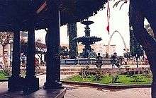
Tourist attractions
Many monuments are located in this city, including the arch of the Alto de la Alianza, which shows the significance of this town.
Other monuments include a neo-renaissance Cathedral, the Courthouse, the Alameda Bolognesi Walkway and the caves of Toquepala, where archaeologists have found some of the oldest human remains in Peru.
Festivities
The most important festivity in the city is the Semana de Tacna ("Tacna Week"), which runs from August 25–30.
On August 28, a large Peruvian flag is shown throughout the city during the Paseo de la Bandera, which celebrates the anniversary of the reincorporation of Tacna into Peruvian sovereignty and is one of the most important patriotic demonstrations in the whole country. This tradition started in 1901, during the Chilean occupation of Tacna, by a group of tacneños who defied the prohibition of showing Peruvian flags imposed by the Chilean authorities.
There is an agrarian and industrial fair as part of these celebrations.
In September, the festival of the Señor de Locumba is celebrated, which draws thousands of faithful people from all over the world.
Religion
The major religion in Tacna is Catholicism but, in 2008 the first mosque in Peru was completed in Tacna, the Mosque Bab ul Islam founded by Pakistani immigrants.
See also
- 2001 southern Peru earthquake
- the Roman Catholic Diocese of Tacna y Moquegua
References
- ↑ Perú: Población estimada al 30 de junio y tasa de crecimiento de las ciudades capitales, por departamento, 2011 y 2015. Perú: Estimaciones y proyecciones de población total por sexo de las principales ciudades, 2012-2015 (Report). Instituto Nacional de Estadística e Informática. March 2012. Retrieved 2015-06-03.
- ↑ Southern Peru Railroads
External links
| Wikimedia Commons has media related to Tacna. |
- (Spanish) Official website
-
 "Tacna". Encyclopædia Britannica (11th ed.). 1911.
 - "Tacna. The capital of the Province of Tacna, Chile". New International Encyclopedia. 1905.
Coordinates: 18°00′53″S 70°14′56″W / 18.01466°S 70.24887°W