Tacheng Airport
| Tacheng Airport 塔城机场 Tǎchéng Jīchǎng | |||||||||||
|---|---|---|---|---|---|---|---|---|---|---|---|
 | |||||||||||
| IATA: TCG – ICAO: ZWTC | |||||||||||
| Summary | |||||||||||
| Airport type | Public | ||||||||||
| Serves | Tacheng, Xinjiang, China | ||||||||||
| Elevation AMSL | 604 m / 1,982 ft | ||||||||||
| Coordinates | 46°40′21″N 83°20′27″E / 46.67250°N 83.34083°E | ||||||||||
| Map | |||||||||||
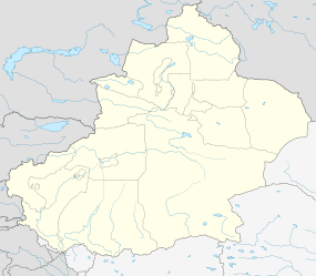 TCG Location of airport in Xinjiang | |||||||||||
| Runways | |||||||||||
| |||||||||||
Tacheng Airport (Chinese: 塔城机场; pinyin: Tǎchéng Jīchǎng) (IATA: TCG, ICAO: ZWTC) is an airport serving Tacheng, a city in Xinjiang Uyghur Autonomous Region, China.[1]
Facilities
The airport resides at an elevation of 1,980 feet (604 m) above mean sea level. It has one runway designated 12/30 which measures 2,380 by 45 metres (7,808 ft × 148 ft)[2]
Airlines and destinations
| Airlines | Destinations |
|---|---|
| Tianjin Airlines | Urumqi |
See also
References
- 1 2 Airport information for Tacheng, Xinjiang Uyghur, China (TCG / ZWTC) at Great Circle Mapper.
- 1 2 Airports in China at AirfieldMaps.co.uk
External links
This article is issued from Wikipedia - version of the 11/27/2016. The text is available under the Creative Commons Attribution/Share Alike but additional terms may apply for the media files.