Tabaille-Usquain
| Tabaille-Usquain | |
|---|---|
|
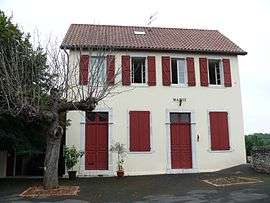
The mairie | |
 Tabaille-Usquain | |
|
Location within Nouvelle-Aquitaine region  Tabaille-Usquain | |
| Coordinates: 43°21′27″N 0°53′36″W / 43.3575°N 0.8933°WCoordinates: 43°21′27″N 0°53′36″W / 43.3575°N 0.8933°W | |
| Country | France |
| Region | Nouvelle-Aquitaine |
| Department | Pyrénées-Atlantiques |
| Arrondissement | Oloron-Sainte-Marie |
| Canton | Sauveterre-de-Béarn |
| Intercommunality | Communauté de communes de Sauveterre-de-Béarn |
| Government | |
| • Mayor (2014–2020) | Germain Sallenave |
| Area1 | 4.50 km2 (1.74 sq mi) |
| Population (2013)2 | 31 |
| • Density | 6.9/km2 (18/sq mi) |
| Time zone | CET (UTC+1) |
| • Summer (DST) | CEST (UTC+2) |
| INSEE/Postal code | 64531 / 64190 |
| Elevation |
69–181 m (226–594 ft) (avg. 119 m or 390 ft) |
|
1 French Land Register data, which excludes lakes, ponds, glaciers > 1 km² (0.386 sq mi or 247 acres) and river estuaries. 2 Population without double counting: residents of multiple communes (e.g., students and military personnel) only counted once. | |
Tabaille-Usquain is a commune in the Pyrénées-Atlantiques department and Nouvelle-Aquitaine region of south-western France.
See also
References
| Wikimedia Commons has media related to Tabaille-Usquain. |
This article is issued from Wikipedia - version of the 11/3/2016. The text is available under the Creative Commons Attribution/Share Alike but additional terms may apply for the media files.