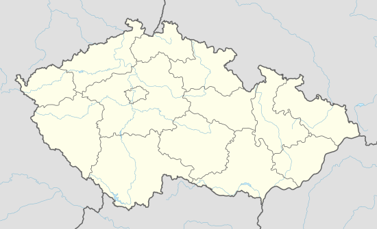
Týniště (Plzeň-South District)
| Týniště | |
|---|---|
| Municipality | |
 | |
 Týniště | |
| Coordinates: 49°30′43″N 13°24′8″E / 49.51194°N 13.40222°ECoordinates: 49°30′43″N 13°24′8″E / 49.51194°N 13.40222°E | |
| Country |
|
| Region | Plzeň |
| District | Plzeň-South |
| Area | |
| • Total | 8.09 km2 (3.12 sq mi) |
| Elevation | 530 m (1,740 ft) |
| Population (2006) | |
| • Total | 56 |
| • Density | 6.9/km2 (18/sq mi) |
| Postal code | 334 01 |
Týniště is a small municipality (56 inhabitants in 2006, compared to 175 inhabitants in 1880)which is located in the Pilsen Region (Plzeňský kraj) 36 kilometres (23 miles) to the south of the city of Pilsen (Plzeň) 530 metres (1,720') above sea level on the regional route 230 (Czech: krajská silnice 230).[1] Until 1990 a part of the Horšice municipality.
The village was firstly mentioned in 1379. In the 16th century it was known as Pustá ("empty" or "deserted").
Luh (pron: /lυx/) – a part of the municipality which is located 2 kilometres (1.25 miles) to the west of Týniště, 446 metres (1,450') above sea level with a saw-mill on the Zlatý potok stream (Golden Stream) and a hunting lodge.

Pub 'Hospoda U Kaiserů'

The municipal water tower

Luh
References
- ↑ http://www.mapy.cz/#x=130633426@y=134375664@z=9@mm=ZP@sa=r@st=sr@ssq=Tyniste@sss=1@ssp=120705957_126814081_150393765_149833601@srq=route(fast,toll):49%C2%B031%E2%80%B215.91%E2%80%B3N%2013%C2%B025%E2%80%B23.34%E2%80%B3E%3E49%C2%B044'50.913%22N%2013%C2%B022'39.314%22E
This article is issued from Wikipedia - version of the 4/7/2016. The text is available under the Creative Commons Attribution/Share Alike but additional terms may apply for the media files.