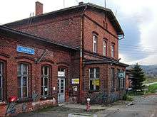
Szczytna
| Szczytna | ||
|---|---|---|
| ||
 Szczytna | ||
| Coordinates: 50°25′N 16°26′E / 50.417°N 16.433°E | ||
| Country |
| |
| Voivodeship | Lower Silesian | |
| County | Kłodzko | |
| Gmina | Szczytna | |
| Area | ||
| • Total | 80.38 km2 (31.03 sq mi) | |
| Population (2006) | ||
| • Total | 5,234 | |
| • Density | 65/km2 (170/sq mi) | |
| Website | http://www.szczytna.pl | |
Szczytna [ˈʂt͡ʂɨtna] (German: Rückers) is a town in Kłodzko County, Lower Silesian Voivodeship, in south-western Poland. It is the seat of the administrative district (gmina) called Gmina Szczytna, close to the Czech border. Prior to 1945 it was in Germany.
It lies approximately 16 kilometres (10 mi) west of Kłodzko, and 90 kilometres (56 mi) south-west of the regional capital Wrocław.
As at 2006, the town has a population of 5,234.
Two of the skirmishes of the War of the Bavarian Succession (1778–1779) occurred at the hamlet of Biebersdorf. In the first, on 7 August, Major Friedrich Joseph, Count of Nauendorf and two squadrons of the Wurmser Hussars, surprised a Prussian convoy, which surrendered 240 wagons of flour and 13 transport wagons. Nauendorf's Hussars also took as prisoners all the officers and 110 men, and captured 476 horses. While the parties negotiated at their differences at Teschen, on 3 March 1779, Nauendorf raided Biebersdorf again with a larger force of infantry and hussars and captured the entire Prussian garrison. Following this action, Joseph awarded him the Knight's Cross of the Military Order of Maria Theresa (19 May 1779).[1][2]
After World War II the region was placed under Polish administration and ethnically cleansed according to the post-war Potsdam Agreement. The native German populace was expelled and replaced with Poles.
References
- ↑ (German) Jens Florian Ebert, Feldmarschall-Leutnant Graf von Nauendorf. In Die Österreichischen Generäle 1792-1815. Accessed 30 January 2012.
- ↑ Carl von Seidl, Versuch einer militärischen Geschichte des Bayerischen Erbfolge-Kriegs, im Jahre 1778: im Gesichtspunkte der Wahrheit betrachtet..., Von einem Königl. Preussischen Officier 1781. Band 1, p. 144
| Town and seat |  | |
|---|---|---|
| Villages | ||
Coordinates: 50°25′N 16°26′E / 50.417°N 16.433°E