Swat (princely state)
| The Yusufzai State of Swat | ||||||||
| Province of the Durrani Empire (1802–1858) Princely state in alliance with British India (1858–1947) Princely state of Pakistan (1947–1969) | ||||||||
| ||||||||
|
| ||||||||
 | ||||||||
| Capital | Saidu Sharif | |||||||
| Religion | Islam | |||||||
| Government | Principality (1858–1969) | |||||||
| Wāli of Swat | His Highness Sultan Faghal (first) | |||||||
| His Highness Miangul Jahan Zeb, Wāli of Swat (last) | ||||||||
| Historical era | Durani Empire (1802–1858) Indian British Empire (22 February 1858-1947) Princely state of Pakistan (1947-1969) Part of West Pakistan (1955-1969) Khyber-Pakhtunkhwa (1969-present) Dividing between the Swat, Buner and Shangla | |||||||
| • | Established | 1858 | ||||||
| • | Merged into West Pakistan | 14 October 1969 | ||||||
| Currency | Rupee, Pakistan Rupee (after 1947) | |||||||
| ||||||||
| Today part of | Khyber Pakhtunkhwa, Pakistan | |||||||
| The Yusufzai State of Swat Swat | |||||
| Subdivision of Pakistan | |||||
| |||||
|
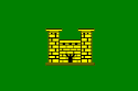
Flag | |||||
| | |||||
| Capital | Saidu Sharif | ||||
| History | |||||
| • | Established | 1849 | |||
| • | Disestablished | 28 July 1969 | |||
| Area | 8,250 km2 (3,185 sq mi) | ||||
| Today part of | Khyber Pakhtunkhwa, Pakistan | ||||
| Government of Khyber Pakhtunkhwa | |||||
 |
| This article is part of the series |
| Former administrative units of Pakistan |
|---|
|
Original provinces |
|
One-unit provinces |
|
Other subdivisions |
The Yusufzai State of Swat (Pashto: د يوسفزو رياست سوات) was a province of the Durrani Empire ruled by local rulers known as the Akhunds, then until 1947 a princely state of the British Indian Empire, which was dissolved in 1969, when the Akhwand acceded to Pakistan. The state lay to the north of the modern Khyber Pakhtunkhwa Province (formerly called NWFP) and continued within its 1947 borders until 1969, when it was dissolved.[1] The area it covered is now divided between the present-day districts of Swat, Buner and Shangla.
History
The Swat region has been inhabited for more than two thousand years and was known in ancient times as Udyana. The location of Swat made it an important stopping point for many invaders, including Alexander the Great and Sultan Mahmud of Ghazni. In the second century BCE, Swat formed part of the Buddhist civilisation of Gandhara.
Swat was a center of Hinayana Buddhism and of the Mahayana school that developed from it. The Chinese pilgrim Fa-Hsien, who visited the valley around 403 CE, mentions 500 monasteries. After him, Sun Yun (519 CE), Xuanzang (630 CE), and Wu-kung (752 CE) visited Swat as well and praised the richness of the region, its favourable climate, the abundance of forest, flowers and fruit-trees and the respect in which Buddhism was held.
The Kushan dynasty ruled for four centuries until it was overrun by the White Huns in the 5th century CE and the glory of the Gandhara era came to an end. Xuanzang recorded the decline of Buddhism. According to him, of the 1400 monasteries that had supposedly been there, most were in ruins or had been abandoned. The monks still quoted from the scriptures but no longer understood them. There were grapes in abundance but cultivation of the fields was sparse.
From the 8th century CE onwards, Muslim Arabs started to exert pressure from the west towards the areas where the Hindu Shahi Dynasty still ruled. At the beginning of the 8th century, various Pashtun and Turkic tribes advanced through Laghman, Ningarhar, and Dir to invade Swat, defeating the Buddhists and the Hindus and seized control in parts of Swat area. Later in 1519 and 1520 they were ousted in their turn by the Yusufzais backed by the Mughal Badshah Zahiruddin Muhammad Babur.
The modern area of Swat was ruled sporadically by religious leaders, who variously took the title of Akhoond, also spelt Akhund or Akond. The Akhund of Swat who died in 1878 was particularly famous as the subject of a well known humorist poem by Edward Lear, The Akond of Swat. The nonsensical poem suggests a far away place and a mystical person, at least through the eyes of a Victorian poet and painter.
The Islamic State of Swat was established in 1849 under Sayyid Akbar Shah with Sharia law remaining in force, but the state was in abeyance from 1878 to 1915. Thereafter Sayyid Abdul-Jabbar Khan, nephew of Sayyid Akbar Shah, was made ruler by a local Jirga and had trouble exercising power. In 1917 another Jirga appointed Miangul Golshahzada Abdul-Wadud, founder of the dynasty of Swat. The British recognised this ruler and the state as a princely state in 1926. Following the independence of Pakistan in 1947, the ruler acceded the state to Pakistan, while retaining considerable autonomy. The ruler of Swat was accorded a 15-gun hereditary salute in 1966, but this was followed by the abolition of the state in 1969 by Government of Pakistan.
Demographics
The people of Swat are mainly Pashtuns, Kohistanis and Gujjars. Some have very distinctive physical characteristics, including blonde hair and blue eyes. They may be of Dardic extraction, as found in other parts of Khyber Pakhtunkhwa and the surrounding area.
Government
The rulers of Swat held the title Amir-e Shariyat and from 1918 were known as Badshah; the title changed to Wali in 1926 when it became a Princely State of the British Raj. Since 1969 the former princely state has been under a civil administration as part of Khyber Pakhtunkhwa.[1] The Miangul family is still prominent in Pakistan and has held a variety of appointed and elective posts.
| Tenure | Rulers of Swat[2] |
|---|---|
| 1849 - 11 May 1857 | Sayyid Akbar Shah |
| 11 May 1857 - 1878 | Abdul Ghauffur Khan, the 'Akhund of Swat' |
| 1878–1915 | State in abeyance, no proper accepted ruler |
| 1915 - September 1917 | Syed Abdul-Jabbar Shah |
| September 1917 - 12 December 1949 | Miangul Abdul Wadud (Badshah Sahib) |
| 12 December 1949 – 28 July 1969 | Miangul Abdul-Haqq Jahan Zeb |
See also
References
- 1 2 Claus, Peter J.; Diamond, Sarah; Ann Mills, Margaret (2003). South Asian Folklore: An Encyclopedia : Afghanistan, Bangladesh, India, Nepal, Pakistan, Sri Lanka. Taylor & Francis. p. 447. ISBN 9780415939195.
- ↑ Ben Cahoon, WorldStatesmen.org. "Pakistan Princely States". Retrieved 2007-10-03.
- The Yusufzai State of Swat on valleyswat.net
- The Yusufzai State of Swat Facebook page
- The Yusufzai State of Swat Facebook page
Further reading
- The Last Wali of Swat: An Autobiography as Told by Fredrik Barth (Asian Portraits), by Fredrik Barth
- Sack, John (2000). Report from Practically Nowhere. ISBN 0-595-08918-6.
- Sultan-i-Rome, Swat State, 1915–1969, From Genesis to Merger: An Analysis of Political, Administrative, Socio-Political, and Economic Development, Karachi: Oxford University Press (2008), ISBN 0-19-547113-X
- Sultan-i-Rome. Forestry in the Princely State of Swat and Kalam (North-West Pakistan): A Historical Perspective on Norms and Practices, NCCR IP6 Working Paper No. 6. Zurich: Department of Geography, University of Zurich (2005)
External links
- Gaju Khan Yusufzai
- Yusufzai at Khyber.org
- Government of Khyber Pakhtunkhwa
- RoyalArk website on general and dynastic history
- Details on the ruling family of Swat
- Daily Times: NWFP Religious Background
- Geographic Journal article on Swat