Swan Bay, Victoria
| Swan Bay Victoria | |||||||||||||
|---|---|---|---|---|---|---|---|---|---|---|---|---|---|
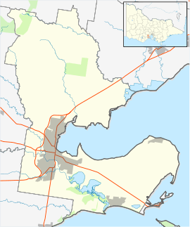 Swan Bay Location in City of Greater Geelong | |||||||||||||
| Coordinates | 38°13′33″S 144°38′38″E / 38.22583°S 144.64389°ECoordinates: 38°13′33″S 144°38′38″E / 38.22583°S 144.64389°E | ||||||||||||
| Postcode(s) | 3225 | ||||||||||||
| LGA(s) | City of Greater Geelong | ||||||||||||
| State electorate(s) | Bellarine | ||||||||||||
| Federal Division(s) | Corio | ||||||||||||
| |||||||||||||
Swan Bay is a bounded rural coastal locality of the City of Greater Geelong between Queenscliff and St Leonards. It is bounded in the west by Portarlington-Queenscliff Road, in the north by Anderson Road, in the east by an offshore line across Swan Bay excluding Swan Island, and in the south by the coastline abutting Queenscliff.
Duck Island is included in the locality, within the Port Phillip Heads Marine National Park (Swan Bay section).
See also
- Swan Bay, the geographic area
- Swan Bay and Port Phillip Bay Islands Important Bird Area
References
This article is issued from Wikipedia - version of the 5/24/2016. The text is available under the Creative Commons Attribution/Share Alike but additional terms may apply for the media files.