Svirce (Medveđa)
| Svirce Свирце, Svirca(albanian) | |
|---|---|
| Village | |
 Svirce | |
| Coordinates: RS 42°42′58″N 21°34′27″E / 42.71611°N 21.57417°E | |
| Country |
|
| District | Jablanica District |
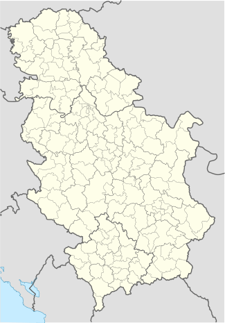
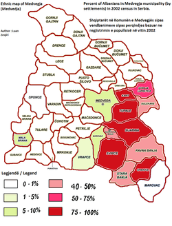
| Municipality | Medveđa |
| Area | |
| • Total | 8.5 sq mi (21.9 km2) |
| Elevation | 3,284 ft (1,001 m) |
| Population (2002) | |
| • Total | 501 |
| Time zone | CET (UTC+1) |
| • Summer (DST) | CEST (UTC+2) |
Svirce is a village in the south of municipality of Medveđa, Serbia. Until the 1999 Kosovo War it had 1300 people, the largest village in population in Medvedja municipality after the town of Medvedja itself. According to the 2002 census, the village has a population of 501 people,all ethnic Albanians.[1]
Geography
Svirca is mostly a mountainous village in altitude but having a big territory of 22 km2, the village has a low altitude around 460 meters in the north to Sijarina village and reaching up to 1080 meters to the south in the border with Republic of Kosovo and the Kosovar part of the Svirca village. In the west it borders Borovac village and a small part of Vrapce village In the north is the small Spa town of Sijarinska Banja and village of Sijarina, in the east borders Ravna Banja and Stara Banja villages. It has different types of vegetation and animals and also some artificial plantations of mostly Pine trees in the border with Kosovo during the time of Yougoslavia. It is a part of the Goljak old mountain range that is located in Serbia and Kosovo.
History
The Svirca village is separated in two since the Serbo-Turkish War (1876–78) and the most important the Russo-Turkish War (1877-78) . The war ended in defeat for the Ottoman Empire. The larger part of Svirca became part of Serbia and the smaller part in the south remained part of Ottoman Kosovo. It is one of few villages in the region that were spared from The Expulsion of Albanians 1877-1878. The discrimination and fear from the Serbian police and army and the economic situation all combined in 1998-2001 caused a great depopulation. In 1971 and 1981 it had around 1300 people all ethnic local Albanian. Today it has less than 100 people in summer and less than 50 in winter. There is a police station in the center of the village 42°45′N 21°35′E / 42.75°N 21.58°E which controls every citizen when going to visit their abandoned homes closer to the border with Kosovo.
References
Coordinates: 42°42′58″N 21°34′27″E / 42.71611°N 21.57417°E
- ↑ Popis stanovništva, domaćinstava i Stanova 2002. Knjiga 1: Nacionalna ili etnička pripadnost po naseljima. Republika Srbija, Republički zavod za statistiku Beograd 2003. ISBN 86-84433-00-9
geoSerbia, geographic portal of Serbia