Suwayq
| Suwayq | |
|---|---|
| Town | |
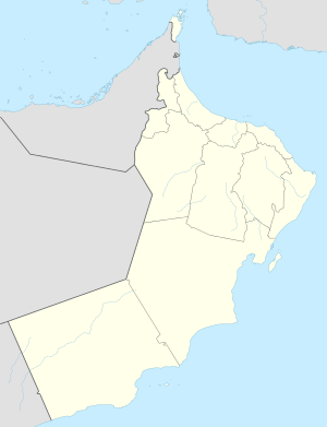 Suwayq Location in Oman | |
| Coordinates: 23°50′58″N 57°26′19″E / 23.84944°N 57.43861°E | |
| Country |
|
| Governorate | Al Batinah Region |
| Time zone | +4 (UTC+4) |
Al Suwaiq (Arabic: السويق) is a coastal town in the region Al Bāţinah, in northeastern Oman. It is located at around 23°50′58″N 57°26′19″E / 23.84944°N 57.43861°ECoordinates: 23°50′58″N 57°26′19″E / 23.84944°N 57.43861°E. The name of the town refers in Arabic Language to Market, It’s named by this name because it located in the central of AL Batina Region and attracted the people lived in the mounts and also people lived by the region’s coast to buy and sell goods.
A Suwayq logo
AL Suwayq logo is the Arabian Camel because the people in the town have very kind relationship between them and this animal which was the best transporter in the past. The logo idea come by Rashid Bin Hilal Bin Hamed Al Saadi, one of the town sons.
A’Suwaiq is one of Al-Batinah-north governorates’ wilayat. It is 48 km width and 80 km length. The nature of this wilayat blends four terrains: coasts, plains, mountains and valleys. A’Suwaiq is special for its long coast line and known as the largest wilaya in Oman. It is 135 km far from the capital Muscat. A’Suwaiq bordered by: Al Mosina’a from east, Al-Khaboura from west, Gulf of Oman from north and Al-Hoqain from south.
There are about 20 historic buildings (houses, castles, Forts and fortress) distributed in its villages. Most of these historic buildings have deteriorated and need to be restored. The most famous forts are: A’Suwaiq fort, Al Tharmad fort, Al Hilal fort, Al Mghabsha fort, Al Borusheed fort. Also there is an old mosque called Al Sabbara. This mosque was built during the reign of Ahmed bin Sa’aeed
A’Suwaiq fort: It mediates A’Suwaiq, in A’Suwaiq souq (old market), and the entrance of the fort facing the sea. It is rectangular shape contains three circular shape towers and one Square shape. It is 60 meters length and 43 meters width. Inside the fort there is a small fort. The fort used to be the headquarters of the governor. It was built by Mud, stones and Omani plaster, and it was restored by th Ministry of Heritage and Culture in 1992.
Al Mabrah Village:
Al Mabrah Village is affiliated to willayat As’Souaiq. Its location is near Western-Hajar mountains. The village's tourist appeal derives from its outstanding geographic location, the scenic views, and the geometric design of Aflaj which are coming from Wadi Al Asdani. This falaj extended to 3 km from the wadis’ heart to the village. Also, it is considered as the main water source for irrigation in Al Mabrah village.