Sutton, Massachusetts
| Sutton, Massachusetts | ||
|---|---|---|
| Town | ||
|
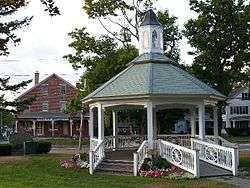
Sutton Town Common | ||
| ||
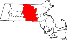
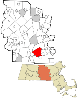 Location in Worcester County and the state of Massachusetts. | ||
| Coordinates: 42°09′00″N 71°45′48″W / 42.15000°N 71.76333°WCoordinates: 42°09′00″N 71°45′48″W / 42.15000°N 71.76333°W | ||
| Country | United States | |
| State | Massachusetts | |
| County | Worcester | |
| Settled | 1704 | |
| Incorporated | 1714 | |
| Government | ||
| • Type | Open town meeting | |
| • Town Administrator | James Smith | |
| • Board of Selectmen |
John Hebert David Hall Paul Maynard Jesse Limanek Michael Kenney | |
| Area | ||
| • Total | 33.9 sq mi (87.9 km2) | |
| • Land | 32.4 sq mi (83.9 km2) | |
| • Water | 1.6 sq mi (4.0 km2) | |
| Elevation | 706 ft (215 m) | |
| Population (2010) | ||
| • Total | 8,963 | |
| • Density | 260/sq mi (100/km2) | |
| Time zone | Eastern (UTC-5) | |
| • Summer (DST) | Eastern (UTC-4) | |
| ZIP code | 01590 | |
| Area code(s) | 508 / 774 | |
| FIPS code | 25-68610 | |
| GNIS feature ID | 0619491 | |
| Website | http://www.suttonma.org/ | |

Sutton is a town in Worcester County, Massachusetts, United States. The population was 8,963 at the 2010 census.
History
A Nipmuc, John Wampas, visited England in the 1600s and deeded land in the Sutton area to Edward Pratt. Pratt sold interests in this land to others, and competing claims among them and the Nipmucs led to a General Court case in Massachusetts in 1704, which granted Pratt and his fellow proprietors an eight-mile-square section of land, which is now Sutton.[1]
Three families were the first to settle on the land, that of Benjamin Marsh, Elisha Johnson and Nathaniel Johnson. Brothers Samuel and Daniel Carriel also occupied the Marsh family cabin. The "big snow" of 1717 completely buried their cabins. A friendly Indian found the cabin of the Johnson family only by seeing smoke from the chimney coming out of the snow. The Indian rescued the family, and as Mrs. Johnson recalled, "No voice ever sounded so sweet as that of that Indian down the chimney." Marsh served as a selectman, town moderator and in various other positions of responsibility as the town became established. His daughter, Abigail, was the first child born in Sutton. On Sep. 16, 1735, he founded the town's Baptist church, which is the fourth oldest Baptist church in Massachusetts. He served as elder of the church, and was pastor from 1737 until his death in 1775.[2][3][4] They settled on property in the area called Manchaug, near Marble Village. It is home of one of the oldest schoolhouses in America dating back to the 18th century, according to the Worcester Telegram & Gazette.
By 1735, Hassananmisco and a small portion of the northeastern territory of the township of Sutton had incorporated as the town of Grafton. Millbury was set apart from Sutton in 1813. In early days, Millbury was called North Parish. In the 1830s, Wilkinsonville (a section in north Sutton) took its own name; another area name is "Pleasant Valley," now known due to a golf course of the same name in Sutton.
Through the 18th and 19th centuries, Sutton was a town that enjoyed both agricultural and industrial benefits. The farms and orchards in the area did very well, as did the three large mills that were built in the Manchaug area.[5]
The town is part of the historic Blackstone River Valley National Heritage Corridor and has several of its sites.[6]
Geography
According to the United States Census Bureau, the town has a total area of 33.9 square miles (88 km2), of which 32.4 square miles (84 km2) is land and 1.5 square miles (3.9 km2), or 4.57%, is water.
The town contains five villages, known as Sutton Center, Manchaug, Wilkinsonville, West Sutton, and South Sutton. Located in the Blackstone Valley, Sutton shares its borders with the towns of Millbury, Grafton, Northbridge, Douglas, Uxbridge, and Oxford.
Purgatory Chasm State Reservation is located in the eastern part of town.
Demographics
| Historical population | ||
|---|---|---|
| Year | Pop. | ±% |
| 1850 | 2,595 | — |
| 1860 | 2,676 | +3.1% |
| 1870 | 2,699 | +0.9% |
| 1880 | 3,105 | +15.0% |
| 1890 | 3,180 | +2.4% |
| 1900 | 3,328 | +4.7% |
| 1910 | 3,078 | −7.5% |
| 1920 | 2,578 | −16.2% |
| 1930 | 2,147 | −16.7% |
| 1940 | 2,749 | +28.0% |
| 1950 | 3,102 | +12.8% |
| 1960 | 3,638 | +17.3% |
| 1970 | 4,590 | +26.2% |
| 1980 | 5,855 | +27.6% |
| 1990 | 6,824 | +16.5% |
| 2000 | 8,250 | +20.9% |
| 2010 | 8,963 | +8.6% |
| * = population estimate. Source: United States Census records and Population Estimates Program data.[7][8][9][10][11][12][13][14][15][16] | ||
As of the 2010 U.S. Census there were 8,963 people residing in Sutton. As of the census[17] of 2000, there were 8,250 people, 2,811 households, and 2,282 families residing in the town. The population density was 254.8 inhabitants per square mile (98.4/km2). There were 2,950 housing units at an average density of 91.1 per square mile (35.2/km2). The racial makeup of the town was 98.18% White, 0.68% African American, 0.01% Native American, 0.59% Asian, 0.27% from other races, and 0.55% from two or more races. Hispanic or Latino of any race were 0.70% of the population.
There were 2,811 households out of which 42.3% had children under the age of 18 living with them, 71.3% were married couples living together, 6.8% had a female householder with no husband present, and 18.8% were non-families. 15.0% of all households were made up of individuals and 6.2% had someone living alone who was 65 years of age or older. The average household size was 2.93 and the average family size was 3.27.
In the town the population was spread out with 29.4% under the age of 18, 5.6% from 18 to 24, 31.5% from 25 to 44, 25.4% from 45 to 64, and 8.1% who were 65 years of age or older. The median age was 36 years. For every 100 females there were 99.3 males. For every 100 females age 18 and over, there were 97.1 males.
The median income for a household in the town was $75,141, and the median income for a family was $81,000. Males had a median income of $53,482 versus $37,463 for females. The per capita income for the town was $27,490. About 3.4% of families and 4.4% of the population were below the poverty line, including 5.2% of those under age 18 and 6.8% of those age 65 or over.
Local business
Sutton, although home to several agricultural businesses, has a growing small business population. Part of the Blackstone Valley, many of the businesses are affiliated with groups like the Blackstone Valley Tourism Association, and the Sutton Chain of Lights.
Several notable Sutton businesses are:
- Polyvinyl Films, creators of Stretch-Tite Premium Food Wrap
- Vaillancourt Folk Art, chalkware collectible studios
- Blackstone National Golf Club, golf course which plays host to several major tournaments annually
- Pleasant Valley Country Club, golf course used by PGA and LPGA
- Atlas Box And Crating Co., Inc, national box company
- Eaton Farm Confectioners Historic candy manufacturing company, originally established in 1892 as Chute's Candies
- Whittier Farms, Inc, national breeder of Holsteins, and processing plant with two milk stores
Government
Sutton has an open town meeting type government. The town government in Sutton consists of the Town Administrator and the Board of Selectmen. The current town administrator is James A. Smith, and the current members of the Board of Selectmen are John Hebert, David Hall, Paul Maynard, Jesse Limanek, and Michael Kenney.[18]
Library
The Sutton Free Library was established in 1876. .[19][20] In fiscal year 2008, the town of Sutton spent 0.7% ($165,982) of its budget on its public library—some $18 per person.[21]
Public services
The public services in Sutton include the police, fire,and highway departments. The Police Department is located at 4 Uxbridge Road. The Fire Department has 3 stations, one in the center of town, one in the Wilkinsonville village, and one in the Manchaug village. The Sutton Highway Department is located at 25 Pleasant Valley Road.[22]
Education
Public schools in Sutton fall under the jurisdiction of Sutton Public School District. Sutton public schools consist of the Simonian Center for Early Learning, Sutton Elementary School, Sutton Middle School, and Sutton High School.
Notable people
- Edward Putnam, early pioneer of Sutton (and the Edward Putnam House still stands in Sutton)
- Rufus Putnam, Revolutionary War general (and his home is pictured on the Sutton town seal)
- Solomon Sibley, first mayor of Detroit, Michigan, was born in Sutton
- Homer Sprague, Civil War Colonel, writer, and academic who served as president of the University of North Dakota and Mills College, among others
- Stephen Waters, established in 1757 the Waters Farm, which developed and marketed the Sutton Beauty apple.
Adjacent towns
- Millbury (North)
- Grafton (Northeast)
- Northbridge (East)
- Uxbridge (Southeast)
- Douglas (South)
- Oxford (West)
Notes
- ↑ "History of Sutton". suttonma.org. Retrieved January 24, 2011.
- ↑ Stager, Helen A. and Evelyn, A Family Odyssey, pp. 106-7, Nicollet Press, Inc., Pipestone, MN, 1983.
- ↑ Benedict, Rev. William A. and Tracy, Rev. Hiram A., History of the Town of Sutton, Massachusetts, from 1704 to 1876, pp. 18-24, 27, 37, 39, 43, 45, 46, 49, 51, 58, 61, 70, 71, 75, 77-8, 89, 255, 461-3, 689-91, Sanford & Co., Worcester, MA, 1878.
- ↑ Marsh, William H. III, History of our Marsh Family, p. 9, Bremerhaven, Germany, 1978.
- ↑ suttonmass.org
- ↑ "Plan your visit/valley sites/Douglas, Nortbridge, Sutton". National Park Service. Retrieved 2007-12-26.
- ↑ "TOTAL POPULATION (P1), 2010 Census Summary File 1". American FactFinder, All County Subdivisions within Massachusetts. United States Census Bureau. 2010.
- ↑ "Massachusetts by Place and County Subdivision - GCT-T1. Population Estimates". United States Census Bureau. Retrieved July 12, 2011.
- ↑ "1990 Census of Population, General Population Characteristics: Massachusetts" (PDF). US Census Bureau. December 1990. Table 76: General Characteristics of Persons, Households, and Families: 1990. 1990 CP-1-23. Retrieved July 12, 2011.
- ↑ "1980 Census of the Population, Number of Inhabitants: Massachusetts" (PDF). US Census Bureau. December 1981. Table 4. Populations of County Subdivisions: 1960 to 1980. PC80-1-A23. Retrieved July 12, 2011.
- ↑ "1950 Census of Population" (PDF). Bureau of the Census. 1952. Section 6, Pages 21-10 and 21-11, Massachusetts Table 6. Population of Counties by Minor Civil Divisions: 1930 to 1950. Retrieved July 12, 2011.
- ↑ "1920 Census of Population" (PDF). Bureau of the Census. Number of Inhabitants, by Counties and Minor Civil Divisions. Pages 21-5 through 21-7. Massachusetts Table 2. Population of Counties by Minor Civil Divisions: 1920, 1910, and 1920. Retrieved July 12, 2011.
- ↑ "1890 Census of the Population" (PDF). Department of the Interior, Census Office. Pages 179 through 182. Massachusetts Table 5. Population of States and Territories by Minor Civil Divisions: 1880 and 1890. Retrieved July 12, 2011.
- ↑ "1870 Census of the Population" (PDF). Department of the Interior, Census Office. 1872. Pages 217 through 220. Table IX. Population of Minor Civil Divisions, &c. Massachusetts. Retrieved July 12, 2011.
- ↑ "1860 Census" (PDF). Department of the Interior, Census Office. 1864. Pages 220 through 226. State of Massachusetts Table No. 3. Populations of Cities, Towns, &c. Retrieved July 12, 2011.
- ↑ "1850 Census" (PDF). Department of the Interior, Census Office. 1854. Pages 338 through 393. Populations of Cities, Towns, &c. Retrieved July 12, 2011.
- ↑ "American FactFinder". United States Census Bureau. Retrieved 2008-01-31.
- ↑ http://suttonma.org/Pages/SuttonMA_BOS/index
- ↑ C.B. Tillinghast. The free public libraries of Massachusetts. 1st Report of the Free Public Library Commission of Massachusetts. Boston: Wright & Potter, 1891.
- ↑ Sutton Public Library. Retrieved 2010-11-10
- ↑ July 1, 2007 through June 30, 2008; cf. The FY2008 Municipal Pie: What’s Your Share? Commonwealth of Massachusetts, Board of Library Commissioners. Boston: 2009. Available: Municipal Pie Reports. Retrieved 2010-08-04
- ↑ http://suttonma.org/Pages/index
External links
| Wikimedia Commons has media related to Sutton, Massachusetts. |
- Official website
- Sutton Public Schools
- SuttonMass.org, unofficial website
- Lake Singletary
- Manchaug Pond
- Midstate Trail
- Nipmuck Nation
- Purgatory Chasm State Reservation