Sunriver, Oregon
| Sunriver, Oregon | |
|---|---|
| Census-designated place | |
|
The Deschutes River in Sunriver | |
| Coordinates: 43°53′3.01″N 121°26′15″W / 43.8841694°N 121.43750°WCoordinates: 43°53′3.01″N 121°26′15″W / 43.8841694°N 121.43750°W | |
| Country | United States |
| State | Oregon |
| County | Deschutes |
| Area | |
| • Total | 9.0 sq mi (23.2 km2) |
| • Land | 8.8 sq mi (22.9 km2) |
| • Water | 0.2 sq mi (0.4 km2) |
| Elevation | 4,164 ft (1,269.2 m) |
| Population (2010) | |
| • Total | 1,393 |
| • Density | 158/sq mi (60.9/km2) |
| Time zone | PST (UTC-8) |
| • Summer (DST) | PDT (UTC-7) |
| ZIP code | 97707 |
| Area code(s) | 458 and 541 |

Sunriver, Oregon is a census-designated place and 3,300-acre (1,300 ha) planned residential and resort community in Deschutes County, Oregon, United States. As of the 2010 census it had a population of 1,393.[1] It is part of the Bend, Oregon Metropolitan Statistical Area. It is located on the eastern side of the Deschutes River about 15 miles (24 km) south of Bend at the base of the Cascade Range.
Sunriver consists of residential homesites and common areas, recreational facilities, the Sunriver Resort and a commercial development known as The Village at Sunriver.
The Sunriver Resort Lodge has hotel rooms, banquet facilities, a fine dining restaurant, and other amenities. Sunriver Resort manages four golf courses. Two are public (Meadows and Woodlands) and two are private (Caldera and Crosswater, available to guests staying at the resort).[2] Sunriver also features the SHARC (Sunriver Homeowner's Aquatic and Recreation Center), completed in 2012.
History
Sunriver is located on the grounds of the former Camp Abbot, a World War II training facility designed to train combat engineers in a simulated combat environment. The U.S. Army camp opened in 1942, but by June 1944 the camp was abandoned and most of the settlement was razed.[3]
The Officers' Club was spared and has been preserved and renovated and is now known as the "Great Hall", under management of Sunriver Resort. The name "Sunriver" was selected by developers John Gray and Donald V. McCallum. The initial condominiums were built in 1968 in conjunction with the completion of Sunriver Lodge, and in 1969 the master plan was completed and developers began selling lots.[4][5]
Sunriver was also the site of the pioneer Shonquest Ranch.[6] Sunriver post office was established on July 18, 1969, at the same time the public facilities were opened.[6]
Climate
This region experiences warm (but not hot) and dry summers, with no average monthly temperatures above 71.6 °F (22.0 °C). According to the Köppen Climate Classification system, Sunriver has a warm-summer Mediterranean climate, abbreviated "Csb" on climate maps.[7]
See also
References
- ↑ "Geographic Identifiers: 2010 Demographic Profile Data (G001): Sunriver CDP, Oregon". U.S. Census Bureau, American Factfinder. Retrieved December 14, 2015.
- ↑ "Oregon Golf Resorts & Group Vacations". Sunriver Resort. Archived from the original on 2007-07-30. Retrieved 2007-09-27.
- ↑ "Formerly Used Defense Sites - Portland District - US Army Corps of Engineers". US Army Corps of Engineers. Retrieved 2007-09-27.
- ↑ "Sunriver History". Deschutes County Government, Oregon. Retrieved 2007-09-27.
- ↑ "Resort History – Sunriver Oregon Lodging". Sunriver Resort. Archived from the original on 2007-07-30. Retrieved 2007-09-27.
- 1 2 McArthur, Lewis A.; McArthur, Lewis L. (2003) [1928]. Oregon Geographic Names (7th ed.). Portland, Oregon: Oregon Historical Society Press. pp. 872, 924. ISBN 978-0875952772.
- ↑ "Sunriver, Oregon". Weatherbase. Canty Media. Retrieved January 2, 2016.
External links
![]() Sunriver (Oregon) travel guide from Wikivoyage
Sunriver (Oregon) travel guide from Wikivoyage
![]() Media related to Sunriver, Oregon at Wikimedia Commons
Media related to Sunriver, Oregon at Wikimedia Commons
Municipalities and communities of Deschutes County, Oregon, United States | ||
|---|---|---|
| Cities | 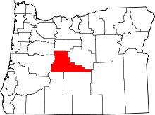 | |
| CDPs | ||
| Other unincorporated communities | ||