Sunndalsøra
| Sunndalsøra | |
|---|---|
| Village | |
|
Sunndalsøra viewed from the mountain Litlkalkinn. The estuary of the river Driva is clearly visible, as is the aluminium plant. The Sunndalsfjord stretches out to northwest towards Kristiansund | |
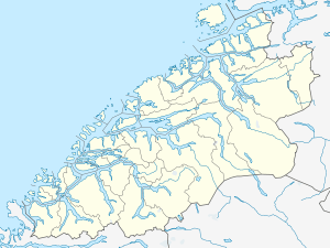
 Sunndalsøra  Sunndalsøra Location in Møre og Romsdal | |
| Coordinates: 62°40′31″N 08°33′05″E / 62.67528°N 8.55139°ECoordinates: 62°40′31″N 08°33′05″E / 62.67528°N 8.55139°E | |
| Country | Norway |
| Region | Western Norway |
| County | Møre og Romsdal |
| District | Nordmøre |
| Municipality | Sunndal Municipality |
| Area[1] | |
| • Total | 3.42 km2 (1.32 sq mi) |
| Elevation[2] | 0.5 m (1.6 ft) |
| Population (2013)[1] | |
| • Total | 4,030 |
| • Density | 1,178/km2 (3,050/sq mi) |
| Time zone | CET (UTC+01:00) |
| • Summer (DST) | CEST (UTC+02:00) |
| Post Code | 6600 Sunndalsøra |
![]() Sunndalsøra is a town and the administrative centre of Sunndal Municipality in Møre og Romsdal county, Norway.
Sunndalsøra is a town and the administrative centre of Sunndal Municipality in Møre og Romsdal county, Norway.
Location
Sunndalsøra is located at the mouth of the river Driva at the beginning of the Sunndalsfjorden. It is about 4 kilometres (2.5 mi) west of Hoelsand, 10 kilometres (6.2 mi) southeast of Øksendalsøra, and about 9 kilometres (5.6 mi) west of Grøa. Norwegian National Road 70 runs through the municipality on its way from Kristiansund to Oppdal. Sunndalsøra is surrounded by steep mountains reaching 1,700 m amsl, such as Hårstadnebba, which is used for BASE jumping
Population and local economy

The 3.42-square-kilometre (850-acre) town has a population (2013) of 4,030; which gives the village a population density of 1,178 inhabitants per square kilometre (3,050/sq mi).[1]
The village is the largest in Sunndal Municipality and it is home to Hov Church, the main church for the parish. Norsk Hydro operates an aluminium plant at Sunndalsøra. About 900 employees work at the plant, which has been operating since 1954. In 2004, the plant was modernized to become the biggest and among the most modern aluminium plants in Europe, greatly reducing pollution. In addition to aluminium related research, aquaculture research also takes place in Sunndalsøra, and many also work in public service in Sunndal municipality.[3]
Climate
Sunndalsøra in Sunndal is well known in Norway for occasional extrem warm winter temperatures. This is due to the mountains surrounding the fjord and the town, creating a foehn warming with the right weather setup: A strong low SW of the coast bringing mild air from the Atlantic further warmed by the mentioned foehn. Sunndalsøra has the national all-time high for December with 18.3 °C (64.9 °F) recorded in 1998, and the all-time high for February with 18.9 °C (66.0 °F), recorded February 23th 1990. This is also the warmest winter temperature ever recorded in Scandinavia.
| Climate data for Sunndalsøra (10 m, average temperatures 10 last years; extremes 1983 - 2015) | |||||||||||||
|---|---|---|---|---|---|---|---|---|---|---|---|---|---|
| Month | Jan | Feb | Mar | Apr | May | Jun | Jul | Aug | Sep | Oct | Nov | Dec | Year |
| Record high °C (°F) | 17.4 (63.3) |
18.9 (66) |
18.4 (65.1) |
22.2 (72) |
28.1 (82.6) |
31.2 (88.2) |
32.1 (89.8) |
31.7 (89.1) |
27.6 (81.7) |
25 (77) |
21.6 (70.9) |
18.3 (64.9) |
32.1 (89.8) |
| Average high °C (°F) | 2 (36) |
3 (37) |
4 (39) |
9 (48) |
13 (55) |
16 (61) |
18 (64) |
17 (63) |
14 (57) |
9 (48) |
5 (41) |
3 (37) |
9.4 (48.8) |
| Average low °C (°F) | −2 (28) |
−2 (28) |
−1 (30) |
2 (36) |
6 (43) |
9 (48) |
12 (54) |
11 (52) |
8 (46) |
4 (39) |
1 (34) |
−1 (30) |
3.9 (39) |
| Record low °C (°F) | −16.6 (2.1) |
−18.9 (−2) |
−16 (3) |
−6.3 (20.7) |
−1 (30) |
0.7 (33.3) |
4 (39) |
0.9 (33.6) |
−1.5 (29.3) |
−7.3 (18.9) |
−11.4 (11.5) |
−16.7 (1.9) |
−18.9 (−2) |
| Average precipitation mm (inches) | 77 (3.03) |
62 (2.44) |
72 (2.83) |
55 (2.17) |
51 (2.01) |
60 (2.36) |
89 (3.5) |
86 (3.39) |
112 (4.41) |
102 (4.02) |
93 (3.66) |
102 (4.02) |
961 (37.84) |
| Average precipitation days | 10 | 9 | 10 | 9 | 8 | 11 | 13 | 13 | 14 | 12 | 11 | 13 | 133 |
| Source #1: [4] | |||||||||||||
| Source #2: [5] | |||||||||||||
References
- 1 2 3 Statistisk sentralbyrå (1 January 2013). "Urban settlements. Population and area, by municipality.".
- ↑ "Sunndalsøra" (in Norwegian). yr.no. Retrieved 2010-11-18.
- ↑ Store norske leksikon. "Sunndalsøra" (in Norwegian). Retrieved 2013-04-25.
- ↑ "Sunndalsøra average conditions; base period 10 last years". Storm Weather Center. Retrieved 17 September 2016.
- ↑ "Eklima/met.no database". Norwegian Meterological Institute. Retrieved 17 September 2016.
