Sunlight Ski Area
Coordinates: 39°23′59.3″N 107°20′21.4″W / 39.399806°N 107.339278°W
| Sunlight Mountain Resort | |
|---|---|
| Location | White River National Forest, Garfield Co., Colorado, U.S. |
| Nearest city |
Glenwood Springs: 12 miles (20 km) |
| Coordinates | 39°23′59.3″N 107°20′21.4″W / 39.399806°N 107.339278°W |
| Vertical | 2,010 feet (613 m) |
| Top elevation | 9,895 feet (3,016 m) |
| Base elevation | 7,885 feet (2,403 m) |
| Skiable area | 470 acres (1.9 km2) |
| Runs |
67 total |
| Longest run | 2.5 miles (4.0 km) |
| Lift system |
3 chairlifts - (1 triple, 2 double) |
| Terrain parks | none |
| Snowfall | 250 in (635 cm) |
| Night skiing | none |
| Website | sunlightmtn.com |
Sunlight Mountain Resort and Ski Area is a ski area in Colorado, located in Garfield County in the White River National Forest, south of nearby Glenwood Springs.
About
The ski area caters to local skiers and large groups. The area has three chairlifts and a vertical drop exceeding 2,000 feet (610 m). Operations began in December 1966 with one chairlift and a second was added in 1973.[1]
Terrain
The resort has surprising variety of terrain for its size, encompassing easy beginner runs, cruiser runs, as well as a section of steep chutes. The area covers a northeast-facing below-tree line basin that funnels all runs toward a single base area. Sunlight's summit offers views of Mount Sopris and the Elk Mountains.
U.S. Ski Team
- Alice McKennis (b. 1989), World Cup racer in speed events
References
External links
| Major cities | 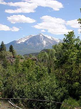 | |
|---|---|---|
| Other communities | ||
| Near valley | ||
| Ski resorts | ||
| Bodies of water | ||