Suan Luang District
| Suan Luang สวนหลวง | |
|---|---|
| Khet | |
|
Outer perimeter of the shrine to Mae Nak Phra Khanong at Wat Mahabut. | |
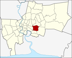 Khet location in Bangkok | |
| Coordinates: 13°43′49″N 100°39′5″E / 13.73028°N 100.65139°ECoordinates: 13°43′49″N 100°39′5″E / 13.73028°N 100.65139°E | |
| Country |
|
| Province | Bangkok |
| Seat | Suan Luang |
| Khwaeng | 1 |
| Khet established | 14 Jan 1994 |
| Area | |
| • Total | 23.678 km2 (9.142 sq mi) |
| Population (2015) | |
| • Total | 120,136 |
| • Density | 5,073.73/km2 (13,140.9/sq mi) |
| Time zone | ICT (UTC+7) |
| Postal code | 10250 |
| Geocode | 1034 |

Suan Luang (Thai: สวนหลวง; IPA: [sǔan lǔaŋ]) is one of the 50 districts (khet) of Bangkok, Thailand. It is bounded by other Bangkok districts (from north clockwise): Bang Kapi, Saphan Sung, Prawet, Phra Khanong, and Watthana.
History
Suan Luang was a sub-district of Phra Khanong district. When Phra Khanong district was split into smaller districts on 9 November 1989, Suan Luang became part of the new Prawet district. On 14 January 1994 (based on announcement 8 October 1993) Suan Luang was elevated to a district, merging the area once belong to Suan Luang sub-district with additional land from Prawet and Khlong Toei. The combined area is still called Suan Luang sub-district, and it is the only sub-district within Suan Luang district.
Administration
The district has only one sub-district (kwaeng).
| 1. | Suan Luang | สวนหลวง |
Places

- Wat Maha But is well known for its Mae Nak shrine. Numerous works of fiction and films including Nang Nak were influenced by Mae Nak.
Education
St. Mark's International School Bangkok is in the district.[1]
References
- ↑ "Location." St. Mark's International School Bangkok. Retrieved on 6 Mar 2013. "St. Mark's International School 900 New Rama 9 Rd, Suan Luang, Bangkok 10250"
.svg.png)