Stratonis (castra)
| Stratonis | |
|---|---|
|
In Tabula Peutingeriana | |
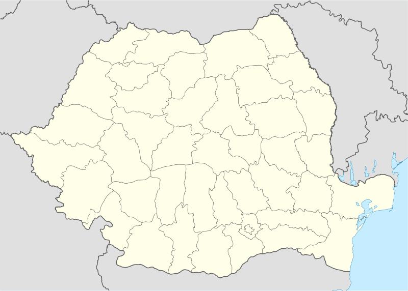 Location within Romania | |
| Attested by | Tabula Peutingeriana |
| Place in the Roman world | |
| Province | Moesia |
| Administrative unit | Moesia Inferior |
| Directly connected to |
|
| Location | |
| Coordinates | 44°01′31″N 28°39′08″E / 44.02526°N 28.65211°ECoordinates: 44°01′31″N 28°39′08″E / 44.02526°N 28.65211°E |
| Altitude | 22 m |
| Town | Tuzla |
| County | Constanța |
| Country |
|
| Site notes | |
| Condition | Ruined |
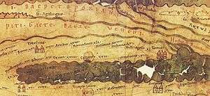
Stratonis was a fort in the Roman province of Moesia. As Tabula Peutingeriana shows it is situated between Callatis and Tomis; 22 miles from Callatis and 12 miles from Tomis.
See also
External links
Notes
This article is issued from Wikipedia - version of the 11/10/2016. The text is available under the Creative Commons Attribution/Share Alike but additional terms may apply for the media files.