Strait of Anián

The Strait of Anián was a semi-mythical strait, documented from around 1560, that was believed by early modern cartographers to mark the boundary between North America and Asia and to permit access to a Northwest Passage from the Arctic Ocean to the Pacific. The true strait was discovered in 1728 and became known as the Bering Strait. The Strait of Anian had been generally placed nearby but sometimes appeared as far south as California.[1][2]
History
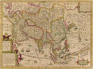
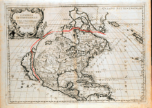
The source of this idea is unknown. The Martin Waldseemüller map of 1506 or 1507 shows America and Asia separated. A 1562 map by Paolo Forlani shows Asia and North America joined north of about the latitude of San Diego. The strait probably took its name from Ania, a Chinese province mentioned in a 1559 edition of Marco Polo's book. The name probably first appeared on a map issued by the Italian cartographer Giacomo Gastaldi in 1562.[3] It appeared on maps by Abraham Ortelius (1564), Bolognini Zaltieri (1567) and Gerardus Mercator (1567). The Zaltieri and Gastaldi maps show it narrow and crooked. Gastaldi and Ortelius have an "Ania" or "Anian" on the east side of the strait. A speculative map of 1578 shows Frobisher Strait extending all the way across Canada and ending at the Strait of Anian.[4] A 1719 map by Herman Moll shows the strait as a probable bay at 50° North north of an Island of California. The 1728 edition of a map by Johannes van Keulen shows the strait north of the Island of California with the note that 'they say that one can come through this strait to Hudson Bay, but this is not proven.'
For related concepts see Early knowledge of the Pacific Northwest. See Shangdu (Xanadu) for two more maps showing a Strait of Anian.
References
- ↑ Samuel Eliot Morison, The European Discovery of America, 1971
- ↑ Derek Hayes,’Historical Atlas of the North Pacific Ocean’,2001
- ↑ Hayes, page 24. He says this is a revision of a 1546 map.
- ↑ Glyn Williams,"Arctic Labyrinth", 2010, page 30

