Stowe's Hill
| Stowe's Hill | |
|---|---|
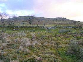 Stowe's Hill from the west. | |
| Highest point | |
| Elevation | 381 m (1,250 ft) [1] |
| Prominence | 78 m (256 ft) [1] |
| Listing | TuMP |
| Coordinates | 50°31′34″N 4°27′33″W / 50.5262°N 4.4593°WCoordinates: 50°31′34″N 4°27′33″W / 50.5262°N 4.4593°W |
| Geography | |
| Location | Bodmin Moor, England |
| OS grid | SX257724 |
| Topo map | OS Landranger 201, Explorer 109 |
| Geology | |
| Mountain type | granite tor |
Stowe's Hill is an elongated hill, 381 metres (1,250 ft) high, located on the eastern edge of Bodmin Moor in the county of Cornwall, England.[2]
Stowe's Hill is a prominent granite ridge located about 1500 metres north of Minions,[2] the highest village in Cornwall. It is dominated by Stowe's Pound, a huge tor enclosure comprising two massive stone-walls. The smaller enclosure surrounds the tors at the southern end of the hill; the larger one encircles the rest of the ridge. At the southern end is a large, disused quarry, but the hill is best known as the site of the Cheesewring, the extraordinary granite formation that gave the quarry its name.[3][4]
Inside Stowe's Pound are two Bronze Age cairns, a stone round house and over 100 house platforms. The site is thought to be Neolithic or Bronze Age and connected with other settlements and ritual monuments in the vicinity.[5]
References
- 1 2 P30 Database, Appendix v2.1
- 1 2 Ordnance Survey 1:25,000 Explorer map series, No. 109
- ↑ Stowe's Pound at www.historic-cornwall.org.uk. Accessed on 2 Sep 2013
- ↑ London, Pete (2013). Ancient Cornwall, "Discover Cornwall" Series, Tor Mark, Redruth. ISBN 978-085025-433-4.
- ↑ Johnson, Nicholas and Rose, Peter (2003). Cornwall's Archaeological Heritage, Historic Environmental Unit, Cornwall County Council, Twelveheads Press, Truro, pp. 38/39. ISBN 0-906294-52-5