Storm King Mountain (New York)
| Storm King Mountain | |
|---|---|
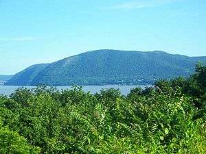
 Storm King from the Breakneck Ridge train station across the Hudson | |
| Highest point | |
| Elevation |
|
| Prominence | 100 ft (30 m) [1] |
| Coordinates | 41°25′58″N 73°59′41″W / 41.4328716°N 73.9945843°WCoordinates: 41°25′58″N 73°59′41″W / 41.4328716°N 73.9945843°W [2] |
| Geography | |
 Storm King Mountain | |
| Parent range | Hudson Highlands |
| Topo map | USGS West Point |
| Climbing | |
| Easiest route | Trail hike |
Storm King Mountain is along the west bank of the Hudson River south of Cornwall-on-Hudson, New York. Together with Breakneck Ridge on the opposite bank of the river it forms "Wey-Gat" or Wind Gate, the picturesque northern gateway to the Hudson Highlands. Its distinctive curved ridge is the most prominent aspect of the view south down Newburgh Bay, from Newburgh, Beacon, and the Newburgh-Beacon Bridge. It can also be seen by southbound travelers on nearby sections of the New York State Thruway. This view was popular with early artists of the Hudson River School, and helped give them their name.
While thought of as the highest in the area, its summit reaching approximately 1,340 feet (410 m) above sea level, the eastern summit officially known as Butter Hill is actually higher, at 1,380 feet (420 m) in elevation.
Name

On his initial voyage up the river, Henry Hudson and his crew called the mountain Klinkesberg, due to its wrinkled rock cliffs near the river. The name failed to stick, however.
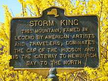
Later, the early Dutch colonists of the region referred to the mountain simply as "Boterberg" (from which Butter Hill came, since the mountain looked like a lump of butter). In the middle of the 19th century, writer Nathaniel Parker Willis, who had taken up residence in the region, proposed the name:
The tallest mountain is ... looked upon as the most sure foreteller of a storm. When the white cloud-beard descends upon his breast in the morning ... there is sure to be a rain-storm before night. Standing aloft before other mountains in the chain, this sign is peculiar to him. He seems the monarch, and this seems his stately ordering of a change in the weather. Should not STORM-KING, then, be his proper title?
The nearby Storm King School and Storm King Art Center, as well as some other local businesses, have also taken the name. The section of NY 218 that winds around the eastern slope of the mountain overlooking the river was originally built as the Storm King Highway. Today that name is often used for the four-lane section of US 9W to the west, with 218 referred to as the Old Storm King Highway.
History
In 1962 the mountain became the focus of a landmark environmental battle when local activists formed the Scenic Hudson Preservation Coalition (today known as just Scenic Hudson) to fight against plans by utility Consolidated Edison to cut away part of the mountain near the river and build a pump storage hydro-electric plant complete with transmission lines across the Hudson River for an ambitious power generating scheme which would also have entailed creating a reservoir in much of what is now Black Rock Forest. In a lawsuit brought by the coalition, a judge ruled for the first time that environmentalists had standing to challenge executive branch decisions in federal court. In 1979 Con Ed finally abandoned even a greatly scaled-down version of the project, and settled a parallel lawsuit brought against their Indian Point facility by agreeing to regulate the operation of their Hudson River power plants so as to minimize the number of fish they killed and endow the Hudson River Foundation with $12 million.[3]
After forest fires on the mountain during the dry summer of 1999, unexploded ordnance left over from 19th century artillery training at the nearby United States Military Academy was discovered in some areas close to the trails. As a result the mountain was closed to hiking until October 2002, when authorities could be sure it had been safely removed.
On February 20, 2011, the NYPD rescued two wayward Fourth Class "plebes" from the United States Military Academy nearby, who stranded themselves 500 feet up on the southern cliff face while rappelling.[4]
Climb
The mountain is the centerpiece of Storm King State Park. With wide views of the river and surrounding areas, both Storm King and Butter Hill summits are highly popular with hikers. The orange-blazed unnamed connector trail, leading to the yellow-blazed Stillman Trail, most often accessed at a parking area on US 9W, offers an immediate and steep climb up Butter Hill followed by a longer and more relaxing trip to the summit of Storm King itself.
Although infrequently attempted and not permitted by the park authorities, there are documented technical rock climbing routes above the river, as well as ice climbing, when conditions are favorable.
Gallery
 Storm King and Butter Hill from Newburgh, NY
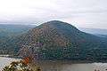 Storm King and New York State Route 218 as seen from atop Breakneck Ridge
 Seen looking west from the base of Breakneck Ridge
Popular culture references
Storm King is said to be the inspiration for the song of the same name by the New York band Big Tree.
Liz Graham wrote and performed a song titled "Storm King" on her 1998 eponymous release Liz Graham.
Dar Williams wrote and performed a song titled "Storm King" on her 2012 release In the Time of Gods.
See also
References
- 1 2 "Storm King Mountain, New York". Peakbagger.com. 2004-11-01. Retrieved 2008-03-01.
- ↑ "Storm King Mountain". Geographic Names Information System. United States Geological Survey. Retrieved 2010-05-17.
- ↑ Lifset, Robert (August 5, 2014). Power on the Hudson: Storm King Mountain and The Emergence of Modern American Environmentalism (1st ed.). Pittsburgh: University of Pittsburgh Press. p. 328. ISBN 978-0822963059.
- ↑ Rosenberg, Noah; Goldstein, Joseph (22 Feb 2011). "Night Helicopter Rescue Lifts 2 West Point Cadets Off Ledge - nytimes.com". The New York Times. Retrieved 22 Feb 2011.
External links
| Wikimedia Commons has media related to Storm King Mountain. |